Perth railway station is the largest station on the Transperth network, serving the central business district of Perth, Western Australia. It serves as an interchange between the Airport, Armadale, Fremantle, Joondalup, Mandurah and Midland lines as well as Transwa's Australind service.

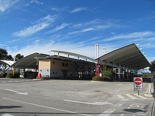
Elizabeth Quay bus station, formerly the Esplanade Busport, is a Transperth bus station, located at the southern edge of the Perth CBD in Western Australia, next to the Perth Convention Exhibition Centre and Elizabeth Quay railway station. It has 35 stands and is served by 55 Transperth routes operated by Path Transit, Swan Transit and Transdev WA. It is also served by South West Coach Lines services.

Stirling railway station is a railway station on the Transperth network. It is located on the Joondalup line, nine kilometres from Perth station serving the suburb of Stirling.

Cannington railway station is located on the Armadale/Thornlie Line, serving the suburb of Cannington south of Perth, Western Australia. It is located 12.2 kilometres (7.6 mi) from Perth Station, and is part of the Transperth commuter rail network.

Oats Street railway station is a railway station on the Transperth network in Perth, Western Australia. It is located on the Armadale and Thornlie line, 8.2 kilometres from Perth station serving the suburbs of Carlisle, East Victoria Park and Kewdale.

Midland railway station is the terminus of the Midland line in Perth. Western Australia. It is operated by Transperth and is connected with the feeder bus services that utilise the adjacent bus terminal in Midland.

Claremont railway station is a railway station on the Transperth network in Western Australia. It is located on the Fremantle and Airport lines, 9.3 kilometres from Perth station serving the suburb of Claremont.

Kalamunda bus station is a Transperth bus station located next to the Kalamunda Central shopping centre in Kalamunda, Western Australia. It has four stands and is served by eight Transperth routes operated by Path Transit and Swan Transit.

Morley bus station is a Transperth bus station located next to the Galleria Shopping Centre in Morley, Western Australia. It has 12 stands and is served by 20 Transperth routes operated by Path Transit, Swan Transit and Transdev WA.

Karrinyup bus station is a Transperth bus station located next to Karrinyup Shopping Centre in Karrinyup, approximately 10 kilometres north of Perth, Western Australia. It has four stands and is served by five Transperth routes operated by Swan Transit.

Kwinana bus station is a Transperth bus station located next to the Kwinana Marketplace Shopping Centre in Kwinana Town Centre. It has 10 stands and is served by five Transperth routes operated by Transdev WA.

Warwick railway station is a railway station on the Transperth network. It is located on the Joondalup line, 13 kilometres (8.1 mi) from Perth station serving the suburb of Warwick.

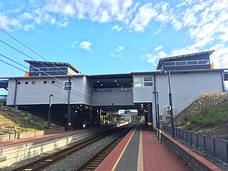
Whitfords railway station is a railway station located on the boundary of Padbury and Kingsley, suburbs of Perth, Western Australia. It is on the Joondalup railway line, which is part of the Transperth commuter rail network. It is located in the median of the Mitchell Freeway, and consists of an elevated bus interchange on top of an island platform at ground level. South of Whitfords, trains run every 5 minutes during peak. North of Whitfords, trains run every 10 minutes during peak. Between peak during the day, trains run every 15 minutes. The journey to Perth railway station is 19.8 kilometres (12.3 mi), and takes 19 minutes.

Joondalup railway station is a railway station on the Transperth network. It is located on the Joondalup line, 26 kilometres from Perth station serving the regional metropolitan city of Joondalup.

Canning Bridge railway station is a railway station on the Transperth network. It is located on the Mandurah line, four kilometres from Perth station inside the median strip of the Kwinana Freeway located adjacent to the suburb of Como.

Murdoch railway station is a railway and bus station on the Transperth network. It is located on the Mandurah line, 13.8 kilometres (8.6 mi) from Perth station inside the median strip of the Kwinana Freeway serving the suburb of Murdoch.

Kwinana railway station is a railway station in Bertram and Parmelia, suburbs of Perth, Western Australia. It is on the Mandurah railway line, which is part of the Transperth commuter rail network, and it serves the City of Kwinana. It has two side platforms located in a cutting, accessed by a ground-level station concourse. Services run every 10 minutes during peak, and every 15 minutes between peak. The journey to Perth railway station is 32.9 kilometres (20.4 mi), and takes 26 minutes. The station has a bus interchange with five bus stands, and five regular bus routes.

Wellard railway station is a railway station in Wellard, a suburb of Perth, Western Australia. It is on the Mandurah railway line, which is part of the Transperth commuter rail network, and is located at the centre of a transit oriented development. It has two side platforms located in a cutting, accessed by a ground-level station concourse. Services run every 10 minutes during peak, and every 15 minutes between peak. The journey to Perth railway station is 37.1 kilometres (23.1 mi), and takes 30 minutes. The station has a bus interchange with four bus stands, and three regular bus routes.

Rockingham railway station is a railway station in Rockingham, a suburb of Perth, Western Australia. It is on the Mandurah railway line, which is part of the Transperth commuter rail network. It has two side platforms, linked by a pedestrian overpass accessed by stairs, a lift, and escalators. Services run every 10 minutes during peak, and every 15 minutes between peak. The journey to Perth railway station is 43.2 kilometres (26.8 mi), and takes 34 minutes. The journey to Mandurah railway station is 27.6 kilometres (17.1 mi), and takes 17 minutes. The station has a bus interchange with twelve bus stands, and 14 regular bus routes.

Mandurah railway station is the terminus of the Mandurah railway line and a bus station on the Transperth network, serving the satellite city of Mandurah, Western Australia.


