Bullfrog Basin

Last updated
Bullfrog Basin
recreation site
Grand Staircase 201812 0106 (41943603750).jpg
The Charles Hall Ferry pulling in to the Bullfrog terminus
USA Utah location map.svg
Red pog.svg
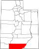
Bullfrog Basin
Location within the state of Utah
Coordinates: 37°30′58″N110°43′43″W / 37.51611°N 110.72861°W / 37.51611; -110.72861
Country United States
State Utah
County Kane
Time zone UTC-7 (Mountain (MST))
  Summer (DST) UTC-6 (MDT)
ZIP codes
84533
Area code 435
GNIS feature ID1435217
Bullfrog Basin Airport
Summary
Airport typePublic
Owner U.S. National Park Service
Serves Glen Canyon National Recreation Area, Utah
Elevation  AMSL 4,167 ft / 1,270 m
Coordinates 37°32′45″N110°42′48″W / 37.54583°N 110.71333°W / 37.54583; -110.71333
Runways
Direction LengthSurface
ftm
1/193,5001,067 Asphalt
Statistics (2023)
Aircraft operations (year ending 9/30/2023)2,502

Bullfrog Basin is one of the National Park Service recreation sites of the Glen Canyon National Recreation Area of Kane County, Utah, United States, adjoining Lake Powell. [2] It encompasses Bullfrog Basin Airport( IATA : BFG, ICAO : U07, FAA LID : U07), the Bullfrog Resort and Marina, the Bullfrog terminus of the Charles Hall Ferry, and a campground.

Contents

It is nearby the 1970s mining town Ticaboo. [3] The National Park Lodge in the site is named Defiance House Lodge. [4] Built on a bluff that overlooks the Bullfrog Bay part of Lake Powell, it is a stucco building with several adjoining prefabricated units. [4] Bullfrog Basin has a USNPS visitor centre, and the Bullfrog Resort and Marina includes a restaurant, shops, and a gas station. [4]

Its development was personally championed by Calvin Rampton in the 1960s, who secured a US$2.7 million funds-matching grant from the Economic Development Administration in 1966 to pave an access road to the area. [5] Although the road did not connect to a settlement at either end, the USNPS had already spent US$1.5 million on clearing the area for the aforementioned airport, marina, and campground; along with a planned restaurant, boat ramp, motel, and visitor centre. [5]

The Lake Powell Parkway, originally planned as part of the USNPS Mission 66 (a.k.a. the Grand Circle) road system, would have joined Bullfrog to US-89 near Page, Arizona in one direction and to I-70 near Moab, Utah in the other, and would have significantly increased access to Bullfrog. [6] However, it met with significant opposition in the 1970s, with campaigners preferring the Canyon Country Parkway instead, and the much cheaper idea of paving an existing dirt road between Bullfrog and the Burr Trail. [7] This was highly favoured by the Garfield county commissioner Del LeFevre, and the title of the engineering study indicated the intention to increase tourism for Bullfrog: Boulder-Bullfrog Scenic Road: A Vital Link in the Grand Circle Adventure. [8]

By 1979 the recreation area had a permanent resident population of 115: 40 Park Service employees and their families, 60 concessions workers and their families, and 15 state employees and their families. [9] Employment of extra staff during the tourist season was raising this to some 200 people. [9] Some of the population was living in 2 Park Service duplexes, and some in the 1 Utah state-owned duplex, but most were living in rented mobile homes. [9] There was one school in one of the mobile homes, with a single teacher, although a second teacher and mobile home were planned given the contemporary expansion at Ticaboo, and no commercial power. [9]

Hobie Cat Beach, a 15 acres (6.1 ha) beach near to the Bullfrog Marina, was (along with Lone Rock Beach near to Wahweap Marina to the southwest along the Colorado River) notorious in the 1990s for its Memorial Day parties, which one park ranger characterized at the time as a congregation of thousands of people between 16 and 25 who came "to drink beer, fornicate, and fight". [10] Unable to effectively police Memorial Day in 1992, with officers outnumbered by an encircling crowd of youths when they attempted to arrest a suspected drug dealer, police presence was boosted in 1993, with a temporary local dedicated justice system erected in Bullfrog, comprising a courtroom, holding cells, judges, bail bondsmen, and bailiffs. [10]

The drought at Lake Powell in the first decade of the 21st century caused the USNPS to significantly extend the boat ramp at Bullfrog Marina; so much so, in the words of James Lawrence Powell, Executive Director of the National Physical Science Consortium at the University of Southern California, that "had the ramp been level, a small plane could have landed on it". [11]

The airport is owned by the National Park Service. [1] It is located 5 miles (8 km) north of Bullfrog Marina and Lake Powell. There are no aircraft assigned or stationed here; it is for transient aircraft and visitors to Lake Powell and Glen Canyon National Recreation Area.[ citation needed ] It covers an area of 42 acres (17 ha) and contains one runway designated 1/19 with a 3,500 x 40 ft (1,067 x 12 m) asphalt surface. [1] For the 12-month period ending September 30, 2023, the airport had 2,502 aircraft operations: 99% general aviation and 1% air taxi. [1]

In 1990, given an estimate that 55% of the flights to and from the airport were simply flights to nearby Cal Black Memorial airport at Halls Crossing to refuel, Bullfrog Basin having no refuelling facilities of its own, the FAA raised the possibility of closing the airstrip at Bullfrog Basin entirely, reducing flights by a projected 23% and reducing aircraft noise. [12] Other options considered but rejected were closing both airports, or closing the Halls Crossing airport and leaving the Bullfrog Basin one open. [13] The airport remained open, however, with 6690 total operations in 1999, down from a peak of 10800 total operations in 1991 (figures taken by the USFAA from the Utah Department of Aviation). [14] A 1993 lawsuit had challenged the methodology used in the USFAA's 1990 Environmental Impact Statement, resulting in three requests for comments from interested parties by the USFAA in 1995, 1997, and 1998. [15] [16] In its revised report of 2000 the USFAA still raised the possibility of closure of Bullfrog Basin airport by 2008, but considered this to be the pessimistic view and recorded that the Utah Department of Transport had told it of no such closure plans. [17]

Climate

Climate data for Bullfrog Basin 1991-2020, extremes 1967-
MonthJanFebMarAprMayJunJulAugSepOctNovDecYear
Record high °F (°C)67
(19)
76
(24)
85
(29)
94
(34)
102
(39)
111
(44)
114
(46)
108
(42)
106
(41)
94
(34)
81
(27)
71
(22)
114
(46)
Mean daily maximum °F (°C)46.3
(7.9)
52.8
(11.6)
63.3
(17.4)
71.7
(22.1)
81.8
(27.7)
94.0
(34.4)
99.6
(37.6)
96.6
(35.9)
87.9
(31.1)
73.5
(23.1)
58.3
(14.6)
46.1
(7.8)
72.7
(22.6)
Mean daily minimum °F (°C)26.0
(−3.3)
29.6
(−1.3)
36.4
(2.4)
43.7
(6.5)
53.4
(11.9)
64.0
(17.8)
71.4
(21.9)
68.5
(20.3)
59.5
(15.3)
46.0
(7.8)
34.0
(1.1)
25.6
(−3.6)
46.5
(8.1)
Record low °F (°C)3
(−16)
4
(−16)
15
(−9)
21
(−6)
33
(1)
42
(6)
54
(12)
46
(8)
43
(6)
22
(−6)
13
(−11)
0
(−18)
0
(−18)
Average precipitation inches (mm)0.63
(16)
0.53
(13)
0.65
(17)
0.34
(8.6)
0.44
(11)
0.15
(3.8)
0.59
(15)
0.54
(14)
0.81
(21)
0.81
(21)
0.53
(13)
0.42
(11)
6.44
(164.4)
Average snowfall inches (cm)0.9
(2.3)
0.8
(2.0)
0.3
(0.76)
0
(0)
0
(0)
0
(0)
0
(0)
0
(0)
0
(0)
0
(0)
0.2
(0.51)
1.8
(4.6)
4.0
(10)
Average precipitation days (≥ 0.01 in)4.24.04.13.02.71.33.04.03.93.62.63.740.1
Average snowy days (≥ 0.1 in)0.50.60.200000000.11.12.5
Source: NOAA [18] [19]

See also

Related Research Articles

<span class="mw-page-title-main">Glen Canyon Dam</span> Dam in Arizona, USA

Glen Canyon Dam is a concrete arch-gravity dam in the southwestern United States, located on the Colorado River in northern Arizona, near the city of Page. The 710-foot-high (220 m) dam was built by the Bureau of Reclamation (USBR) from 1956 to 1966 and forms Lake Powell, one of the largest man-made reservoirs in the U.S. with a capacity of more than 25 million acre-feet (31 km3). The dam is named for Glen Canyon, a series of deep sandstone gorges now flooded by the reservoir; Lake Powell is named for John Wesley Powell, who in 1869 led the first expedition to traverse the Colorado River's Grand Canyon by boat.

<span class="mw-page-title-main">Lake Mead</span> Reservoir on the Colorado River in Arizona and Nevada

Lake Mead is a reservoir formed by Hoover Dam on the Colorado River in the Southwestern United States. It is located in the states of Nevada and Arizona, 24 mi (39 km) east of Las Vegas. It is the largest reservoir in the US in terms of water capacity. Lake Mead provides water to the states of Arizona, California, and Nevada as well as some of Mexico, providing sustenance to nearly 20 million people and large areas of farmland.

<span class="mw-page-title-main">Lake Powell</span> Reservoir in Utah and Arizona, United States

Lake Powell is an artificial reservoir on the Colorado River in Utah and Arizona, United States. It is a major vacation destination visited by approximately two million people every year. It is the second largest artificial reservoir by maximum water capacity in the United States behind Lake Mead, storing 24,322,000 acre-feet (3.0001×10¹⁰ m3) of water when full. However, Lake Mead has fallen below Lake Powell in size several times during the 21st century in terms of volume of water, depth and surface area.

<span class="mw-page-title-main">Glen Canyon National Recreation Area</span> Protected area in Arizona and Utah, US

Glen Canyon National Recreation Area is a national recreation area and conservation unit of the United States National Park Service that encompasses the area around Lake Powell and lower Cataract Canyon in Utah and Arizona, covering 1,254,429 acres (5,076.49 km2) of mostly rugged high desert terrain. The recreation area is named for Glen Canyon, which was flooded by the Glen Canyon Dam, completed in 1966, and is now mostly submerged beneath the waters of Lake Powell.

<span class="mw-page-title-main">Cedar City Regional Airport</span> Airport in Utah

Cedar City Regional Airport is two miles northwest of Cedar City, in Iron County, Utah. It is owned by the Cedar City Corporation. Airline flights are subsidized by the Essential Air Service program.

<span class="mw-page-title-main">Page Municipal Airport</span> Airport in Coconino County, Arizona

Page Municipal Airport is a public use airport 1 mile east of Page, in Coconino County, Arizona. The airport has scheduled passenger service subsidized by the U.S. Federal Government's Essential Air Service program as well as regular sightseeing flights.

<span class="mw-page-title-main">Grand Canyon National Park Airport</span> Airport in Coconino County, Arizona

Grand Canyon National Park Airport is a state-owned public-use airport located in Tusayan, CDP in unincorporated Coconino County, Arizona, United States. It is near Grand Canyon National Park, 1 mile from the South Rim entrance of the Grand Canyon. The airport is primarily used for scenic tours and charter flights.

<span class="mw-page-title-main">Grant County International Airport</span> Airport in Moses Lake, Washington state

Grant County International Airport is a public use airport in the northwest United States, located six miles (10 km) northwest of the central business district of Moses Lake in Grant County, Washington. Formerly a military facility, the airport is owned by the Port of Moses Lake, and its 13,500-foot (4,110 m) runway is the 17th longest in the U.S.

<span class="mw-page-title-main">Utah State Route 276</span>

State Route 276 is a state highway in remote portions of San Juan County, eastern Garfield County, and Kane County, in the southeast of the U.S. state of Utah. The route is used as an access to Lake Powell, serving the small resort towns of Ticaboo and Bullfrog. Historically, SR-276 crossed Lake Powell via the Charles Hall Ferry, the only auto ferry in the state of Utah; however, the ferry is currently out of service due to low water levels. The entire route is part of the Trail of the Ancients National Scenic Byway. Lake Powell separates the route into two sections; the eastern section was numbered State Route 263 prior to the existence of the ferry.

Grand Canyon Airlines is a 14 CFR Part 135 air carrier headquartered on the grounds of Boulder City Municipal Airport in Boulder City, Nevada, United States. It also has bases at Grand Canyon National Park Airport and Page Municipal Airport, both in Arizona. It operates sightseeing tours and charter service over and around the Grand Canyon. Its headquarters and main operation center is Grand Canyon National Park Airport and Boulder City Municipal Airport. The company slogan is With Grand Canyon Airlines, Your Memories are Cleared for Takeoff!

<span class="mw-page-title-main">Airport apron</span> Area at an airport used by aircraft for parking, loading, fueling, and maintenance

The airport apron, apron, flight line, or ramp is the area of an airport where aircraft are parked, unloaded or loaded, refueled, boarded, or maintained. Although the use of the apron is covered by regulations, such as lighting on vehicles, it is typically more accessible to users than the runway or taxiway. However, the apron is not usually open to the general public, and a permit may be required to gain access. An apron's designated areas for aircraft parking are called aircraft stands.

Temple Bar Airport is a public use airport in Mohave County, Arizona, United States. It is 1.15 miles southwest of the Temple Bar Marina, located on Lake Mead's Temple Basin. The airport is owned by the U.S. National Park Service.

<span class="mw-page-title-main">Blue Mesa Reservoir</span> Lake on the Gunnison River in Colorado, United States

Blue Mesa Reservoir is an artificial reservoir located on the upper reaches of the Gunnison River in Gunnison County, Colorado. The largest lake located entirely within the state, Blue Mesa Reservoir was created by the construction of Blue Mesa Dam, a 390 feet (120 m) tall earthen fill dam constructed on the Gunnison by the U.S. Bureau of Reclamation in 1966 for the generation of hydroelectric power. Managed as part of the Curecanti National Recreation Area, a unit of the National Park Service, Blue Mesa Reservoir is the largest lake trout and Kokanee salmon fishery in Colorado.

<span class="mw-page-title-main">Wendover Airport</span> Airport in Wendover, Utah, United States

Wendover Airport is a county-owned, public-use airport located one nautical mile (2 km) southeast of the central business district of Wendover, a city on the western edge of Tooele County, Utah, United States, near the border with Nevada.

<span class="mw-page-title-main">Greenwood Lake Airport</span> Airport in Passaic County

Greenwood Lake Airport is a public use airport located one nautical mile (2 km) east of the central business district of West Milford, in Passaic County, New Jersey, United States. The airport is owned by New Jersey Department of Transportation. It is included in the National Plan of Integrated Airport Systems for 2011–2015, which categorized it as a general aviation facility.

<span class="mw-page-title-main">Bryce Canyon Airport</span> Airport in Garfield County, Utah

Bryce Canyon Airport is a public-use airport located four miles (6 km) north of Bryce Canyon, in Garfield County, Utah, United States. It is owned by Garfield County.

<span class="mw-page-title-main">Hite, Utah</span> Ranger District in Utah, United States

Historic Hite is a flooded ghost town at the north end of Lake Powell along the Colorado River in western San Juan County, Utah, United States. Lake Powell, and all of its points of interest, are in the Glen Canyon National Recreation Area, managed by the National Park Service and available to the public for recreation. The town existed on land that Lake Powell now covers. Hite was named for Cass Hite, an early settler. The name was transferred to a National Park Recreation Area at the north end of Lake Powell. The Hite Crossing Bridge, near the marina, carries Utah State Route 95 over the Colorado River and connects the area to the north of the lake.

Trident Basin Seaplane Base is a city-owned, public-use seaplane base located in the City of Kodiak, in the Kodiak Island Borough of the U.S. state of United States. This seaplane base is located 4 nautical miles (7 km) northeast of the Kodiak Airport.

<span class="mw-page-title-main">Kulik Lake Airport</span> Airport

Kulik Lake Airport is a public use airport located one nautical mile (1.85 km) south of Kulik Lake, in the Lake and Peninsula Borough of the U.S. state of Alaska. It is owned by Katmai National Park.

<span class="mw-page-title-main">Mount Ellsworth (Utah)</span> Mountain in Utah, United States

Mount Ellsworth is an 8,235-foot elevation summit located in Garfield County, Utah, United States. Mount Ellsworth is part of the Henry Mountains. It is situated in a dry, rugged, and sparsely settled region west of Glen Canyon National Recreation Area, on primitive land administered by the Bureau of Land Management. Precipitation runoff from this mountain drains into tributaries of the nearby Colorado River, which here is Lake Powell eight miles to the east of this mountain.

References

  1. 1 2 3 4 FAA Airport Form 5010 for U07 PDF , effective December 28, 2023
  2. WPRS 1970, p. 7.
  3. Farmer 1999, p. 41.
  4. 1 2 3 Scott & Scott 2012, p. 14.
  5. 1 2 Farmer 1999, p. 36.
  6. Farmer 1999, pp. 37–38.
  7. Farmer 1999, pp. 39–40.
  8. Farmer 1999, p. 42.
  9. 1 2 3 4 USNRC 1979, p. 28.
  10. 1 2 Farmer 1999, p. 174.
  11. Powell 2011, p. 19.
  12. USFAA 1990, p. 28.
  13. USFAA 2000, p. 12.
  14. USFAA 2000, p. 25.
  15. USFAA 2000, p. 14.
  16. USFAA 2000, p. 15.
  17. USFAA 2000, p. 29.
  18. "NOWData - NOAA Online Weather Data". National Oceanic and Atmospheric Administration . Retrieved November 5, 2021.
  19. "Summary of Monthly Normals 1991-2020". National Oceanic and Atmospheric Administration . Retrieved July 2, 2021.

Bibliography

  • Water and Power Resources Service, United States Bureau of Reclamation (May 1970). "Payoff Soars in Basin Project". Reclamation Era. Vol. 56, no. 2. U.S. Department of the Interior.
  • Farmer, Jared (1999). Glen Canyon Dammed: Inventing Lake Powell and the Canyon Country. University of Arizona Press. ISBN   9780816518876.
  • Scott, David L.; Scott, Kay (2012). Complete Guide to the National Park Lodges (7th ed.). Rowman & Littlefield. ISBN   9780762783892.
  • Powell, James Lawrence (2011). "Playing dice with nature". Dead Pool: Lake Powell, Global Warming, and the Future of Water in the West. University of California Press. ISBN   9780520268029.
  • Shootering Canyon Uranium Project, Operation: Environmental Impact Statement. U.S. Nuclear Regulatory Commission. 1979.
  • Halls Crossing Airport Facility Replacement, San Juan County: Environmental Impact Statement. United States Federal Aviation Administration. 1990.
  • Cal Black Memorial Airport, Halls Crossing, Utah: Environmental Impact Statement (Supplement). United States Federal Aviation Administration. 2000.

Further reading