Glendale, Utah

Last updated
Glendale, Utah
US 89 Glendale.jpg
U.S. Route 89 passing through Glendale
Kane County Utah incorporated and unincorporated areas Glendale highlighted.svg
Location in Kane County and the state of Utah
Map of USA UT.svg
Location of Utah in the United States
Coordinates: 37°19′55″N112°36′5″W / 37.33194°N 112.60139°W / 37.33194; -112.60139 Coordinates: 37°19′55″N112°36′5″W / 37.33194°N 112.60139°W / 37.33194; -112.60139
Country United States
State Utah
County Kane
Founded1862
Incorporated March 29, 1935
Area
[1]
  Total7.00 sq mi (18.12 km2)
  Land7.00 sq mi (18.12 km2)
  Water0.00 sq mi (0.00 km2)
Elevation
5,778 ft (1,761 m)
Population
 (2010)
  Total381
  Estimate 
(2019) [2]
407
  Density58.18/sq mi (22.46/km2)
Time zone UTC-7 (Mountain (MST))
  Summer (DST) UTC-6 (MDT)
ZIP code
84729
Area code 435
FIPS code 49-29360 [3]
GNIS feature ID1428204 [4]

Glendale is a town in Kane County, Utah, United States. The population was 381 at the 2010 census. [5]

Contents

History

Glendale was originally called "Berryville", and under the latter name permanent settlement was first made in 1864. [6] Sources differ whether the town was named for glens and dales near the town site, [6] or after Glendale, Scotland, the native home of a share of the early settlers. [7]

Geography

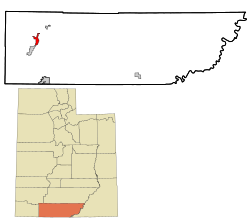
Glendale is located in western Kane County at an elevation of 5,800 feet (1,800 m) in Long Valley, along the East Fork of the Virgin River. U.S. Route 89 passes through the town as it follows the valley, leading southwest 4 miles (6 km) to Orderville and north 41 miles (66 km) to Panguitch.

According to the United States Census Bureau, Glendale has a total area of 7.8 square miles (20.2 km2), all of it land. [5]

Glendale Bench Road leads east from Glendale to the Grand Staircase–Escalante National Monument (GSENM). The rustic and scenic road meets Skutumpah Road, running through the GSENM and ending at one of the GSENM Visitor Centers in Cannonville, near Bryce Canyon.

Demographics

Historical population
CensusPop.
1880 338
1890 253−25.1%
1900 31926.1%
1910 244−23.5%
1920 2502.5%
1930 239−4.4%
1940 29724.3%
1950 226−23.9%
1960 223−1.3%
1970 200−10.3%
1980 23718.5%
1990 28219.0%
2000 35525.9%
2010 3817.3%
2019 (est.)407 [2] 6.8%
Source: U.S. Census Bureau [8]

As of the census [3] of 2000, there were 355 people, 116 households, and 88 families residing in the town. The population density was 45.5 people per square mile (17.6/km2). There were 149 housing units at an average density of 19.1 per square mile (7.4/km2). The racial makeup of the town was 99.15% White, 0.56% Native American, and 0.28% from two or more races. Hispanic or Latino of any race were 3.94% of the population.

There were 116 households, out of which 38.8% had children under 18 living with them, 71.6% were married couples living together, 4.3% had a female householder with no husband present, and 23.3% were non-families. 20.7% of all households were made up of individuals, and 9.5% had someone living alone who was 65 years of age or older. The average household size was 3.06, and the average family size was 3.62.

In the town, the population was spread out, with 34.1% under 18, 8.5% from 18 to 24, 21.1% from 25 to 44, 23.1% from 45 to 64, and 13.2% who were 65 years of age or older. The median age was 31 years. For every 100 females, there were 107.6 males. For every 100 females aged 18 and over, there were 101.7 males.

The median income for a household in the town was $35,938, and the median income for a family was $38,500. Males had a median income of $24,722 versus $20,000 for females. The per capita income for the town was $17,322. About 5.4% of families and 8.1% of the population were below the poverty line, including 15.0% of those under age 18 and none of those age 65 or over.

History

In 1862 ranchers came to Long Valley, land east of the future Zion National Park, to graze cattle along the East Fork of the Virgin River. Robert and Isabella Berry named the area "Berryville". In 1866 after local indigenous tribes killed the Berrys, the other settlers left.

In 1871 Mormons from the Muddy River settlement in Nevada came to settle, naming their town "Glendale". The people of St. Thomas, Nevada, relocated en masse to Glendale that year, preserving their old ward organization in the new location. [9] By the late 1800s, the Mormon communities in the area had grown in the nearby towns of Orderville and Mt Carmel Junction, and Glendale became part of the United Order, a program of economic and moral reform that began in 1874 under Brigham Young.

On March 29, 1935, Glendale became an incorporated town. The towns of Mount Carmel, Orderville, and Glendale are known as Long Valley.

Related Research Articles

<span class="mw-page-title-main">Kane County, Utah</span> County in Utah, United States

Kane County is a county in the U.S. state of Utah. As of the 2010 United States Census, the population was 7,125. Its county seat and largest city is Kanab.

<span class="mw-page-title-main">Gateway, Arkansas</span> Town in Arkansas, United States

Gateway is a town in Benton County, Arkansas, United States. The population was 405 at the 2010 census, up from 116 in 2000. It is part of the Northwest Arkansas region. The town's name reflects its situation as the "gateway" to and from Arkansas.

<span class="mw-page-title-main">Berryville, Arkansas</span> City in Arkansas, United States

Berryville is a city in Carroll County, Arkansas, United States. The population was 5,682 at the 2020 census. making it the largest city in Carroll County. Along with Eureka Springs, it is one of the two county seats of Carroll County.

<span class="mw-page-title-main">Berryville, Texas</span> Town in Texas, United States

Berryville is a town in Henderson County, Texas, United States. The population was 824 at the 2020 census, down from 975 at the 2010 census.

<span class="mw-page-title-main">Corinne, Utah</span> Town in Utah, United States

Corinne is a town in Box Elder County, Utah, United States. The population was 685 at the 2010 census.

<span class="mw-page-title-main">Mendon, Utah</span> City in Utah, United States

Mendon is a city in Cache County, Utah, United States. The population was 1,282 at the 2010 census. It is included in the Logan, Utah-Idaho Metropolitan Statistical Area.

<span class="mw-page-title-main">Ferron, Utah</span> City in Utah, United States

Ferron is a city in western Emery County, Utah, United States. The population was 1,626 at the 2010 census. The 2020 2020 census showed the population at 1,474 residents.

<span class="mw-page-title-main">Escalante, Utah</span> City in Utah, United States

Escalante is a city in central Garfield County, Utah, United States, located along Utah Scenic Byway 12 (SR-12) in the south-central part of the state. As of the 2010 census, 797 people were living in the city.

<span class="mw-page-title-main">Hatch, Utah</span> Town in the state of Utah, United States

Hatch is a town in Garfield County, Utah, United States. The population was 133 at the 2010 census. It is 260 miles (420 km) south of Salt Lake City.

<span class="mw-page-title-main">Nephi, Utah</span> City in Utah, United States

Nephi is a city in Juab County, Utah, United States. It is part of the Provo–Orem metropolitan area. The population was 6,443 at the 2020 census. It is the county seat of Juab County. It was settled by Mormon pioneers in 1851 as Salt Creek, and it acquired its current name in 1882. It is the principal city in the Juab Valley, an agricultural area. Nephi was named after Nephi, son of Lehi, from the Book of Mormon.

<span class="mw-page-title-main">Orderville, Utah</span> Town in Utah, United States

Orderville is a town in western Kane County, Utah, United States. The population was 577 at the 2010 census. The town was founded and operated under the United Order of the Church of Jesus Christ of Latter-day Saints. This system allowed the community to flourish for some time, but ultimately ended in 1885.

<span class="mw-page-title-main">Goshen, Utah</span> Town in the state of Utah, United States

Goshen is a town in Utah County, Utah, United States. It is part of the Provo–Orem Metropolitan Statistical Area. The population was 921 at the 2010 census.

<span class="mw-page-title-main">Highland, Utah</span> City in Utah, United States

Highland is a city in Utah County, Utah, United States. It is approximately 30 miles (48 km) south of Salt Lake City and is part of the Provo–Orem Metropolitan Statistical Area. According to the 2010 census the population was 15,523, a 90.0% increase over the 2000 figure of 8,172.

<span class="mw-page-title-main">Leeds, Utah</span> Town in Washington County, Utah

Leeds is a town in Washington County, Utah, United States. The population was 820 at the 2010 census.

<span class="mw-page-title-main">Rockville, Utah</span> Town in the state of Utah, United States

Rockville is a town in Washington County, Utah, United States. It is located along the Virgin River near the mouth of Zion Canyon. The city lies just outside the park boundary for Zion National Park; the park entrance is located approximately 5 miles (8 km) northeast of the town.

<span class="mw-page-title-main">Springdale, Utah</span> Town in the state of Utah, United States

Springdale is a town in Washington County, Utah, United States. The population was 529 at the 2010 census. It is located immediately outside the boundaries of Zion National Park, and is oriented around the resulting tourist industry. It was originally settled as a Mormon farming community in 1862 by evacuees from the flooding of nearby Northrop. Springdale was named one of the 20 'prettiest towns' in the United States by Forbes Traveler in 2008.

<span class="mw-page-title-main">Toquerville, Utah</span> City in Utah, United States

Toquerville is a city in east–central Washington County, Utah, United States. The population was 1,370 at the 2010 census.

<span class="mw-page-title-main">Torrey, Utah</span> Town in the state of Utah, United States

Torrey is a town located on State Route 24 in Wayne County, Utah, United States, 8 miles (13 km) from Capitol Reef National Park. As of the 2010 census, the town had a population of 182.

<span class="mw-page-title-main">Berryville, Virginia</span> Town in Virginia

Berryville is an incorporated town in and the county seat of Clarke County, Virginia, United States. The population was 4,574 at the 2020 census, up from 4,185 at the 2010 census.

<span class="mw-page-title-main">Mount Carmel Junction, Utah</span> Unincorporated community in Utah, United States

Mount Carmel Junction and Mount Carmel are unincorporated communities located 12 miles (19 km) east of Zion National Park and 17 miles (27 km) north of Kanab in Kane County, Utah, United States. They lie in close proximity to the Coral Pink Sand Dunes State Park.

References

  1. "2019 U.S. Gazetteer Files". United States Census Bureau. Retrieved August 7, 2020.
  2. 1 2 "Population and Housing Unit Estimates". United States Census Bureau. May 24, 2020. Retrieved May 27, 2020.
  3. 1 2 "U.S. Census website". United States Census Bureau . Retrieved 2008-01-31.
  4. "US Board on Geographic Names". United States Geological Survey. 2007-10-25. Retrieved 2008-01-31.
  5. 1 2 "Geographic Identifiers: 2010 Census Summary File 1 (G001), Glendale town, Utah". American FactFinder. U.S. Census Bureau. Archived from the original on February 13, 2020. Retrieved May 21, 2019.
  6. 1 2 The Utah Genealogical and Historical Magazine, Volumes 9-10. 1918. p. 182.
  7. Van Atta, Dale (Jan 22, 1977). "You name it - there's a town for it". The Deseret News. p. 15. Retrieved 18 October 2015.
  8. "Census of Population and Housing". U.S. Census Bureau. Retrieved November 18, 2011.
  9. Andrew Jenson, LDS Biographical Encyclopedia, Vol. 1, p. 378