Cannonville, Utah

Last updated
Cannonville, Utah
LDS church in Cannonville, Utah.jpg
LDS church in Cannonville
Nickname(s): 
Shotgun (Before a new family moved in, then they called it Cannonville)
Motto: 
360 degree view of Cannonville, UT from the Big Red Rock which is on the Southwest side of Cannonville. Cannonville UT 2023.PHOTOSPHERE~4.jpg
360 degree view of Cannonville, UT from the Big Red Rock which is on the Southwest side of Cannonville.
Garfield County Utah incorporated and unincorporated areas Cannonville highlighted.svg
Location in Garfield County and state of Utah
Coordinates: 37°34′0″N112°3′6″W / 37.56667°N 112.05167°W / 37.56667; -112.05167
Country United States
State Utah
County Garfield
Founded1874
Incorporated 1934
Founded byJames L. Thompson
Named for George Q. Cannon
Government
  MayorBill Scoffield
  ClerkTom Shakespear
Area
[1]
  Total2.57 sq mi (6.65 km2)
  Land2.57 sq mi (6.65 km2)
  Water0.00 sq mi (0.00 km2)
Elevation
[2]
5,886 ft (1,794 m)
Population
 (2020)
  Total186
  Estimate 
(2019) [3]
173
  Density67.42/sq mi (26.03/km2)
Time zone UTC-7 (Mountain (MST))
  Summer (DST) UTC-6 (MDT)
ZIP code
84718
Area code 435
FIPS code 49-10330 [4]
GNIS feature ID1426344 [2]

Cannonville is a town in Garfield County, Utah, United States, along Utah Scenic Byway 12. As of the 2020 census, the population was 186. [5]

Contents

History

Cannonville was laid out in 1874. [6] A post office called Cannonville was established in 1879, and remained in operation until 1966. [7] The community bears the name of George Q. Cannon, a Mormon official. [8]

Geography

Aerial view of Cannonville, 2004 CannonvilleUT aerial view.jpg
Aerial view of Cannonville, 2004
Looking northwest along Highway 12 Highway 12 Cannonville Utah.jpg
Looking northwest along Highway 12

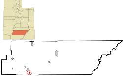
Cannonville is located near the southern border of Garfield County, in the valley of the Paria River. Via State Route 12 it is 3.5 miles (5.6 km) east to Henrieville and 5 miles (8 km) north to Tropic. Bryce Canyon National Park is 6 miles (10 km) in a straight line to the west, 16 miles (26 km) by road.

According to the United States Census Bureau, the town has a total area of 2.0 square miles (5.1 km2), all land. [9]

Climate

The climate in this area features a large daily and annual temperature range, with cold, dry winters and hot summers. Rainfall is highly seasonal, with most precipitation falling during the late-summer monsoon season and average annual precipitation of nine inches. According to the Köppen Climate Classification system, Cannonville has a hot and cold arid desert climate, abbreviated "BWk" on climate maps. [10]

Climate data for Cannonville, Utah
MonthJanFebMarAprMayJunJulAugSepOctNovDecYear
Mean daily maximum °F (°C)32
(0)
36
(2)
43
(6)
52
(11)
63
(17)
75
(24)
81
(27)
77
(25)
72
(22)
57
(14)
46
(8)
34
(1)
56
(13)
Mean daily minimum °F (°C)14
(−10)
16
(−9)
25
(−4)
32
(0)
41
(5)
50
(10)
57
(14)
55
(13)
50
(10)
37
(3)
27
(−3)
16
(−9)
35
(2)
Average precipitation inches (mm)0.8
(21)
1.0
(25)
1.0
(26)
0.7
(18)
0.9
(22)
0.6
(16)
1.1
(27)
1.7
(42)
1.4
(36)
1.1
(27)
0.9
(23)
0.9
(23)
12.1
(306)
Average snowfall inches (cm)7.8
(19.9)
7.2
(18.3)
6.7
(17.1)
1.9
(4.9)
0.2
(0.5)
0
(0)
0
(0)
0
(0)
0
(0)
0.5
(1.2)
4.0
(10.1)
8.5
(21.5)
36.8
(93.5)
Average extreme snow depth inches (cm)6.7
(17)
7.9
(20)
5.9
(15)
2.0
(5)
0
(0)
0
(0)
0
(0)
0
(0)
0
(0)
0
(0)
0.8
(2)
2.8
(7)
7.9
(20)
Average precipitation days67755378545668
Average relative humidity (%)71.569.36253.545.936.243.950.148.957.163.970.156.0
Mean daily daylight hours 10.411.312.413.714.715.3151412.811.610.610.112.7
Source: Weatherbase [10] World Weather online(Temperatures-Snowfall 2009-2023) [11]

Demographics

Historical population
CensusPop.Note
1880 137
1890 27399.3%
1900 211−22.7%
1910 2193.8%
1920 31142.0%
1930 227−27.0%
1940 25010.1%
1950 205−18.0%
1960 153−25.4%
1970 113−26.1%
1980 13418.6%
1990 131−2.2%
2000 14813.0%
2010 16712.8%
2019 (est.)173 [3] 3.6%
U.S. Decennial Census [12]

As of the census [4] of 2000, there were 148 people, 50 households, and 41 families residing in the town. The population density was 119.9 people per square mile (46.5/km2). There were 60 housing units at an average density of 48.6 per square mile (18.8/km2). The racial makeup of the town was 95.27% White, 0.68% Pacific Islander, 3.38% from other races, and 0.68% from two or more races. Hispanic or Latino of any race were 4.05% of the population.

There were 50 households, of which 42.0% had children under 18 living with them, 66.0% were married couples living together, 14.0% had a female householder with no husband present, and 18.0% were non-families. 18.0% of all households were made up of individuals, and 16.0% had someone living alone who was 65 years of age or older. The average household size was 2.96, and the average family size was 3.34.

In the town, the population was spread out, with 33.8% under 18, 6.8% from 18 to 24, 19.6% from 25 to 44, 20.3% from 45 to 64, and 19.6% who were 65 years of age or older. The median age was 38 years. For every 100 females, there were 117.6 males. For every 100 females aged 18 and over, there were 96.0 males.

The median income for a household in the town was $28,750, and the median income for a family was $32,250. Males had a median income of $23,750 versus $12,083 for females. The per capita income was $11,481. None of the families and 3.7% of the population lived below the poverty line, including no under eighteens and 10.9% of those over 64.

See also

Related Research Articles

<span class="mw-page-title-main">Garfield County, Utah</span> County in Utah, United States

Garfield County is a county in south central Utah, United States. As of the 2020 United States Census the population was 5,083, making it the fifth-least populous county in Utah; with about one inhabitant per square mile, it is also the least densely populated county in Utah. Its county seat and largest city is Panguitch.

<span class="mw-page-title-main">Jordan, Montana</span> Town in Montana, United States

Jordan is a town in and the county seat of Garfield County, Montana, United States. The population was 356 at the 2020 census. It is Garfield County's only incorporated community.

<span class="mw-page-title-main">Garfield, Texas</span> CDP in Texas, United States

Garfield is a census-designated place (CDP) in Travis County, Texas, United States. As of the 2020 census, the CDP population was 1,825.

<span class="mw-page-title-main">Trenton, Utah</span> Town in Utah, United States

Trenton is a town in Cache County, Utah, United States. The population was 464 at the 2010 census. It is included in the Logan, Utah-Idaho (partial) Metropolitan Statistical Area.

<span class="mw-page-title-main">Manila, Utah</span> Town in the state of Utah, United States

Manila is a small city located on the northern edge of Daggett County, Utah, United States, just south of the Wyoming border. The town is at the junction of State Route 43 and State Route 44, and is the county seat of Daggett County. Nearby sites include the Flaming Gorge National Recreation Area and the Flaming Gorge Reservoir just east of town, and to the south is Ashley National Forest, which includes Kings Peak (13,528 ft), the highest point in Utah.

<span class="mw-page-title-main">Myton, Utah</span> City in Utah, United States

Myton is a city in Duchesne County, Utah, United States. Established in 1905, Myton had a population of 569 at the 2010 census.

<span class="mw-page-title-main">Antimony, Utah</span> Town in the state of Utah, United States

Antimony is a town in Garfield County, Utah, United States. The population was 118 at the 2020 census.

<span class="mw-page-title-main">Boulder, Utah</span> Town in the state of Utah, United States

Boulder is a town in Garfield County, Utah, United States, 27 miles (44 km) northeast of Escalante on Utah Scenic Byway 12 at its intersection with the Burr Trail. As of the 2020 census, the town population was 227.

<span class="mw-page-title-main">Hatch, Utah</span> Town in the state of Utah, United States

Hatch is a town in Garfield County, Utah, United States. The population was 132 at the 2020 census. It is 260 miles (420 km) south of Salt Lake City.

<span class="mw-page-title-main">Henrieville, Utah</span> Town in the state of Utah, United States

Henrieville is a town in Garfield County, Utah, United States, along Utah Scenic Byway 12. As of the 2020 census, the town population was 221.

<span class="mw-page-title-main">Panguitch, Utah</span> City and county seat in Utah, United States

Panguitch is a city in and the county seat of Garfield County, Utah, United States. The population was 1,725 at the 2020 census. The name Panguitch comes from a Southern Paiute word meaning “Big Fish,” likely named after the plentiful nearby lakes hosting rainbow trout year-round.

<span class="mw-page-title-main">Tropic, Utah</span> Town in Utah, United States

Tropic is a town in Garfield County, Utah, United States, along Utah Scenic Byway 12. As of the 2020 census, the town had a population of 486. Tropic was founded in 1891.

<span class="mw-page-title-main">Levan, Utah</span> Town in Juab County, Utah, United States

Levan is a town in Juab County, Utah, United States. As of the 2020 census it had a population of 862.

<span class="mw-page-title-main">Nephi, Utah</span> City in and county seat of Juab County, Utah, United States

Nephi is a city in Juab County, Utah, United States. It is part of the Provo–Orem metropolitan area. The population was 6,443 at the 2020 census. It is the county seat of Juab County. It was settled by Mormon pioneers in 1851 as Salt Creek, and it acquired its current name in 1882. It is the principal city in the Juab Valley, an agricultural area. Nephi was named after Nephi, son of Lehi, from the Book of Mormon.

<span class="mw-page-title-main">Big Water, Utah</span> Town in the state of Utah, United States

Big Water is a town in Kane County, Utah, United States. The population was 475 at the 2010 census, up from 417 at the 2000 census. It is located 17 miles (27 km) northwest of Page, Arizona, on US-89 near Lake Powell and the Glen Canyon Dam. It was originally called Glen Canyon City and housed workers who built the dam in the 1950s.

<span class="mw-page-title-main">Glendale, Utah</span> Town in Utah, United States

Glendale is a town in Kane County, Utah, United States. The population was 381 at the 2010 census.

<span class="mw-page-title-main">Junction, Utah</span> Town in the state of Utah, United States

Junction is a town in and the county seat of Piute County, Utah, United States. The population was 191 at the 2010 census.

<span class="mw-page-title-main">Laketown, Utah</span> Town in the state of Utah, United States

Laketown is a town in Rich County, Utah, United States. The population was 248 at the 2010 census. The town is named for nearby Bear Lake.

<span class="mw-page-title-main">Randolph, Utah</span> Town in the state of Utah, United States

Randolph is a town in Rich County, Utah, United States and as of the 2010 census, the town population was 464. It is the county seat of Rich County. Randolph had the highest percentage of people of any city in the country vote for George W. Bush in the 2004 election, at 95.6% Randolph's municipal classification was officially changed from a city to a town on January 1, 2009. The controversial WWASPS boarding school Old West Academy is located just outside Randolph.

<span class="mw-page-title-main">Rockville, Utah</span> Town in the state of Utah, United States

Rockville is a town in Washington County, Utah, United States. It is located along the Virgin River near the mouth of Zion Canyon. The city lies just outside the park boundary for Zion National Park; the park entrance is located approximately 5 miles (8 km) northeast of the town.

References

  1. "2019 U.S. Gazetteer Files". United States Census Bureau. Retrieved August 7, 2020.
  2. 1 2 U.S. Geological Survey Geographic Names Information System: Cannonville, Utah
  3. 1 2 "Population and Housing Unit Estimates". United States Census Bureau. May 24, 2020. Retrieved May 27, 2020.
  4. 1 2 "U.S. Census website". United States Census Bureau . Retrieved 2008-01-31.
  5. "Explore Census Data". data.census.gov. Retrieved 2024-04-11.
  6. The Utah Genealogical and Historical Magazine, Volumes 9-10. 1918. p. 81.
  7. "Garfield County". Jim Forte Postal History. Retrieved 18 October 2015.
  8. Van Atta, Dale (Jan 22, 1977). "You name it - there's a town for it". The Deseret News. p. 15. Retrieved 18 October 2015.
  9. "Geographic Identifiers: 2010 Demographic Profile Data (G001): Cannonville town, Utah". U.S. Census Bureau, American Factfinder. Retrieved March 28, 2017.[ dead link ]
  10. 1 2 "Cannonville, Utah Travel Weather Averages". Weatherbase. Retrieved 4 September 2023.
  11. "Cannonville Annual Weather Averages". World Weather Online. Retrieved 4 September 2023.
  12. "Census of Population and Housing". Census.gov. Retrieved June 4, 2015.

Commons-logo.svg Media related to Cannonville, Utah at Wikimedia Commons