Burton, Illinois

Last updated

Burton
USA Illinois location map.svg
Red pog.svg
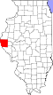
Burton
Location of Burton within Illinois
Usa edcp location map.svg
Red pog.svg
Burton
Burton (the United States)
Coordinates: 39°54′17″N091°14′57″W / 39.90472°N 91.24917°W / 39.90472; -91.24917
CountryUnited States
StateIllinois
County Adams
Township Burton
Area
[1]
  Total0.33 sq mi (0.85 km2)
  Land0.33 sq mi (0.85 km2)
  Water0.00 sq mi (0.00 km2)
Elevation
2,152 ft (656 m)
Population
 (2020)
  Total103
  Density312.12/sq mi (120.64/km2)
Time zone UTC-6 (CST)
  Summer (DST) UTC-5 (CDT)
ZIP code
62301 (Quincy)
Area code 217
FIPS code 17-10006
GNIS feature ID405275 [2]

Burton is an unincorporated community and census-designated place in Adams County about four miles east of Quincy.

Contents

Burton was platted ca. 1836. [3] A post office called Burton was established in 1840, and remained in operation until 1922. [4]

Geography

Burton is located at 39°54′29″N91°14′57″W / 39.907938°N 91.249269°W / 39.907938; -91.249269 . According to the 2021 census gazetteer files, Burton has a total area of 0.33 square miles (0.85 km2), all land. [5]

Demographics

As of the 2020 census [6] there were 103 people, 27 households, and 13 families residing in the CDP. The population density was 312.12 inhabitants per square mile (120.51/km2). There were 44 housing units at an average density of 133.33 per square mile (51.48/km2). The racial makeup of the CDP was 98.06% White, 0.97% Pacific Islander, and 0.97% from two or more races.

Historical population
CensusPop.Note
2020 103
U.S. Decennial Census [7]

See also

Notes and references

  1. "2020 U.S. Gazetteer Files". United States Census Bureau. Retrieved March 15, 2022.
  2. U.S. Geological Survey Geographic Names Information System: Burton
  3. The History of Adams County, Illinois: Containing a History of the County, Its Cities, Towns, Etc. Windmill Pub. 1879. p. 507.
  4. "Adams County". Jim Forte Postal History. Retrieved March 26, 2017.
  5. Bureau, US Census. "Gazetteer Files". Census.gov. Retrieved June 29, 2022.
  6. "Explore Census Data". data.census.gov. Retrieved June 28, 2022.
  7. "Census of Population and Housing". Census.gov. Retrieved June 4, 2016.


Related Research Articles

<span class="mw-page-title-main">Burnt Store Marina, Florida</span> Census-designated place in Florida, United States

Burnt Store Marina is an unincorporated community and census-designated place (CDP) in Lee County, Florida, United States. The population was 1,890 at the 2020 census, up from 1,793 at the 2010 census. It is part of the Cape Coral-Fort Myers, Florida Metropolitan Statistical Area.

<span class="mw-page-title-main">Columbus, Illinois</span> Village in Illinois, United States

Columbus is a village in Adams County, Illinois, United States. The population was 114 at the 2020 census. It is part of the Quincy, IL–MO Micropolitan Statistical Area.

Lake Catherine is an unincorporated community and census-designated place (CDP) in Lake County, Illinois, United States. Per the 2020 census, the population was 1,279.

<span class="mw-page-title-main">Hurley, Mississippi</span> Census-designated place in Mississippi

Hurley is an unincorporated community and census-designated place (CDP) in Jackson County, Mississippi, United States. It is part of the Pascagoula Metropolitan Statistical Area. The population was 1,551 at the 2010 census, up from 985 at the 2000 census.

<span class="mw-page-title-main">Westport, North Carolina</span> Census-designated place in North Carolina, United States

Westport is an unincorporated community and census-designated place (CDP) located in Lincoln County, North Carolina, United States. The population of the CDP was 4,026 at the 2010 census, up from 2,006 at the 2000 census. The community's name comes from its location on the west side of Lake Norman.

Elgin is an unincorporated community and census-designated place (CDP) in Lancaster County, South Carolina, United States. The population was 2,607 at the 2010 census.

West Union is an unincorporated census-designated place located in York Township in the southeast corner of Clark County, Illinois, on Illinois Route 1. Its postal zip code is 62477. As of the 2020 census, its population was 271.

Serena is an unincorporated community and census-designated place in LaSalle County, Illinois, United States. Serena has a post office with ZIP code 60549. Serena was the residence of Peg McDonnell Breslin, the first woman elected to the Illinois Appellate Court outside Cook County.

<span class="mw-page-title-main">Garden Prairie, Illinois</span> CDP in Illinois, United States

Garden Prairie is an unincorporated former village and census-designated place located in Boone County, Illinois, United States. It is part of the Rockford, Illinois Metropolitan Statistical Area.

Fowler is an unincorporated community and census-designated place in Gilmer Township, Adams County, Illinois, United States and is located near Quincy. It is part of the Quincy, IL–MO Micropolitan Statistical Area. U.S. Route 24 passes through the center of town as well as the Burlington Northern and Santa Fe Railroad. Interstate 172 begins two miles west of Fowler.

Olive Branch is an unincorporated census-designated place in Alexander County, Illinois, United States. It has a post office with the ZIP code 62969. Its population was 650 at the 2020 census.

Penfield is an unincorporated census-designated place in Compromise Township, Champaign County, Illinois, United States. Its population was 151 at the 2020 census.

<span class="mw-page-title-main">Dewey, Illinois</span> Census-designated place in Illinois, United States

Dewey is an unincorporated community and census-designated place in East Bend Township, Champaign County, Illinois, United States.

Langleyville is an unincorporated census-designated place in Christian County, Illinois, United States. As of the 2020 census, it had a population of 391.

Adams is a census-designated place in Burton Township, Adams County, Illinois, United States. Adams is about 13 miles (21 km) southeast of Quincy.

Beverly is an unincorporated community and census-designated place in Beverly Township, Adams County, Illinois, United States. Beverly is about 26 miles (42 km) southeast of Quincy in the southeast corner of Adams County.

Bloomfield is an unincorporated community and census-designated place in Ellington and Mendon Townships, Adams County, Illinois, United States. Bloomfield is located on Illinois Route 336 about 9 miles (14 km) north of Quincy.

Fall Creek is an unincorporated community and census-designated place in Fall Creek Township, Adams County, Illinois, United States. Fall Creek is located along Interstate 172 southwest of Payson.

Kingston is an unincorporated community and census-designated place in Beverly and Richfield Townships, Adams County, Illinois, United States. Kingston is located along Illinois Route 104 southeast of Liberty.

Annapolis is an unincorporated census-designated place (CDP) in Crawford County, Illinois, United States. Annapolis is 10 miles (16 km) north-northwest of Robinson. Annapolis has a post office with ZIP code 62413. Its population was 106 as of 2020.