Spring Valley, Illinois | |
|---|---|
 Spring Valley, Illinois  Spring Valley, Illinois | |
| Coordinates: 39°53′48″N90°58′43″W / 39.89667°N 90.97861°W | |
| Country | United States |
| State | Illinois |
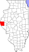
| County | Adams |
| Elevation | 604 ft (184 m) |
| Time zone | UTC-6 (Central (CST)) |
| • Summer (DST) | UTC-5 (CDT) |
| Area code | 217 |
| GNIS feature ID | 1785353 [1] |
Spring Valley is an unincorporated community in McKee Township, Adams County, Illinois, United States. Spring Valley is east of Liberty and west of Siloam Springs State Park.