Fall Creek takes its name from a nearby creek of the same name, which was named for a waterfall along its course.[3] A post office called Falls Creek was established in 1861, and closed in 1866. The post office was reestablished in 1872, the name was changed to Fallcreek in 1894, and the post office was discontinued in 1909.[4]
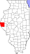
Geography
According to the 2021 census gazetteer files, Fall Creek has a total area of 0.06 square miles (0.16km2), all land.[5]
As of the 2020 census[8] there were 31 people, 14 households, and 14 families residing in the CDP. The population density was 563.64 inhabitants per square mile (217.62/km2). There were 12 housing units at an average density of 218.18 per square mile (84.24/km2). The racial makeup of the CDP was 93.55% White, 3.23% Asian, and 3.23% from two or more races.
This page is based on this Wikipedia article Text is available under the CC BY-SA 4.0 license; additional terms may apply. Images, videos and audio are available under their respective licenses.