Buru Regency

Last updated
Buru Regency
Kabupaten Buru
Lambang Kabupaten Buru.png
Motto(s): 
Retemena Barasehe
(Keep Moving Forward, Never Give Up)
Locator map of Buru Regency in Maluku.png
Location within Maluku
Indonesia Maluku location map.svg
Red pog.svg
Buru Regency
Location in Maluku and Indonesia
Indonesia location map.svg
Red pog.svg
Buru Regency
Buru Regency (Indonesia)
Coordinates: 3°19′40″S126°41′03″E / 3.3277°S 126.6841°E / -3.3277; 126.6841
Country Flag of Indonesia.svg  Indonesia
Province Flag of Maluku.svg  Maluku
Capital Namlea
Government
  RegentRamly I. Umasugi
  Vice RegentAmustofa Besan
Area
  Total7,595.58 km2 (2,932.67 sq mi)
Population
 (mid 2023 estimate) [1]
  Total139,408
  Density18/km2 (48/sq mi)
Time zone UTC+9 (IEST)
Area code (+62) 913
Website burukab.go.id

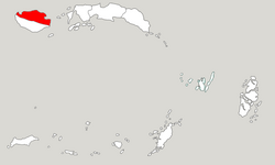
Buru Regency is a regency of Maluku province, Indonesia. When it was first created on 4 October 1999 (by separation from Central Maluku Regency), the regency encompassed the entire island (plus outlying islands); but on 24 June 2008 the southern 40% of the island was split off to form a separate Buru Selatan (South Buru) Regency. The residual Buru Regency comprises the northern 60% of the island of Buru and covers an area of 7,595.58 km2. The population at the 2010 census was 108,445 [2] and at the 2020 census this had increased to 135,238; [3] the official estimate as at mid 2023 was 139,408 (comprising 70,598 males and 68,810 females). [1] The principal town lies at Namlea.

Administrative Districts

At the time of the 2010 census the Buru Regency was divided into five districts (kecamatan), but subsequently this has been increased to ten districts by the splitting of the existing districts. The ten districts are tabulated below with their areas and their populations at the 2010 census [2] and the 2020 census, [3] together with the official estimates as at mid 2023. [1] The table also includes the location of the district headquarters, the number of administrative villages (all classed as rural desa) in each district, and its postal codes.

Kode
Wilayah
Name of
District
(kecamatan)
Area
in
km2
Pop'n
census
2010
Pop'n
census
2020
Pop'n
estimate
mid 2023
Admin
centre
No.
of
villages
Post
codes
81.04.01Namlea951.1537,21836,68037,264Namlea797571
81.04.03Waeapo (a)102.5034,15312,04012,692Waenetat797578
81.04.06Waplau585.2310,00012,69813,186Waplau1097573
81.04.10Bata Bual (b)108.608,1479,4399,261Ilath597574
81.04.14Teluk Kaiely
(Kaiely Bay)
141.08(c)3,9984,412Kaiely597577
81.04.12Waelata234.50(c)13,58114,482Basakale1097579
81.04.11Lolong Guba457.02(c)12,46513,315Kubalahin1097576
81.04.15Lilialy481.50(c)11,20811,181Sawa597570
81.04.02Air Buaya1,702.3518,92712,01912,082Air Buaya1097572
81.04.13Fena Leisela2,831.65(c)11,19011,533Wainlana1397575
Totals7,595.58108,445135,238139,408Namlea82

Notes: (a) including the offshore islands of Pulau Nirwana Besar and Pulau Nirwana Kecil. (b) including the offshore island of Pulau Batukapal. (c) the 2010 populations of these new districts are included in the figures for the districts from which they were split away.

Related Research Articles

<span class="mw-page-title-main">Sikka Regency</span> Regency in Lesser Sunda Islands, Indonesia

Sikka is a regency within East Nusa Tenggara province, Indonesia, on the island of Flores. It is bordered to the west by Ende Regency and to the east by East Flores Regency. It covers an area of 1,675.36 km2 and had a population of 300,301 at the 2010 census and 321,953 at the 2020 Census; the official estimate as at mid 2023 was 335,360 - comprising 163,060 males and 172,300 females). The capital is the town of Maumere, which comprises the districts of Alok Barat, Alok and Alok Timur.

<span class="mw-page-title-main">South Aceh Regency</span> Regency in Sumatra, Indonesia

South Aceh Regency is a regency in the Aceh province of Indonesia. It is located on the west coast of the island of Sumatra. The regency covers an area of 4,173.82 square kilometres and had a population of 202,251 at the 2010 Census, 224,588 in 2015 and 232,414 at the 2020 Census; the official estimate as at mid 2023 was 239,475 . Its population density was thus 48.5 inhabitants/km2 at the 2010 census, 53.8 inhabitants/km2 in 2015, 55.7 inhabitants/km2 at the 2020 census, and 57.4 inhabitants/km2 in mid 2023. The seat of the regency government is at Tapaktuan.

<span class="mw-page-title-main">Aceh Singkil Regency</span> Regency in Sumatra, Indonesia

Aceh Singkil Regency is a regency in the Aceh province of Indonesia. It is situated largely on the island of Sumatra, but also includes the offshore Banyak Islands, the largest of which is Tuangku, with the principal town of Alaban. The regency was created on 20 April 1999 from the former southern districts of South Aceh Regency. Until 2007 it included the large town of Subulussalam, but on 2 January of that year that town was split off to become an autonomous city. The seat of the Aceh Singkil Regency government is at the port of Singkil on the Sumatra coast. The Regency now covers an area of 1,857.88 km2, and had a population of 102,509 at the 2010 Census, rising to 114,326 at the 2015 Census and to 126,514 at the 2020 Census; the official estimate as at mid 2023 was 135,435.

<span class="mw-page-title-main">Alor Regency</span> Regency in Indonesia

Alor Regency is a regency (kabupaten) in East Nusa Tenggara (NTT) province of Indonesia. Established in 1958, Alor Regency administers the Alor Archipelago with its seat (capital) in Kalabahi on Alor Island.

<span class="mw-page-title-main">Langkat Regency</span> Regency in North Sumatra, Indonesia

Langkat Regency is the northernmost regency of North Sumatra Province in Indonesia. Its administrative centre is the town of Stabat. It has a land area of 6,263.29 km2 and its population was 967,535 at the 2010 Census and 1,030,202 at the 2020 Census; the official estimate as at mid 2023 was 1,066,711 - comprising 538,822 males and 527,889 females.

<span class="mw-page-title-main">Yapen Islands Regency</span> Regency in Papua, Indonesia

Yapen Islands Regency is a regency (kabupaten) in Papua Province of eastern Indonesia. It covers an area of 2,432.49 km2 (939.19 sq mi), and had a population of 82,951 at the 2010 Census and 112,676 at the 2020 Census; the official estimate as at mid 2022 was 116,107. It comprises an archipelago which lies in Cenderawasih Bay off the north coast of Western New Guinea.

<span class="mw-page-title-main">Sumbawa Regency</span> Regency in West Nusa Tenggara, Indonesia

Sumbawa Regency is a Regency (Kabupaten) of the Indonesian Province of West Nusa Tenggara. It is located on the island of Sumbawa and covers an area of 6,643.99 km2, following the separation on 18 December 2003 of what were until then its westernmost five districts to form the newly-created West Sumbawa Regency. It includes the substantial island of Moyo, lying off the north coast of Sumbawa. The population of the Regency at the 2010 Census was 415,789, which rose at the 2020 Census to 509,753; the official estimate as at mid 2023 was 529,487. The capital is the town of Sumbawa Besar on the north coast of Sumbawa Island.

<span class="mw-page-title-main">Lembata Regency</span> Regency in East Nusa Tenggara, Indonesia

Lembata Regency is a regency in East Nusa Tenggara province of Indonesia. Established on 4 October 1999 from the most easterly part of East Flores Regency, the regency covers the island of Lembata, together with three small offshore islands together forming the eastern part of the Solor Archipelago, and has its administrative seat (capital) in Lewoleba. The population of the Regency was 117,829 at the 2010 decennial census and at the 2020 census was 135,930; the official estimate as at mid 2023 was 141,391 - comprising 68,409 males and 72,982 females.

South Halmahera Regency is a regency of North Maluku Province, Indonesia. It lies partly on Halmahera Island and partly on smaller islands to the west and south of Halmahera. It covers a land area of 8,779.32 km2, and at the 2010 Census it had a population of 198,911 people, while the 2020 Census showed that this had risen to 248,395 and the official estimate in mid 2022 was 253,331. The capital lies at the town of Labuha on Bacan Island.

Central Halmahera Regency is a regency in North Maluku Province, Indonesia. It covers a land area of 2,485.76 km2, and had a population of 42,815 at the 2010 Census and 56,802 at the 2020 Census; the official estimate as at mid 2022 was 59,096. The capital lies at Weda.

<span class="mw-page-title-main">Paser Regency</span> Regency in East Kalimantan, Indonesia

Paser Regency is a regency (kabupaten) within East Kalimantan province in Indonesia, it is the southernmost regency of the East Kalimantan province. Its administrative centre is Tana Paser. It covers an area of 7,730 km2, and it had a population of 230,316 at the 2010 Census and 275,452 at the 2020 Census; the official estimate as at mid-2022 was 280,065 . Before 2007, this regency was formerly named Pasir Regency.

<span class="mw-page-title-main">Takalar Regency</span> Regency in South Sulawesi, Indonesia

Takalar Regency is a regency of South Sulawesi Province, Indonesia. It covers an area of 566.51 km2 and had a population of 269,603 at the 2010 census and 300,853 at the 2020 census; the official estimate for mid 2022 was 305,077. The entire regency lies within the official metropolitan area of the city of Makassar. The principal towns are at Galesong and Takalar, but the administrative centre is at Pattallassang.

<span class="mw-page-title-main">Tolitoli Regency</span> Regency in Central Sulawesi, Indonesia

Tolitoli Regency is a regency of Central Sulawesi Province of Indonesia. It was previously part of a larger Buol Tolitoli Regency, but this was split into two on 4 October 1999 after rapid decentralization of the Indonesian government. The present Tolitoli Regency covers an area of 3,701.54 km2 and had a population of 211,296 at the 2010 Census and 225,154 at the 2020 Census; the official estimate as at mid 2022 was 228,641, comprising 116,514 male and 112,127 female inhabitants. Its regency seat is located at the town of Tolitoli, which is a port town and where its population is concentrated.

<span class="mw-page-title-main">North Bolaang Mongondow Regency</span> Regency in North Sulawesi, Indonesia

North Bolaang Mongondow Regency is a regency of North Sulawesi Province of Indonesia. It was created on 2 January 2007 by splitting off districts which were previously part of Bolaang Mongondow Regency. The regency covers an area of 1,672.61 km2 and had a population of 70,693 at the 2010 Census and 83,112 at the 2020 Census; the official estimate as at mid 2022 was 84,543. Bitauna is the only official town (kelurahan) in the regency, but the administrative centre is at Boroko.

<span class="mw-page-title-main">North Minahasa Regency</span> Regency in North Sulawesi, Indonesia

North Minahasa Regency is a regency in North Sulawesi, Indonesia. Its capital is Airmadidi. It was originally part of the Minahasa Regency until it was split off and established as a separate regency on 20 November 2003. It covers an area of 1,059.24 km2, and had a population of 188,904 at the 2010 Census; this had risen to 224,993 at the 2020 Census, and the official estimate as at mid 2022 was 229,368. The Regency includes the offshore islands of Bangka and Talisei to the north of Sulawesi, and Mantenang and Naeng Besar to the northwest.

<span class="mw-page-title-main">South Buru Regency</span> Regency in Maluku, Indonesia

South Buru Regency is a regency of Maluku, Indonesia. It was created on 24 June 2008 by being split off from the existing Buru Regency. It is located on the island of Buru, of which it comprises the southern 40%. The Regency covers an area of 5,060 km2, and it had a population of 53,671 at the 2010 Census, rising to 75,410 at the 2020 Census; the official estimate as at mid 2023 was 79,017. The principal town lies at Elfule in Namrole District.

<span class="mw-page-title-main">Southeast Maluku Regency</span> Regency in Maluku, Indonesia

Southeast Maluku Regency is a regency of Maluku, Indonesia. It is coincident with the Kei Islands, except that the city of Tual, although within the Kei Islands geographically and the seat of the Regency's administration, is since 17 July 2007 technically independent of the Regency. The land area of the Regency is 1,031.01 km2, while the sea area administered by the Regency was 3,181 km2; it had a population of 96,442 at the 2010 Census; this increased to 121,511 at the 2020 Census, and the official estimate as at mid 2023 was 129,034.

<span class="mw-page-title-main">Southwest Maluku Regency</span> Regency in Maluku, Indonesia

Southwest Maluku Regency is a regency of Maluku Province, Indonesia. Geographically it forms the most eastern portion of the Lesser Sunda Islands, although it has never been administratively included with them, and politically has always comprised a part of the Maluku Province. It comprises a number of islands and island groups in the south of the province, including Lirang Island, Wetar Island, Kisar Island, Romang Island, the Letti Islands, the Damer Islands, the Sermata Islands and the Babar Islands. The total land area is 4,581.06 km2, and the population was 70,714 at the 2010 Census and 81,928 at the 2020 Census; the official estimate as at mid 2023 was 93,766.

<span class="mw-page-title-main">Manokwari Regency</span> Regency in West Papua, Indonesia

Manokwari Regency is a regency in West Papua, Indonesia. Following the splitting away of twenty of its former districts in 2013, it now covers an area of 3,168.28 km2 and had a population of 192,663 at the 2020 Census; the official estimate as at mid 2022 was 200,785. The administrative centre is presently at the town of Manokwari, which is also the capital of the province, but under proposals currently under consideration by the Indonesian Parliament, the town is intended to be split off from the regency to form a separate independent city.

<span class="mw-page-title-main">East Seram Regency</span> Regency in Maluku, Indonesia

East Seram Regency is a regency of Maluku (province), in Indonesia. It is mainly located on the island of Seram, but also includes smaller islands to the southeast comprising the Gorom and Watubela archipelagoes. The regency covers a land area of 5,779.12 km2, and had a population of 99,065 at the 2010 Census and 137,972 at the 2020 Census; the official estimate as at mid 2023 was 138,580. The principal town lies at Bula, on Seram Island.

References

  1. 1 2 3 Badan Pusat Statistik, Jakarta, 28 February 2024, Kabupaten Buru Dalam Angka 2024 (Katalog-BPS 1102001.8104)
  2. 1 2 Biro Pusat Statistik, Jakarta, 2011.
  3. 1 2 Badan Pusat Statistik, Jakarta, 2021.