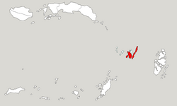
Southeast Maluku Regency (Indonesian: Kabupaten Maluku Tenggara) is a regency of Maluku, Indonesia. It is coincident with the Kei Islands, except that the city of Tual, although within the Kei Islands geographically and the seat of the Regency's administration, is since 17 July 2007 technically independent of the Regency. The land area of the Regency is 1,031.81 km2, while the sea area administered by the Regency was 3,181 km2; it had a population of 96,442 at the 2010 Census;[2] this increased to 121,511 at the 2020 Census,[3] and the official estimate as at mid 2024 was 129,235.[1]
The two principal islands of the Regency are Kei Besar (Greater Kei) in the east and the slightly smaller (excluding those parts of the island now in Tual City) but more densely populated Kei Kecil (Lesser Kei) in the west. The capital is located at Langgur on Kei Kecil.[4] The third-largest island in the group, Dullah, on which the city of Tual is located, is no longer within the Regency.
Kei Besar is long, thin and mountainous. Kei Besar's topography varies between 500 and 800 metres above sea level, and differs from the islands to the west by having a karst formation in the middle of it.[5] Kei Kecil (also called Nuhuroa) is more low-lying, not exceeding about 100 metres above sea level, and contains much swampland; the regency's nominal capital, Langgur, is situated in the north-east of the island, just across a tiny channel from Tual on Dullah Island, and effectively forms a suburb of the City of Tual.
About 50 smaller, forest-covered coral islands lie of the west coast of Kei Kecil; about 33 are part of Kei Kecil District, including Ngaf, Ohoitir, Ohouwa, Nai, Warhu, Hoat and Tangwain; about 16 are part of Kei Kecil Barat District, including Lik, Tarwa, Waha, Warbal, Manir, Ur, Witir, Nuhuta and (further south) Tanimbar Kei. Further groups of islands which lie more to the west (but geographically part of the Kei Islands) form part of Tual City - including the Tayando-Tam group of 27 islands and (even more to the west) the Kur group of 9 islands.
Administrative districts
At the time of the 2010 Census the regency was divided into six districts (kecamatan), but by 2016 five additional districts had been created by the division of the existing districts. These are tabulated below with their land and sea areas and their populations at the 2010 Census[2] and the 2020 Census,[3] together with the official estimates as at mid 2024.[1] The table also includes the locations of the district administrative centres, the number of administrative villages in each district (a total of 185 rural desa and 6 urban kelurahan), and its postal code.
Kode Wilayah
Name of District (kecamatan)
English name
Land area in km2
Sea area in km2
Pop'n Census 2010
Pop'n Census 2020
Pop'n Estimate mid 2024
Admin centre
No. of villages
Post code
81.02.01
Kei Kecil (a)
Lesser Kei
109.27
283.23
40,336
33,987
34,573
Langgur
15
97622
81.02.14
Kei Kecil Barat (b)
West Lesser Kei
95.76
870.27
5,728
7,601
7,859
Ohoira
10
97624
81.02.13
Kei Kecil Timur (c)
East Lesser Kei
68.26
85.81
10,674
8,205
9,133
Rumat
18
97625
81.02.16
Hoat Sorbay
82.28
22.62
(d)
10,139
10,832
Tetoat
13
97621
81.02.15
Manyeuw
61.93
231.93
(d)
6,256
6,309
Rumahdian
9
97623
81.02.19
Kei Kecil Timur Selatan
Southeast Lesser Kei
55.48
125.49
(e)
5,683
5,796
Danar Ternate
11
97626
Total Kei Kecil
Lesser Kei
472.98
1,419.35
56,738
71,871
74,502
76
81.02.03
Kei Besar (f)
Greater Kei
112.97
371.21
22,489
18,818
19,897
Elat
37
97631
81.02.05
Kei Besar Utara Timur (g)
Northeast Greater Kei
167.09
351.62
9,626
11,289
13,346
Hollat
30
97635
81.02.04
Kei Besar Selatan (h)
South Greater Kei
78.83
325.32
7,589
6,916
7,207
Weduar
10
97632
81.02.17
Kei Besar Utara Barat
Northwest Greater Kei
157.81
353.55
(i)
9,131
10,388
Uwat Reyaan
25
97634
81.02.18
Kei Besar Selatan Barat
Southwest Greater Kei
42.13
159.68
(j)
3,486
3,895
Rahangiar
13
97633
Total Kei Besar
Greater Kei
558.83
1,561.38
39,704
49,640
54,733
115
Notes: (a) includes 33 offshore islands. The town of Langgur (the Regency's nominal capital) comprises more than half the population of this district. (b) includes 16 offshore islands. (c) includes 2 offshore islands. (d) the 2010 population of Hoat Sorbay and Manyeuw Districts were included in the figure for Kei Kecil District, from which they were split off. (e) the 2010 population of Kei Kecil Timur Selatan District was included in the figure for Kei Kecil Timur District, from which it was split off. (f) includes 10 offshore islands. (g) includes 3 offshore islands. (h) includes 8 offshore islands. (i) the 2010 population of Kei Besar Utara Barat District was included in the figure for Kei Besar District, from which it was split off. (j) the 2010 population of Kei Besar Selatan Barat District was included in the figure for Kei Besar Selatan District, from which it was split off.
Transport
Aerial view of Dumatubun Airport at Langgur
A small airport named Dumatubun Airport is located at Langgur in Kei Kecil District. However this was replaced for civilian use in 2014 by a new Karel Sadsuitubun Airport, much to the south in Kei Kecil Island, and Dumatubun Airport is now used only for the Indonesian Air Force.
Climate
Langgur, the seat of the regency has a tropical rainforest climate (Af) with moderate rainfall from July to October and heavy to very heavy rainfall from November to June.
On 6 October and 12 November 2022, there were riots between the Elat village and Bombai village. The second riot that occurred on 12 November killed two people and injured dozens of civilians and two policemen.[7]
References
1 2 3 Badan Pusat Statistik, Jakarta, 28 February 2025, Kabupaten Maluku Tenggara Dalam Angka 2025 (Katalog-BPS 1102001.8102)
This page is based on this Wikipedia article Text is available under the CC BY-SA 4.0 license; additional terms may apply. Images, videos and audio are available under their respective licenses.