Cañoncito, Rio Arriba County, New Mexico

Last updated
Cañoncito, New Mexico
Unincorporated community
USA New Mexico location map.svg
Red pog.svg
Cañoncito, New Mexico
Coordinates: 36°10′51″N105°49′56″W / 36.18083°N 105.83222°W / 36.18083; -105.83222 Coordinates: 36°10′51″N105°49′56″W / 36.18083°N 105.83222°W / 36.18083; -105.83222
Country United States
State New Mexico
County Rio Arriba
Elevation 6,240 ft (1,900 m)
Time zone Mountain (MST) (UTC-7)
  Summer (DST) MDT (UTC-6)
Area code(s) 505
GNIS feature ID 904701 [1]

Cañoncito is an unincorporated community in Rio Arriba County, New Mexico, United States. [1] Cañoncito is located on Embudo Creek 3.4 miles (5.5 km) east-southeast of Dixon.

Unincorporated area Region of land not governed by own local government

In law, an unincorporated area is a region of land that is not governed by a local municipal corporation; similarly an unincorporated community is a settlement that is not governed by its own local municipal corporation, but rather is administered as part of larger administrative divisions, such as a township, parish, borough, county, city, canton, state, province or country. Occasionally, municipalities dissolve or disincorporate, which may happen if they become fiscally insolvent, and services become the responsibility of a higher administration. Widespread unincorporated communities and areas are a distinguishing feature of the United States and Canada. In most other countries of the world, there are either no unincorporated areas at all, or these are very rare; typically remote, outlying, sparsely populated or uninhabited areas.

Rio Arriba County, New Mexico County in the United States

Rio Arriba County is a county in the U.S. state of New Mexico. As of the 2010 census, the population was 40,246. Its county seat is Tierra Amarilla. Its northern border is the Colorado state line.

New Mexico State of the United States of America

New Mexico is a state in the Southwestern region of the United States of America; its capital and cultural center is Santa Fe, which was founded in 1610 as capital of Nuevo México, while its largest city is Albuquerque with its accompanying metropolitan area. It is one of the Mountain States and shares the Four Corners region with Utah, Colorado, and Arizona; its other neighboring states are Oklahoma to the northeast, Texas to the east-southeast, and the Mexican states of Chihuahua to the south and Sonora to the southwest. With a population around two million, New Mexico is the 36th state by population. With a total area of 121,590 sq mi (314,900 km2), it is the fifth-largest and sixth-least densely populated of the 50 states. Due to their geographic locations, northern and eastern New Mexico exhibit a colder, alpine climate, while western and southern New Mexico exhibit a warmer, arid climate.

Related Research Articles

Taos County, New Mexico County in the United States

Taos County is a county in the U.S. state of New Mexico. As of the 2010 census, the population was 32,937. Its county seat is Taos. The county was formed in 1852 as one of the original nine counties in New Mexico Territory.

Santa Fe County, New Mexico County in the United States

Santa Fe County is a county in the U.S. state of New Mexico. As of the 2010 census, the population was 144,170, making it New Mexico's third-most populous county, after Bernalillo County and Doña Ana County. Its county seat is Santa Fe, the state capital.

Mora County, New Mexico County in the United States

Mora County is a county in the US state of New Mexico. As of the 2010 census, the population was 4,881. Its county seat is the census-designated place (CDP) Mora. The county has another CDP, Watrous, a village, Wagon Mound, New Mexico, and 12 smaller unincorporated settlements. Mora became a formal county in the US, in what was then the New Mexico Territory, on February 1, 1860. Ecclesiastically, the county is within the Roman Catholic Archdiocese of Santa Fe. County population peaked at about 14,000 around 1920, declining to about 4,000 to 5,000 since the 1970s; the 2016 estimate was 4,500.

Francisco Varallo Argentine footballer

Francisco Antonio "Pancho" Varallo was an Argentine football forward. He played for the Argentine national team from 1930 to 1937. He was a member of Argentina's squad at the inaugural FIFA World Cup in 1930. During his career, Varallo won three leagues titles with Boca Juniors, and with 194 goals, is the club's third highest all-time leading goalscorer.

Capture of Santa Fe battle in the Mexican–American War

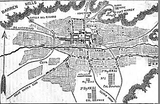
The Capture of Santa Fe, also known as the Battle of Santa Fe or the Battle of Cañoncito, took place near Santa Fe, New Mexico, the capital of the Mexican Province of New Mexico, during the Mexican–American War on 8 August through 14 August 1846. No shots were fired during the capturing of Santa Fe.

United States federal republic in North America

The United States of America (USA), commonly known as the United States or America, is a country composed of 50 states, a federal district, five major self-governing territories, and various possessions. At 3.8 million square miles, the United States is the world's third or fourth largest country by total area and is slightly smaller than the entire continent of Europe's 3.9 million square miles. With a population of over 327 million people, the U.S. is the third most populous country. The capital is Washington, D.C., and the largest city by population is New York City. Forty-eight states and the capital's federal district are contiguous in North America between Canada and Mexico. The State of Alaska is in the northwest corner of North America, bordered by Canada to the east and across the Bering Strait from Russia to the west. The State of Hawaii is an archipelago in the mid-Pacific Ocean. The U.S. territories are scattered about the Pacific Ocean and the Caribbean Sea, stretching across nine official time zones. The extremely diverse geography, climate, and wildlife of the United States make it one of the world's 17 megadiverse countries.

Tohajiilee Indian Reservation

Tohajiilee, Cañoncito Band of Navajos is a non-contiguous section of the Navajo Nation lying in parts of western Bernalillo, eastern Cibola, and southwestern Sandoval counties in the U.S. state of New Mexico, west of the city of Albuquerque. It is a Navajo phrase roughly translated in English as "Dipping Water".

Joseph Horace Eaton Union Army general

Joseph Horace Eaton was an American artist and a career officer in the United States Army. He served as a major during the American Civil War. In recognition of his service, in 1866 he was nominated and in 1867 he was confirmed for appointment to the grade of brevet brigadier general in the regular army to rank from March 13, 1865.

Pío Corcuera Argentine footballer

Pío Sixto Corcuera was an Argentine football striker who played most of his career for Boca Juniors.

Ortiz Mountains

The Ortiz Mountains are a mountain range in north central New Mexico, United States, in Santa Fe County, northeast of the Sandia Mountains and due north of the San Pedro Mountains. The Ortiz include Placer Peak, the highest peak in the range at 8,858 feet, Lone Mountain at 7,310 feet, Cedar Mountain at 7,041 feet, Cerro Chato at 6,965 feet, and the foothills known as the Los Lomas de la Bolsa.

Nuestra Senora de Luz Church and Cemetery

Nuestra Senora de Luz Church and Cemetery is a historic church building 13 miles southeast of Santa Fe, north of Interstate 25 frontage road in Canoncito, New Mexico.

Cañoncito, Bernalillo County, New Mexico Unincorporated community in New Mexico, United States

Cañoncito is an unincorporated community in Bernalillo County, New Mexico, United States. Cañoncito is located along New Mexico State Road 14 13.5 miles (21.7 km) east of central Albuquerque.

Cañoncito or Canoncito may refer to the following places in the U.S. state of New Mexico:

Cañoncito, Taos County, New Mexico Unincorporated community in New Mexico, United States

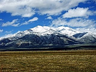
Cañoncito is an unincorporated community in Taos County, New Mexico, United States. Cañoncito is 10 miles (16 km) north-northwest of Taos.

Cañoncito, Santa Fe County, New Mexico Unincorporated community in New Mexico, United States

Cañoncito is an unincorporated community in Santa Fe County, New Mexico, United States. Cañoncito is located on Interstate 25, 11.5 miles (18.5 km) southeast of Santa Fe. Nuestra Señora de Luz Church and Cemetery, which is listed on the National Register of Historic Places, is located in Cañoncito.

Canoncito, Mora County, New Mexico Unincorporated community in New Mexico, United States

Canoncito is an unincorporated community in Mora County, New Mexico, United States. Canoncito is located along New Mexico State Road 518 25 miles (40 km) north of Las Vegas.

Canoncito, San Miguel County, New Mexico Unincorporated community in New Mexico, United States

Canoncito is an unincorporated community in San Miguel County, New Mexico, United States. Canoncito is 15.2 miles (24.5 km) north-northwest of Las Vegas.

References