Primrose Lake is a large lake in the Canadian provinces of Saskatchewan and Alberta in the Churchill River drainage basin. The lake straddles the Saskatchewan / Alberta border, with most of the water surface in Saskatchewan with only the south-west corner of the lake in Alberta. On the Saskatchewan side of the lake is Backes Island Wildlife Refuge, which is a small protected island near the middle of the lake that is important to birds. The entire lake plus surrounding land totalling 1,259.52 km2 (486.30 sq mi) is part of an Important Bird Area (IBA) of Canada.

Lake Diefenbaker is a reservoir and bifurcation lake in southern part of the Canadian province of Saskatchewan. It was formed by the construction of Gardiner Dam and the Qu'Appelle River Dam across the South Saskatchewan and Qu'Appelle Rivers respectively. Construction began in 1959 and the lake was filled in 1967. The lake is 225 kilometres (140 mi) long with approximately 800 kilometres (500 mi) of shoreline. It has a maximum depth of 66 metres (217 ft), while the water levels regularly fluctuate 3–9 metres (9–27 feet) each year. The flow of the two rivers is now regulated with a considerable portion of the South Saskatchewan diverted into the Qu'Appelle. Prior to the dams' construction, high water levels in the South Saskatchewan would frequently cause dangerous ice conditions downstream in Saskatoon while the Qu'Appelle would frequently dry up in the summer months.

Division No. 8 is one of eighteen census divisions in the province of Saskatchewan, Canada, as defined by Statistics Canada. It is located in the west-southwestern part of the province, bordering Alberta. The most populous community in this division is Swift Current.
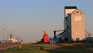
Cabri is a town in southwestern Saskatchewan directly north of Gull Lake, northwest of Swift Current and east of the Great Sand Hills. It was incorporated as a village in 1912 and as a town in 1917.

The Rural Municipality of Blaine Lake No. 434 is a rural municipality (RM) in the Canadian province of Saskatchewan within Census Division No. 16 and SARM Division No. 5. The RM extends east to the North Saskatchewan River and north to the village of Marcelin.
The Rural Municipality of Reno No. 51 is a rural municipality (RM) in the Canadian province of Saskatchewan within Census Division No. 4 and SARM Division No. 3. Located in the southwest corner of the province, it is adjacent to the United States border to the south and the Alberta boundary to the west.

Redberry Lake is a kettle salt lake near Hafford in the Canadian province of Saskatchewan. Named after the buffaloberry, it is a medium-sized saline lake within an area characterized by mostly fresh water aquatic environments. The lake makes up the core protected area of the Redberry Lake (UNESCO) Biosphere Reserve and is a federal bird sanctuary of the same name. It is also an Important Bird Area (IBA) of Canada and its northern most island is the location of the provincial Redberry Wildlife Refuge. A small regional park is situated at the north-west corner of the lake. The countryside surrounding Redberry Lake is typical of the aspen parkland biome of which it is a part.

Lenore Lake is a partly saline lake in the Canadian province of Saskatchewan. It is part of the Lenore Lake basin, which includes several saline lakes as well as the fresh water St. Brieux and Burton Lakes. The basin is part of the Carrot River watershed but has no natural outlet. The lake is within the aspen parkland ecozone of Saskatchewan. Lenore Lake was designated a migratory bird sanctuary in 1925. Raven Island, located at the southern end of Lenore Lake, is a National Wildlife Area of Canada.

Tobin Lake is a reservoir along the course of the Saskatchewan River in the Canadian province of Saskatchewan. Tobin Lake was formed by the building of the E.B. Campbell Dam on the Saskatchewan River in 1963. Tobin Lake is named for William Thorburn, who was a fur trader on the Saskatchewan River. He had built a trading post on the Saskatchewan River where it is met by the Petaigan River. The rapids near the post became known as the "Thornburn Rapids". The name was later shortened to "Tobin Rapids".

The Rural Municipality of Chesterfield No. 261 is a rural municipality (RM) in the Canadian province of Saskatchewan within Census Division No. 8 and SARM Division No. 3.
Greenwater Lake is a lake in the Canadian province of Saskatchewan. The lake is at the heart of Greenwater Lake Provincial Park in the Porcupine Provincial Forest on the Porcupine Hills. The RM of Bjorkdale No. 426 surrounds the lake and Highway 38 provides access to it. The lake is so named not because of the colour of the water but rather the colour of the trees reflecting off the water.
Marean Lake is a spring fed lake in the Canadian province of Saskatchewan. The lake is located at the western end of Greenwater Lake Provincial Park in the Porcupine Provincial Forest on the Porcupine Hills. The RM of Bjorkdale No. 426 surrounds the lake and it is accessed off Highway 679.
Eyebrow Lake is a man-made marshy lake that parallels the Qu'Appelle River in the southern region of the Canadian province of Saskatchewan. Located in the RM of Huron No. 223, it is the first lake in a series of lakes along the Qu'Appelle River after Qu'Appelle River Dam and Lake Diefenbaker. The next lake downstream is Buffalo Pound Lake. The closest community is the village of Tugaske and, while there are no public recreation sites at the lake, it can be accessed by Highway 627. The lake gets its name from the nearby Eyebrow Hills, which are shaped like an eyebrow. The nearby town of Eyebrow and RM of Eyebrow No. 193 are also named after these hills.
Townsend Lake is a lake in the Canadian province of Saskatchewan. It is located in the east-central part of the province in the Porcupine Hills and Porcupine Provincial Forest. The lake is in the Woody River Block of Porcupine Hills Provincial Park. Highway 980 provides access to the east side of the lake and its amenities. Several small creeks feed into the lake from the surrounding hills, lakes, and muskeg. The outflow is a short river at the eastern end of the lake that flows into the western end of Woody Lake.

Bigstick Lake is a shallow endorheic alkali lake in the south-west region of the Canadian province of Saskatchewan. The lake was named after the Big Stick Trail that ran between the town of Maple Creek and the South Saskatchewan River. The trail was notable for a large, solitary tree along its route. The lake and its drainage basin are in a semi-arid region known as Palliser's Triangle.
Porter Lake is a shallow salt lake in the Canadian province of Saskatchewan. It is located in the Rural Municipality of Aberdeen No. 373, about 20 kilometres (12 mi) north-east of Saskatoon. There are no communities along the lake's shore. Access is from Ike Thiessen Road, which connects to Highways 5 and 41. The lake and the surrounding landscape is designated as an Important Bird Area of Canada.
Courtenay Lake is a lake in the Canadian province of Saskatchewan. It is situated in the Churchill River Upland ecozone in the north-eastern corner of the Northern Saskatchewan Administration District. The lake is set in a forest of jack pine and most of the eastern shore is part of a provincial campground. Access to the lake and park is from Highway 905. The only service near the lake is Km 147 Lamp Lighters Lodge, which is a motel, gas station, and restaurant on Highway 905.
Midnight Lake is a lake in the Canadian province of Saskatchewan. It is south of the Meadow Lake Escarpment, which is a plateau that separates the Saskatchewan and Churchill River drainage basins. The lake sits in the transition zone between the boreal forest and aspen parkland ecozones and is at the centre of an Important Bird Area (IBA) of Canada. Access is from Highway 4
Kazan Lake is a lake about 30 kilometres (19 mi) south of the village of Buffalo Narrows in the Canadian province of Saskatchewan. The lake is surrounded by muskeg and boreal forest, with black spruce being the most common tree. Several small streams feed into the lake while its outflow is the Kazan River, which leaves the lake at the north end and flows north for about 15 kilometres (9.3 mi) before emptying into Peter Pond Lake. Peter Pond Lake is along the course of the Churchill River.
Helene Lake is a shallow lake in the Canadian province of Saskatchewan. It is on the plateau that separates the Saskatchewan and Churchill River drainage basins. The lake sits in the transition zone between the boreal forest and aspen parkland ecozones of Canada. It has a subarctic climate and is mostly surrounded by muskeg and boreal forests with some agricultural lands near the south-western shore. The lake's outflow is a short river that flows out of the south-western corner and west to neighbouring Midnight Lake. North of Helene Lake is the Meadow Lake Escarpment.

