Caguana, Utuado, Puerto Rico

Last updated
Caguana
Barrio
78ViewofUtuadoSmaller.jpg
View of Utuado Pueblo from Caguana
Caguana, Utuado, Puerto Rico locator map.png
Location of Caguana within the municipality of Utuado shown in red
Caribbean location map.svg
Red pog.svg
Caguana
Location of Puerto Rico
Coordinates: 18°17′45″N66°44′49″W / 18.29571°N 66.746912°W / 18.29571; -66.746912 [1]
Commonwealth Flag of Puerto Rico.svg  Puerto Rico
Municipality UtuadoFlag.svg Utuado
Area
[1]
  Total15.57 sq mi (40.3 km2)
  Land15.56 sq mi (40.3 km2)
  Water0.01 sq mi (0.03 km2)
Elevation
[2]
1,302 ft (397 m)
Population
 (2010)
  Total4,009
  Density257.6/sq mi (99.5/km2)
 Source: 2010 Census
Time zone UTC−4 (AST)

Caguana is a barrio in the municipality of Utuado, Puerto Rico. Its population in 2010 was 4,009. [3] [4] [5]

Contents

Geography

Caguana is situated at an elevation of 1,302 feet (397 m) south of Santa Rosa in Utuado, Puerto Rico. It has an area of 15.57 square miles (40.3 km2) of which 0.01 square miles (0.026 km2) is water. [1]

History

It is one of the few municipalities of Puerto Rico to have an ancient area for Mesoamerican ballgames, called Batéy games, in the Caribbean. The Caguana Ceremonial Ball Courts Site in Utuado preserves the site where the Taíno people lived. The Tanamá River goes through Caguana, Utuado.

Caguana was in Spain's gazetteers [6] until Puerto Rico was ceded by Spain in the aftermath of the Spanish–American War under the terms of the Treaty of Paris of 1898 and became an unincorporated territory of the United States. In 1899, the United States Department of War conducted a census of Puerto Rico finding that the population of Caguana barrio was 2,555. [7]

Historical population
CensusPop.Note
1900 2,555
1910 2,492−2.5%
1920 2,76811.1%
1930 3,06810.8%
1940 3,49113.8%
1950 4,15319.0%
1960 3,607−13.1%
1980 3,913
1990 3,723−4.9%
2000 4,24714.1%
2010 4,009−5.6%
U.S. Decennial Census
1899 (shown as 1900) [8] 1910-1930 [9]
1930-1950 [10] 1980-2000 [11] 2010 [12]

See also

Related Research Articles

<span class="mw-page-title-main">Centro, Moca, Puerto Rico</span> Barrio of Puerto Rico

Centro barrio is a barrio in the municipality of Moca, Puerto Rico with a population of 1,056 in 2010.

<span class="mw-page-title-main">Río Abajo, Utuado, Puerto Rico</span> Barrio of Puerto Rico

Río Abajo is a barrio in the municipality of Utuado, Puerto Rico. Its population in 2010 was 237. It is an isolated, rural barrio in the Cordillera Central, the mountain range that goes east to west across the center of Puerto Rico.

<span class="mw-page-title-main">Caonillas Abajo, Utuado, Puerto Rico</span> Barrio of Puerto Rico

Caonillas Abajo is a barrio in the municipality of Utuado, Puerto Rico. Its population in 2010 was 965.

<span class="mw-page-title-main">Consejo, Utuado, Puerto Rico</span> Barrio of Puerto Rico

Consejo is a barrio in the municipality of Utuado, Puerto Rico. Its population in 2010 was 610.

<span class="mw-page-title-main">Caonillas Arriba, Utuado, Puerto Rico</span> Barrio of Puerto Rico

Caonillas Arriba is a barrio in the municipality of Utuado, Puerto Rico. Its population in 2010 was 296.

<span class="mw-page-title-main">Ángeles, Utuado, Puerto Rico</span> Barrio of Puerto Rico

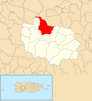
Ángeles is a barrio in the municipality of Utuado, Puerto Rico. Its population in 2010 was 3,056.

<span class="mw-page-title-main">Mameyes Abajo</span> Barrio of Utuado, Puerto Rico

Mameyes Abajo is a barrio in the municipality of Utuado, Puerto Rico. Its population in 2010 was 1,136. The corresponding Mameyes Arriba is located in neighbouring Jayuya at a higher elevation, but was once part of Utuado as well.

<span class="mw-page-title-main">Salto Arriba</span> Barrio of Utuado, Puerto Rico

Salto Arriba is a barrio in the municipality of Utuado, Puerto Rico. Its population in 2010 was 617.

<span class="mw-page-title-main">Viví Arriba</span> Barrio of Utuado, Puerto Rico

Viví Arriba is a barrio in the municipality of Utuado, Puerto Rico. Its population in 2010 was 748.

<span class="mw-page-title-main">Sabana Grande, Utuado, Puerto Rico</span> Barrio of Puerto Rico

Sabana Grande is a barrio in the municipality of Utuado, Puerto Rico. Its population in 2010 was 1,112.

<span class="mw-page-title-main">Santa Isabel, Utuado, Puerto Rico</span> Barrio of Puerto Rico

Santa Isabel is a barrio in the municipality of Utuado, Puerto Rico. Its population in 2010 was 660.

<span class="mw-page-title-main">Tetuán, Utuado, Puerto Rico</span> Barrio of Puerto Rico

Tetuán is a barrio in the municipality of Utuado, Puerto Rico. Its population in 2010 was 680.

<span class="mw-page-title-main">Jayuya Abajo</span> Barrio of Jayuya, Puerto Rico

Jayuya Abajo is a barrio in the municipality of Jayuya, Puerto Rico. Its population in 2010 was 3,367.

<span class="mw-page-title-main">Tanamá, Adjuntas, Puerto Rico</span> Barrio in Puerto Rico

Tanamá is a rural barrio in the municipality of Adjuntas, Puerto Rico. Its population in 2010 was 1,193.

<span class="mw-page-title-main">Santa Rosa, Utuado, Puerto Rico</span> Barrio of Puerto Rico

Santa Rosa is a barrio in the municipality of Utuado, Puerto Rico. Its population in 2010 was 0.

<span class="mw-page-title-main">Arenas, Utuado, Puerto Rico</span> Barrio of Puerto Rico

Arenas is a barrio in the municipality of Utuado, Puerto Rico. Its population in 2010 was 1,860.

<span class="mw-page-title-main">Ranchera, Yauco, Puerto Rico</span> Barrio of Puerto Rico

Ranchera is a barrio in the municipality of Yauco, Puerto Rico. Its population in 2010 was 446.

<span class="mw-page-title-main">Rubias, Yauco, Puerto Rico</span> Barrio of Puerto Rico

Rubias is a barrio in the municipality of Yauco, Puerto Rico. Its population in 2010 was 309.

<span class="mw-page-title-main">Piedras, Cayey, Puerto Rico</span> Barrio of Puerto Rico

Piedras is a barrio in the municipality of Cayey, Puerto Rico. Its population in 2010 was 195.

<span class="mw-page-title-main">Callabo</span> Barrio of Juana Díaz, Puerto Rico

Callabo is a barrio in the municipality of Juana Díaz, Puerto Rico. Its population in 2010 was 2,237.

References

  1. 1 2 3 "US Gazetteer 2019". US Census. US Government.
  2. U.S. Geological Survey Geographic Names Information System: Caguana barrio
  3. Picó, Rafael; Buitrago de Santiago, Zayda; Berrios, Hector H. Nueva geografía de Puerto Rico: física, económica, y social, por Rafael Picó. Con la colaboración de Zayda Buitrago de Santiago y Héctor H. Berrios. San Juan Editorial Universitaria, Universidad de Puerto Rico,1969.
  4. Gwillim Law (20 May 2015). Administrative Subdivisions of Countries: A Comprehensive World Reference, 1900 through 1998. McFarland. p. 300. ISBN   978-1-4766-0447-3 . Retrieved 25 December 2018.
  5. Puerto Rico: 2010 Population and Housing Unit Counts.pdf (PDF). U.S. Dept. of Commerce, Economics and Statistics Administration, U.S. Census Bureau. 2010.
  6. "Anuario del comercio, de la industria, de la magistratura y de la administración. 1881". Biblioteca Nacional de España (in Spanish). p. 1614. Retrieved 4 April 2023.
  7. Joseph Prentiss Sanger; Henry Gannett; Walter Francis Willcox (1900). Informe sobre el censo de Puerto Rico, 1899, United States. War Dept. Porto Rico Census Office (in Spanish). Imprenta del gobierno. p.  161.
  8. "Report of the Census of Porto Rico 1899". War Department Office Director Census of Porto Rico. Archived from the original on July 16, 2017. Retrieved September 21, 2017.
  9. "Table 3-Population of Municipalities: 1930 1920 and 1910" (PDF). United States Census Bureau. Archived (PDF) from the original on August 17, 2017. Retrieved September 21, 2017.
  10. "Table 4-Area and Population of Municipalities Urban and Rural: 1930 to 1950" (PDF). United States Census Bureau. Archived (PDF) from the original on August 30, 2015. Retrieved September 21, 2014.
  11. "Table 2 Population and Housing Units: 1960 to 2000" (PDF). United States Census Bureau. Archived (PDF) from the original on July 24, 2017. Retrieved September 21, 2017.
  12. Puerto Rico: 2010 Population and Housing Unit Counts.pdf (PDF). U.S. Dept. of Commerce Economics and Statistics Administration U.S. Census Bureau. 2010. Archived (PDF) from the original on 2017-02-20. Retrieved 2019-08-02.