Caimital Bajo, Aguadilla, Puerto Rico

Last updated
Caimital Bajo
Barrio
Sector Cambija, Barrio Caimital Bajo, Aguadilla, Puerto Rico.jpg
Walkway in Sector Cambija in Caimital Bajo
Caimital Bajo, Aguadilla, Puerto Rico locator map.png
Caribbean location map.svg
Red pog.svg
Caimital Bajo
Location of Puerto Rico
Coordinates: 18°25′41″N67°08′13″W / 18.42805°N 67.136961°W / 18.42805; -67.136961 [1]
Commonwealth Flag of Puerto Rico.svg  Puerto Rico
Municipality Bandera de Aguadilla, Puerto Rico.svg Aguadilla
Area
[1]
  Total3.76 sq mi (9.7 km2)
  Land3.76 sq mi (9.7 km2)
  Water0.00 sq mi (0.0 km2)
Elevation
[2]
499 ft (152 m)
Population
 (2010)
  Total4,487
  Density1,193.4/sq mi (460.8/km2)
 Source: 2010 Census
Time zone UTC−4 (AST)

Caimital Bajo is a barrio in the municipality of Aguadilla, Puerto Rico. Its population in 2010 was 4,487. In Caimatal Bajo barrio is part of the Aguadilla urban zone. [3] [4] [5]

Contents

History

Caimital Bajo was in Spain's gazetteers [6] until Puerto Rico was ceded by Spain in the aftermath of the Spanish–American War under the terms of the Treaty of Paris of 1898 and became an unincorporated territory of the United States. In 1899, the United States Department of War conducted a census of Puerto Rico finding that the population of Caimital Bajo barrio was 943. [7]

Historical population
CensusPop.Note
1900 943
1910 2,341148.3%
1920 1,993−14.9%
1930 1,701−14.7%
1940 2,28934.6%
1950 2,3512.7%
1960 3,37343.5%
1980 4,261
1990 5,01717.7%
2000 5,2775.2%
2010 4,487−15.0%
U.S. Decennial Census
1899 (shown as 1900) [8] 1910-1930 [9]
1930-1950 [10] 1980-2000 [11] 2010 [12]

Sectors

Barrios (which are, in contemporary times, roughly comparable to minor civil divisions) [13] in turn are further subdivided into smaller local populated place areas/units called sectores (sectors in English). The types of sectores may vary, from normally sector to urbanización to reparto to barriada to residencial, among others. [14] [15] [16] [17] [18]

The following sectors are in Caimital Bajo barrio: [19]

Apartamentos Villa Mar, Avenida Jesús T. Piñero, Avenida Los Corazones, Avenida Victoria, Callejón Los Concepción, Condominio Manuel A. Colón, Condominio Muñekís II, Cuesta Vieja, Égida Jardín del Atlántico, Los Robles, Monte Brujo, Paseo Las Golondrinas, Reparto Grajales, Residencial José A. Aponte, Residencial José de Diego, Richard Moufler, Sector Cambija, Sector El Jobo, Sector Gregorio Igartua, Sector La Pica, Sector Lloret, Sector Sanders, Sector Toño Colón, Urbanización Aromas de Café, Urbanización García, Urbanización Jardines de Maribel, Urbanización Monte Real, Urbanización Victoria, and Villa Alegría.

See also

Related Research Articles

<span class="mw-page-title-main">Frailes, Guaynabo, Puerto Rico</span> Barrio of Puerto Rico

Frailes is a barrio in the municipality of Guaynabo, Puerto Rico. Its population in 2010 was 32,050.

<span class="mw-page-title-main">Santa Rosa, Guaynabo, Puerto Rico</span> Barrio of Puerto Rico

Santa Rosa is a barrio in the municipality of Guaynabo, Puerto Rico. Its population in 2010 was 16,904.

<span class="mw-page-title-main">Palmas, Cataño, Puerto Rico</span> Barrio of Puerto Rico

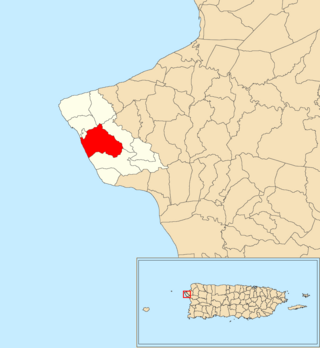
Palmas is a barrio in the municipality of Cataño, Puerto Rico. Its population in 2010 was 23,857.

<span class="mw-page-title-main">Borinquen, Aguadilla, Puerto Rico</span> Barrio of Puerto Rico

Borinquen is a barrio in the municipality of Aguadilla, Puerto Rico. Its population in 2010 was 7,415.

<span class="mw-page-title-main">Cibao, San Sebastián, Puerto Rico</span> Barrio of Puerto Rico

Cibao is a barrio in the municipality of San Sebastián, Puerto Rico. Its population in 2010 was 1,224.

<span class="mw-page-title-main">Pueblo, Rincón, Puerto Rico</span> Barrio of Puerto Rico

Pueblo barrio is a barrio in the municipality of Rincón, Puerto Rico. Its population in 2010 was 3,796. There is also the administrative center and seat called Rincón barrio-pueblo in this municipality, with a smaller population.

<span class="mw-page-title-main">Marín, Patillas, Puerto Rico</span> Barrio of Puerto Rico

Marín is a barrio in the municipality of Patillas, Puerto Rico. Its population in 2010 was 890.

<span class="mw-page-title-main">Calvache</span> Barrio of Rincón, Puerto Rico

Calvache is a barrio in the municipality of Rincón, Puerto Rico. Its population in 2010 was 2,222.

<span class="mw-page-title-main">Machos, Ceiba, Puerto Rico</span> Barrio of Puerto Rico

Machos is a barrio in the municipality of Ceiba, Puerto Rico. Its population in 2010 was 3,567.

<span class="mw-page-title-main">Caimital Alto, Aguadilla, Puerto Rico</span> Barrio of Puerto Rico

Caimital Alto is a barrio in the municipality of Aguadilla, Puerto Rico. Its population in 2010 was 3,989.

<span class="mw-page-title-main">Camaceyes, Aguadilla, Puerto Rico</span> Barrio of Puerto Rico

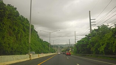
Camaceyes is a barrio in the municipality of Aguadilla, Puerto Rico. Its population in 2010 was 12,547. In Camaceyes barrio is part of the Aguadilla urban zone.

<span class="mw-page-title-main">Ceiba Alta, Aguadilla, Puerto Rico</span> Barrio of Puerto Rico

Ceiba Alta is a rural barrio in the municipality of Aguadilla, Puerto Rico. Its population in 2010 was 667.

<span class="mw-page-title-main">Corrales, Aguadilla, Puerto Rico</span> Barrio of Puerto Rico

Corrales is a rural barrio in the municipality of Aguadilla, Puerto Rico. Its population in 2010 was 7,659. In Corrales barrio is Cabán, a comunidad.

<span class="mw-page-title-main">Aguacate, Aguadilla, Puerto Rico</span> Barrio of Puerto Rico

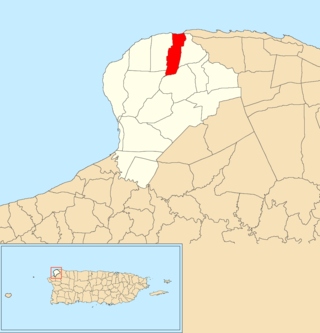
Aguacate is a barrio in the municipality of Aguadilla, Puerto Rico. Its population in 2010 was 1,525.

<span class="mw-page-title-main">Aguadilla barrio-pueblo</span> Historical and administrative center (seat) of Aguadilla, Puerto Rico

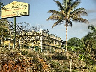
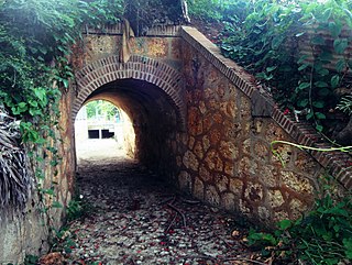
Aguadilla barrio-pueblo is an urban barrio and the administrative center (seat) of Aguadilla, a municipality of Puerto Rico. Its population in 2010 was 3,627.

<span class="mw-page-title-main">Monte Llano, Morovis, Puerto Rico</span> Barrio of Puerto Rico

Monte Llano is a barrio in the municipality of Morovis, Puerto Rico. Monte Llano has about 15 sectors and its population in 2010 was 2,948.

<span class="mw-page-title-main">Guaniquilla, Aguada, Puerto Rico</span> Barrio of Puerto Rico

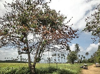
Guaniquilla is a coastal barrio in the municipality of Aguada, Puerto Rico. Its population in 2010 was 2,663.

<span class="mw-page-title-main">Ciénaga Baja</span> Barrio of Río Grande, Puerto Rico

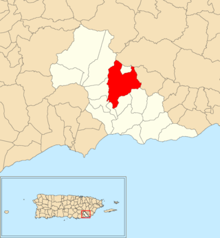
Ciénaga Baja is a barrio in the municipality of Río Grande, Puerto Rico. Its population in 2010 was 18,385.

References

  1. 1 2 "US Gazetteer 2019". US Census. US Government.
  2. U.S. Geological Survey Geographic Names Information System: Caimital Bajo barrio
  3. Picó, Rafael; Buitrago de Santiago, Zayda; Berrios, Hector H. Nueva geografía de Puerto Rico: física, económica, y social, por Rafael Picó. Con la colaboración de Zayda Buitrago de Santiago y Héctor H. Berrios. San Juan Editorial Universitaria, Universidad de Puerto Rico,1969.
  4. Gwillim Law (20 May 2015). Administrative Subdivisions of Countries: A Comprehensive World Reference, 1900 through 1998. McFarland. p. 300. ISBN   978-1-4766-0447-3 . Retrieved 25 December 2018.
  5. Puerto Rico: 2010 Population and Housing Unit Counts.pdf (PDF). U.S. Dept. of Commerce, Economics and Statistics Administration, U.S. Census Bureau. 2010.
  6. "Anuario del comercio, de la industria, de la magistratura y de la administración. 1881". Biblioteca Nacional de España (in Spanish). p. 1614. Retrieved 4 April 2023.
  7. Joseph Prentiss Sanger; Henry Gannett; Walter Francis Willcox (1900). Informe sobre el censo de Puerto Rico, 1899, United States War Dept. Porto Rico Census Office (in Spanish). Imprenta del gobierno. p.  160.
  8. "Report of the Census of Porto Rico 1899". War Department Office Director Census of Porto Rico. Archived from the original on July 16, 2017. Retrieved September 21, 2017.
  9. "Table 3-Population of Municipalities: 1930 1920 and 1910" (PDF). United States Census Bureau. Archived (PDF) from the original on August 17, 2017. Retrieved September 21, 2017.
  10. "Table 4-Area and Population of Municipalities Urban and Rural: 1930 to 1950" (PDF). United States Census Bureau. Archived (PDF) from the original on August 30, 2015. Retrieved September 21, 2014.
  11. "Table 2 Population and Housing Units: 1960 to 2000" (PDF). United States Census Bureau. Archived (PDF) from the original on July 24, 2017. Retrieved September 21, 2017.
  12. Puerto Rico: 2010 Population and Housing Unit Counts.pdf (PDF). U.S. Dept. of Commerce Economics and Statistics Administration U.S. Census Bureau. 2010. Archived (PDF) from the original on 2017-02-20. Retrieved 2019-08-02.
  13. "US Census Barrio-Pueblo definition". factfinder.com. US Census. Archived from the original on 13 May 2017. Retrieved 5 January 2019.
  14. Mari Mut, José A. (28 August 2013). "Los pueblos de Puerto Rico y las iglesias de sus plazas" (in Spanish). Retrieved 19 June 2020 via archive.org.
  15. "Agencia: Oficina del Coordinador General para el Financiamiento Socioeconómico y la Autogestión (Proposed 2016 Budget)". Puerto Rico Budgets (in Spanish). Retrieved 28 June 2019.
  16. Rivera Quintero, Marcia (2014), El vuelo de la esperanza : Proyecto de las Comunidades Especiales Puerto Rico, 1997-2004 (Primera edición ed.), San Juan, Puerto Rico Fundación Sila M. Calderón, ISBN   978-0-9820806-1-0
  17. "Leyes del 2001". Lex Juris Puerto Rico (in Spanish). Retrieved 24 June 2019.
  18. "Comunidades Especiales de Puerto Rico" (in Spanish). 8 August 2011. Retrieved 24 June 2019.
  19. "PRECINTO ELECTORAL AGUADILLA 035" (PDF). Comisión Estatal de Elecciones (in Spanish). PR Government. 30 January 2019. Archived from the original (PDF) on June 25, 2020. Retrieved 21 June 2020.