Calamovilfa arcuata

Last updated

Calamovilfa arcuata
Sporobolus arcuatus.jpg
Status TNC G2.svg
Imperiled  (NatureServe) [1]
Scientific classification Red Pencil Icon.png
Kingdom: Plantae
Clade: Tracheophytes
Clade: Angiosperms
Clade: Monocots
Clade: Commelinids
Order: Poales
Family: Poaceae
Genus: Calamovilfa
Species:
C. arcuata
Binomial name
Calamovilfa arcuata
K.E. Rogers
Synonyms

Sporobolus arcuatus

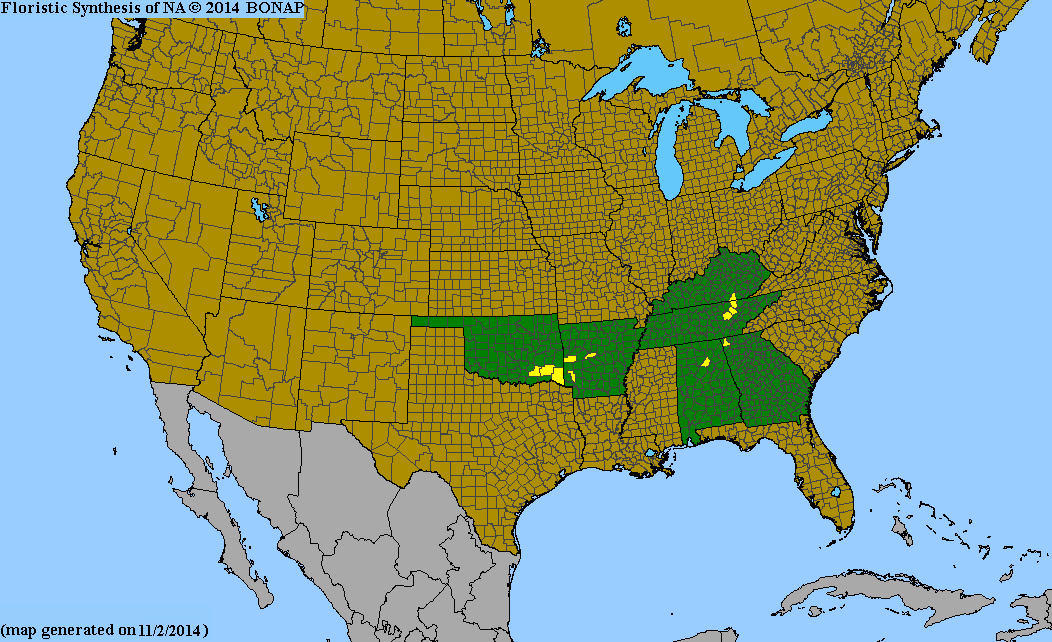
Calamovilfa arcuata, commonly known as Cumberland sandreed, [2] is a species of flowering plant in the grass family. It is native to the southeastern United States, [3] where it is found in river scour zones. Due to its specialized habitat, it has a highly localized range, found only on the Cumberland Plateau and in the Ouachita Mountains. [4]

Contents

Natural history

This species is found only is a specialized riverine habitat that is kept open by extreme flood scouring events. These flood events naturally occur in high-gradient, rocky rivers, which results in the prevention of large tree growth. This species takes advantage of the prairie-like openings these floods create. [5] Due to its specialized habitat, and low density of populations, Calamovilfa arcuata is considered imperiled. [1] On the Cumberland Plateau, it is most often found on sandstone cobble where it co-occurs with two other rare plants that are also restricted to this habitat: Conradina verticillata (Cumberland rosemary) and Solidago arenicola (sand goldenrod). [6]

This species produces flowers in late summer, at the time when the chances of a scouring flood occurring are lessened. [7]

Taxonomy

Calamovilfa arcuata was first described to science in 1970 from a population found on Daddys Creek in Cumberland County, Tennessee. [5] Recent genetic evidence suggests that this species, along with the rest of the genus Calamofilva, are perhaps best instead included in the genus Sporobolus , although this change has yet to receive widespread recognition. [4]

Related Research Articles

Brisbane Water National Park Protected area in New South Wales, Australia

The Brisbane Water National Park is a protected national park that is located in the Central Coast region of New South Wales, in eastern Australia. The 11,506-hectare (28,430-acre) national park is situated 47 kilometres (29 mi) north of Sydney, 10 kilometres (6.2 mi) west of Woy Woy, and 12 kilometres (7.5 mi) southwest of Gosford.

New River (Kanawha River tributary)

The New River is a river which flows through the U.S. states of North Carolina, Virginia, and West Virginia before joining with the Gauley River to form the Kanawha River at the town of Gauley Bridge, West Virginia. Part of the Ohio River watershed, it is about 360 miles (580 km) long.

Cumberland Plateau

The Cumberland Plateau is the southern part of the Appalachian Plateau in the Appalachian Mountains of the United States. It includes much of eastern Kentucky and Tennessee, and portions of northern Alabama and northwest Georgia. The terms "Allegheny Plateau" and the "Cumberland Plateau" both refer to the dissected plateau lands lying west of the main Appalachian Mountains. The terms stem from historical usage rather than geological difference, so there is no strict dividing line between the two. Two major rivers share the names of the plateaus, with the Allegheny River rising in the Allegheny Plateau and the Cumberland River rising in the Cumberland Plateau in Harlan County, Kentucky.

Big South Fork of the Cumberland River

The Big South Fork of the Cumberland River is a 76-mile-long (122 km) river in the U.S. states of Tennessee and Kentucky. It is a major drainage feature of the Cumberland Plateau, a major tributary of the Cumberland River system, and the major feature of the Big South Fork National River and Recreation Area.

Driftless Area

The Driftless Area is a region in southwestern Wisconsin, southeastern Minnesota, northeastern Iowa, and the extreme northwestern corner of Illinois, of the American Midwest. The region escaped the flattening effects of glaciation during the last ice age and is consequently characterized by steep, forested ridges, deeply carved river valleys, and karst geology characterized by spring-fed waterfalls and cold-water trout streams. Ecologically, the Driftless Area's flora and fauna are more closely related to those of the Great Lakes region and New England than those of the broader Midwest and central Plains regions. Colloquially, the term includes the incised Paleozoic Plateau of southeastern Minnesota and northeastern Iowa. The region includes elevations ranging from 603 to 1,719 feet at Blue Mound State Park, and covers 24,000 square miles (62,200 km2). The rugged terrain is due both to the lack of glacial deposits, or drift, and to the incision of the upper Mississippi River and its tributaries into bedrock.

<i>Eucalyptus camaldulensis</i> Species of plant

Eucalyptus camaldulensis, commonly known as the river red gum, is a tree that is endemic to Australia. It has smooth white or cream-coloured bark, lance-shaped or curved adult leaves, flower buds in groups of seven or nine, white flowers and hemispherical fruit with the valves extending beyond the rim. A familiar and iconic tree, it is seen along many watercourses across inland Australia, providing shade in the extreme temperatures of central Australia.

Appalachian Plateau Series of rugged dissected plateaus in the eastern United States

The Appalachian Plateau is a series of rugged dissected plateaus located on the western side of the Appalachian Mountains. The Appalachian Mountains are a mountain range that run down the East Coast of the United States. The Appalachian Plateau is the northwestern part of the Appalachian Mountains, stretching from New York to Alabama. The plateau is a second level United States physiographic region, covering parts of the states of New York, Pennsylvania, Ohio, Maryland, West Virginia, Virginia, Kentucky, Tennessee, Alabama, and Georgia.

Big South Fork National River and Recreation Area Protected area in central northeast Tennessee and southeastern Kentucky, United States

The Big South Fork National River and Recreation Area, commonly known as Big South Fork, preserves the Big South Fork of the Cumberland River and its tributaries in northeastern Tennessee and southeastern Kentucky. In addition, the former mining community of Blue Heron is preserved and interpreted via signage.

Cumberland Plain plain in Australia

The Cumberland Plain, an IBRA biogeographic region, is a relatively flat region lying to the west of Sydney CBD in New South Wales, Australia. Cumberland Basin is the preferred physiographic and geological term for the low-lying plain of the Permian-Triassic Sydney Basin found between Sydney and the Blue Mountains, and it is a structural sub-basin of the Sydney Basin.

<i>Corydalis flavula</i> Species of flowering plants in the poppy family Papaveraceae

Corydalis flavula is an herbaceous perennial plant native to the eastern United States. Its natural habitat is open woods and slopes.

<i>Schwalbea</i> A genus of flowering plants belonging to the broomrape family

Schwalbea americana, commonly known as American chaffseed, is the sole species currently classified in the genus Schwalbea. It is an erect, hemiparasitic, perennial herb in the family Orobanchaceae. It is native to the southeastern United States where it is found in wet acidic grasslands. This species has declined tremendously from its historical range due to fire suppression, and it is currently listed as "Endangered" by the U.S. Fish and Wildlife Service.

The Cumberland dusky salamander is a species of salamander in the family of lungless salamanders, Plethodontidae. It is endemic to the United States. Its natural habitats are temperate forests and rivers. This species is threatened by habitat loss.

<i>Minuartia cumberlandensis</i>

Minuartia cumberlandensis is a rare species of flowering plant in the pink family known by the common names Cumberland stitchwort and Cumberland sandwort. It is endemic to the Cumberland Plateau near the Big South Fork of the Cumberland River in Tennessee and Kentucky. This rare plant is found only in cool sandstone rock shelters, on the moist sandy cave floors behind the drip line. There are 27 occurrences in Tennessee and one in Kentucky. The plant is a federally listed endangered species.

<i>Conradina verticillata</i>

Conradina verticillata is a flowering shrub in the mint family, found in the Cumberland Plateau. It is also called Conradina montana or Cumberland rosemary. It has been classified as a threatened species under the Endangered Species Act since 1991.

<i>Spiraea virginiana</i>

Spiraea virginiana is a rare species of flowering plant in the rose family (Rosaceae) known by the common names Virginia meadowsweet and Virginia spiraea. It is native to the southern Appalachian Mountains, where it has a distribution scattered across nine states. However, most populations are very small and poor in quality. It is threatened by disturbances in the hydrology of its habitat, introduced species of plants, and other threats. It is a federally listed threatened species of the United States.

<i>Amorpha ouachitensis</i>

Amorpha ouachitensis is an uncommon North American species of flowering plant in the legume family known by the common names Ouachita leadplant, Ouachita Mountain leadplant, Ouachita false indigo, and Ouachita indigobush. It is native to Oklahoma and Arkansas in the United States.

<i>Platanthera flava</i> Species of flowering plant in the orchid family Orchidaceae

Platanthera flava, the palegreen orchid, is a species of pale-flowered orchid. It is native to eastern North America, from Texas east to Florida, north to Ontario, Quebec and Nova Scotia.

Dharawal National Park Protected area in New South Wales, Australia

The Dharawal National Park is a protected national park that is located in the Illawarra region of New South Wales, in eastern Australia. The 6,508-hectare (16,080-acre) national park is situated between the Illawarra Range and the Georges River and is approximately 45 kilometres (28 mi) south west of Sydney. There are three entry points to the park: from the east through Darkes Forest; from the north through Wedderburn; and from the south through Appin.

Cumberland Plain Woodland

The Cumberland Plain Woodland is one of six main indigenous woodland communities of Sydney, New South Wales, Australia, that comprises an open tree canopy, a groundcover with grasses and herbs, usually with layers of shrubs and/or small trees. Situated in the Cumberland Plain, it is made up of dry sclerophyll woodlands, grasslands and/or forests, reminiscent of Mediterranean forests and temperate grasslands.

References

  1. 1 2 Calamovilfa arcuata NatureServe
  2. "Calamovilfa arcuata". Natural Resources Conservation Service PLANTS Database. USDA . Retrieved 13 January 2017.
  3. "Calamovilfa arcuata". County-level distribution map from the North American Plant Atlas (NAPA). Biota of North America Program (BONAP). 2014. Retrieved 13 January 2017.
  4. 1 2 "Flora of the Southern and Mid-Atlantic States".
  5. 1 2 Calamovilfa arcuata Missouri Botanical Garden
  6. "Cumberland Plateau Sandstone Riverscour Shrubby Grassland Austin Pay State University Herbarium". Archived from the original on 2017-01-16. Retrieved 2017-01-13.
  7. "Calamovilfa arcuata Oklahoma Natural Heritage Inventory". Archived from the original on 2016-06-18. Retrieved 2017-01-13.