Torrens Park is a mainly residential large inner-southern suburb of Adelaide, incorporating some of the foothills and adjacent to the original "Mitcham Village". It was named after Sir Robert Richard Torrens, the instigator of the Torrens title system of land registration and transfer, who built a large home in the area which he named Torrens Park.

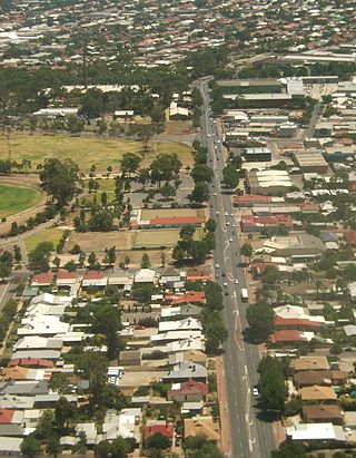
Prospect is the seat of the City of Prospect and an inner northern suburb of greater Adelaide. It is located 5 km (3.1 mi) north of Adelaide's centre.

Unley is an inner-southern suburb of Adelaide, South Australia, within the City of Unley. The suburb is the home of the Sturt Football Club in the South Australian National Football League (SANFL). Unley neighbours Adelaide Park Lands, Fullarton, Hyde Park, Malvern, Parkside and Wayville.
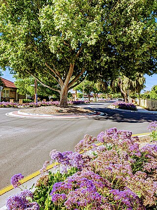
Surrey Downs is a northeastern suburb of Adelaide, South Australia. It is located in the City of Tea Tree Gully local government area, and is adjacent to Wynn Vale, Golden Grove, Fairview Park and Redwood Park.
West Croydon is an inner western suburb of Adelaide, South Australia.

Athelstone is a suburb of Adelaide in the City of Campbelltown. It was established in the 19th century but only became part of suburban Adelaide in the second half of the 20th century.
Beulah Park is a suburb of Adelaide, South Australia in the City of Burnside.
Royston Park is a suburb of Adelaide in the City of Norwood Payneham St Peters. It is a narrow suburb at a little more than 200 m wide. It was created by a subdivision in 1909. Royston Park is bordered by Joslin and Marden, along with the River Torrens.
Plympton is an inner south-western suburb of Adelaide, South Australia. The name is believed to have been given by Henry Mooringe Boswarva to a private subdivision in the area, naming after his home town in Devon, England. It was accepted as an official name for the suburb in 1944.

Thebarton, formerly Theberton, on Kaurna land, is an inner-western suburb of Adelaide, South Australia in the City of West Torrens. The suburb is bounded by the River Torrens to the north, Port Road and Bonython Park to the east, Kintore Street to the south, and South Road to the west.
South Plympton is a suburb of Adelaide in the City of Marion.

Tranmere is an eastern suburb of Adelaide, South Australia. It is located in the City of Campbelltown.
Pennington is a northern suburb of Adelaide, South Australia, located about 10 km from the Adelaide city centre. It is located in the City of Charles Sturt.
Yatala Vale is an outer northeastern rural suburb of Adelaide, South Australia. It is located in the City of Tea Tree Gully local government area, and is adjacent to Golden Grove and Fairview Park, as well as the rural districts of Upper Hermitage and Gould Creek.

Valley View is a suburb of Adelaide, South Australia. It spans three separate local government areas. They are the City of Salisbury, the City of Port Adelaide Enfield, and the City of Tea Tree Gully. The suburb's boundaries are defined by the intersection of Walkleys, Grand Junction and North East Roads in the south, and Wright and Kelly Roads in the north and east.
Underdale is a western suburb of South Australia's capital city Adelaide on Kaurna land. It sits between Henley Beach Road and the River Torrens. It is largely residential with a very small industrial section on the eastern side of Holbrook's Road near the river.

Allenby Gardens is a western suburb of Adelaide, South Australia. It is located in the City of Charles Sturt.

Welland is an inner suburb of Adelaide in the City of Charles Sturt local government area. It is around 5 km west northwest of the city centre. It was named for Welland, Worcestershire in 1907.
West Hindmarsh is a suburb of Adelaide, located in the City of Charles Sturt local government area. It is around 4 km west northwest of the Adelaide city centre. It is bounded on the south by the River Torrens, east by South Road, north by Port Road and west by streets separating it from the suburb of Welland which has the same north and south boundaries. Grange Road crosses the middle of the suburb.
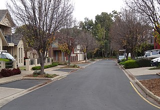
Windsor Gardens is a suburb in the north-eastern suburbs of Adelaide, the capital of South Australia.