Prospect is the seat of the City of Prospect and an inner northern suburb of greater Adelaide. It is located 5 km (3.1 mi) north of Adelaide's centre.

Milperra, a suburb of local government area City of Canterbury-Bankstown, is located 24 kilometres west of the Sydney central business district in the state of New South Wales, Australia, and is a part of the South Western Sydney region.
Greenhill Road is a major road in Adelaide, South Australia, that provides a connection to the eastern and hills suburbs. Its western section, running along the south side of Adelaide Parklands, forms part of Adelaide's City Ring Route.

Glandore is a suburb of Adelaide, South Australia, partly in the City of Marion and partly in the City of West Torrens. The name is believed to come from Glandore in County Cork, Ireland, whence the family of John O'Dea, one of the original property owners of the area, came.
Everard Park is a small inner south-western suburb of Adelaide in the City of Unley, once part of the extensive land holdings of the prominent colonist Dr. Charles George Everard, and the location of "Marshfield", the home of part of his family.
Plympton is an inner south-western suburb of Adelaide, South Australia. The name is believed to have been given by Henry Mooringe Boswarva to a private subdivision in the area, naming after his home town in Devon, England. It was accepted as an official name for the suburb in 1944.

Park Holme is a south-western suburb of Adelaide in the City of Marion, South Australia, located about 8 km (5 mi) from the Adelaide city centre. It is bordered to the east by Marion Road, to the west by Hendrie Street, to the south by Oaklands Road, and to the north by Tarranna Ave, which is just south of Bray Street. It is adjacent to Ascot Park, Edwardstown, South Plympton, Mitchell Park, Clovelly Park, Glengowrie, Morphettville and Oaklands Park. Park Holme covers 115 hectares, (1.15 sq km).

Croydon Park is a north-western suburb of Adelaide 5.9 km from the CBD, in the state of South Australia, Australia and is within the City of Port Adelaide Enfield. It is adjacent to Dudley Park, Devon Park, Renown Park, Regency Park, Ferryden Park Kilkenny, and West Croydon. The post code for Croydon Park is 5008. It is bounded to the south by Lamont Street and Torrens Road, to the north by Regency Road and in the east and west by Harrison Road and Goodall Avenue respectively. Croydon Park is predominantly a residential suburb, with a warehousing presence on the northern edges near Regency Road. Croydon Park has been completely divided by the North-South Motorway.
Camden Park is a suburb of the city of Adelaide, South Australia.

Anzac Highway is an 8.7-kilometre-long (5.4 mi) main arterial road heading southwest from the city of Adelaide, the capital of South Australia, to the beachside suburb of Glenelg.
Kurralta Park is a suburb of Adelaide, South Australia in the City of West Torrens.
Hilton is an inner western suburb of Adelaide, South Australia. It is located in the City of West Torrens, for which it is the council seat.

Mile End is an inner western suburb of Adelaide, located in the City of West Torrens, around 2 kilometres from the Adelaide city centre. It has a census area population of 4,413 people (2011). Much of the suburb is residential, but there are small commercial areas along Henley Beach Road and South Road.

Parafield Gardens is a suburb of Adelaide, South Australia. The suburb is largely residential, with a pocket of industrial land in the southwest corner. There are two small shopping centres in the area, one on Salisbury Highway, and another on Sheperdson Road.

Glenelg East is a residential suburb 9 kilometres (5.6 mi) south-west of the centre of Adelaide, South Australia. It is characterised by quarter-acre blocks with heritage homes and parks intermingled with contemporary modern homes and low-rise multi-dwelling units.

Richmond is an inner suburb of Adelaide, South Australia. It is located on Kaurna land in the City of West Torrens.
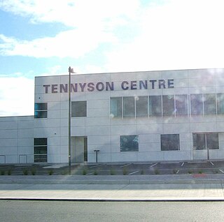
Ashford Hospital is a 239-bed private, not-for-profit hospital on Anzac Highway in the suburb of Ashford 5 kilometers from the CBD.

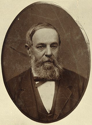
Dr Charles George Everard MD was a physician, pioneer farmer and Member of the Legislative Council, in the early days of South Australia.
William Edward Everard was a South Australian businessman and politician.

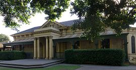
Ashford House, located in the Adelaide suburb of Ashford, South Australia, was originally built in 1838 by Dr Charles Everard, and is amongst the oldest historic buildings in South Australia.