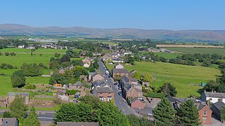
Alston is a town in Westmorland and Furness, Cumbria, England, within the civil parish of Alston Moor. It is located at about 1,000 feet (300 m) above sea level in the North Pennines, the River South Tyne, and shares the title of 'highest market town in England', with Buxton, Derbyshire. Despite its relative isolation, the town has road connections to the Tyne Gap to the north, Weardale and Teesdale to the south-east, and Penrith to the south-west.

Penrith is a market town and civil parish in the Westmorland and Furness district of Cumbria, England. It is less than 3 miles (5 km) outside the Lake District National Park and about 17 miles (27 km) south of Carlisle. It is between the Rivers Petteril and Eamont and just north of the River Lowther. The town had a population of 15,181 at the 2011 census. It is part of historic Cumberland.

The A595 is a primary route in Cumbria, in Northern England that starts in Carlisle, passes through Whitehaven and goes close to Workington, Cockermouth and Wigton. It passes Sellafield and Ravenglass before ending at the Dalton-in-Furness by-pass, in southern Cumbria, where it joins the A590 trunk road. The road is mostly single carriageway, apart from in central Carlisle, where it passes the castle as a busy dual carriageway road named Castle Way, and prior to that as Bridge Street and Church Street, where it passes close to the McVitie's or Carr's biscuit factory. The Lillyhall bypass is also dual carriageway.

Aylestone is a suburb of Leicester in Leicestershire, England, southwest of the city centre and east of the River Soar.

Kingsthorpe is a suburb and civil parish of Northampton, England. It is situated to the north of Northampton town centre and is served by the A508 and A5199 roads which join at Kingsthorpe's centre. The 2011 Census recorded the population of the district council ward as 4,477.

Walmley is a suburban village situated in the civil parish of Sutton Coldfield, West Midlands. It lies within the City of Birmingham on its northeastern outer fringe, where it forms part of the Sutton Walmley and Minworth electoral ward. It is in southern Sutton Coldfield, close to Minworth, Erdington, Wylde Green, Pype Hayes and south of Thimble End. It is approximately 7 miles (11.3 km) northeast of Birmingham City Centre. It is the main focus of the Sutton New Hall Birmingham City Council ward.

Manor House is a district in the London Borough of Hackney. Located in North London, it lies immediately east of Finsbury Park, west of Stamford Hill and south of Harringay.

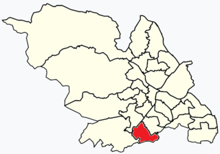
Beauchief and Greenhill ward—which includes the districts of Batemoor, Beauchief, Chancet Wood, Greenhill, Jordanthorpe, Lowedges and Meadowhead—is one of the 28 electoral wards in the City of Sheffield, England. It is in the southern part of the city and covers an area of 2.4 square miles (6.2 km2). The population of the ward in 2016 was estimated to be 19,669 people in 9,209 houses.

Walderslade is a large suburb in Kent in Chatham split between the unitary authority of Medway and the boroughs of Maidstone and Tonbridge & Malling in South East England. It was, until 1998, fully part of Kent and is still ceremonially associated via the Lieutenancies Act. It encompasses almost all the ME5 postcode district.

Frampton Cotterell is a village and civil parish in South Gloucestershire, England, on the River Frome. The village is contiguous with Winterbourne to the south-west and Coalpit Heath to the east. The parish borders Iron Acton to the north and Westerleigh to the south-east, the large town of Yate is 2 miles away. The village is 8 miles north-east of Bristol. The population of the village together with the adjoining village of Winterbourne was 14,694 in 2011. The population of the parish alone was 6,520 at the 2011 census.

Acton is a suburb and community in Wrexham, Wrexham County Borough, Wales. It spans the north-eastern part of Wrexham. The area is largely residential and at its centre, lies Acton Park, the location of the former Acton Hall.

Bitterne is an eastern suburb and ward of Southampton, in the ceremonial county of Hampshire, England.

Eamont Bridge is a small village immediately to the south of Penrith, Cumbria, England.

Langwathby is a village and civil parish in northern Cumbria, and in the historic English county of Cumberland, about 5 miles (8 km) north east of Penrith on the A686 road. The village lies on the east bank of the River Eden. At the 2001 census the parish had a population of 748, increasing to 866 at the 2011 Census.

Newbiggin is a small village in Cumbria, North West England. It is in the Dacre civil parish about 3 mi (4.8 km) west of Penrith. It lies at 750 ft (230 m) sheltered from the prevailing south-westerly wind by Flusco Pike, 150 ft (46 m) higher. It is described as a "non-nucleated village," lying for a mile along either side of the C3019 between the A66 and the B5288. There are at least six other villages in Cumbria with the same name, which is derived from the Old English ‘new biggin', or new house. Locally this village is referred to as the "Stainton Newbiggin," to distinguish it from the others.

Kirkby Thore is a small village and civil parish in Cumbria, England, in the historic county of Westmorland. It is close to the Lake District national park and the Cumbrian Pennines. It includes the areas of Bridge End, in the southwest by the A66, and Cross End in the northeast of the village. In the 2001 census, the parish had a population of 731, increasing to 758 in the 2011 Census. The market town of Appleby-in-Westmorland is about five miles away, and the larger town of Penrith is about eight miles away.

The A686 is a road in Northern England. It runs from Penrith in Cumbria to Haydon Bridge in Northumberland. AA Magazine named the A686 as one of their "Ten Great Drives" owing to the dramatic scenery of the North Pennines hills encountered along its route. Travel journalist Phil Llewellin said:
England’s great wilderness sprawls across the northern Pennines, where the mountains have fascinating names such as Fiend’s Fell and Wildboar Fell. Penrith merits a visit after leaving the M6, and memories of the motorway fade as the A686 crosses the River Eden valley. The mood changes dramatically in Melmerby, where the road starts its long climb to the cafe at Hartside, 1,900 feet (580 m) above sea level, with stunning views across the Solway Firth and Scotland. The road leads to Alston, which claims to be England’s highest market town, a charming little place with cobbled streets and quaint buildings. The A686 beyond Alston crosses another breathtaking expanse of windswept upland before running down to the River Allen's beautiful wooded gorge.
The suburban district of Sketty is about 2 miles (3.2 km) west of the Swansea city centre on Gower Road. It falls within the Sketty council ward of Swansea. It is also a community.

Cliburn is a village and civil parish in the Westmorland and Furness Unitary Authority of Cumbria, England. The civil parish includes the hamlet of Town Head. In 2001 the population was 204, increasing to 274 at the 2011 Census.


