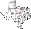
Carlton, Texas

Last updated

Carlton, Texas
USA Texas location map.svg
Red pog.svg
Carlton
Usa edcp location map.svg
Red pog.svg
Carlton
Coordinates: 31°55′11″N98°10′17″W / 31.91972°N 98.17139°W / 31.91972; -98.17139
Country United States
State Texas
County Hamilton
Elevation
[1]
1,332 ft (406 m)
Population
 (2020)
  Total102
Time zone UTC-6 (Central (CST))
  Summer (DST) UTC-5 (CDT)
ZIP codes
76436
Area code 254
GNIS feature ID2805785 [1]

Carlton is a census-designated place (CDP) in Hamilton County in Central Texas, United States. It lies in the northeastern part of the county and has an estimated population of 70. [2]

Contents

History

Carlton was founded in 1877 by a man named H.H. Armstrong on land owned by two local settlers; rancher J. M. Evans and Dr. F. M. Carlton, the town's namesake. With growth stimulated by its location on the major area stagecoach line, Carlton prospered through the late 1870s and by 1878 possessed its own school and several churches. In 1879, the post office at nearby Honey Creek was moved to Carlton and renamed for its new location. In 1900, the community had a reported population of just over 160 and several businesses, including a large cotton gin. The Stephenville North and South Texas Railway, part of the historic Cotton Belt Route, was built through Carlton in 1907 on its way from nearby Alexander to Hamilton. Carlton reached its peak population of 750 residents by 1910. During this time, two small weekly newspapers had served the area; the Courier, which ran from 1907 to 1909, and the Citizen, which ran 1910-1936.

Prosperity came to an end in the 1930s, however. Effects of the boll weevil blight of the 1920s and the Great Depression exacted a dire toll on Carlton. The railroad was abandoned in 1934, and by 1940 the population had fallen to 400. The declining population led to the closing of the Carlton schools in 1969 and by 1980 the reported population had dropped to seventy, a figure it maintained through to the 2000 Census.

Demographics

Historical population
CensusPop.Note
2020 102
U.S. Decennial Census [3]
1850–1900 [4] 1910 [5]
1920 [6] 1930 [7] 1940 [8]
1950 [9] 1960 [10] 1970 [11]
1980 [12] 1990 [13] 2000 [14]
2010 [15] 2020 [16]

Carlton first appeared as a census designated place in the 2020 U.S. Census. [17] [16]

2020 Census

Carlton CDP, Texas – Racial and ethnic composition
Note: the US Census treats Hispanic/Latino as an ethnic category. This table excludes Latinos from the racial categories and assigns them to a separate category. Hispanics/Latinos may be of any race.
Race / Ethnicity (NH = Non-Hispanic)Pop 2020 [16] % 2020
White alone (NH)8381.37%
Black or African American alone (NH)00.00%
Native American or Alaska Native alone (NH)21.96%
Asian alone (NH)00.00%
Pacific Islander alone (NH)00.00%
Other race alone (NH)00.00%
Mixed race or Multiracial (NH)54.90%
Hispanic or Latino (any race)1211.76%
Total102100.00%

Education

Carlton is served by the Hico Independent School District.

Miscellaneous

Portions of Carlton's ZIP code: 76436 extend into neighboring areas of Comanche and Erath counties in Central Texas. Carlton has one large historic town cemetery, located on the north side of Fm-2823, going from Carlton west towards the Comanche County line.

See also

Related Research Articles

<span class="mw-page-title-main">Hungerford, Texas</span> CDP in Texas, United States

Hungerford is a census-designated place (CDP) in northeastern Wharton County, Texas, United States. U.S. Route 59, Texas State Highway 60, and Farm to Market Road 1161 intersect in the community. The Kansas City Southern Railway Co. passes through Hungerford. The population was 390 at the 2020 census. It is located on what in the 1820s was part of colonist Alexander Jackson's land grant north of George E. Quinan's home. By the 1870s, the Quinan settlement grew up a short distance away, but its residents moved to the new town when the railroad came through Hungerford.

<span class="mw-page-title-main">Lingleville, Texas</span> Census-designated place in Erath County, Texas, United States

Lingleville is a census-designated place (CDP) in Erath County, Texas, United States. Lingleville is located at the intersection of Farm to Market Road 8 and Farm to Market Road 219, 10 miles (16 km) west of Stephenville.

<span class="mw-page-title-main">McDade, Texas</span> Census-designated place in Bastrop County, Texas, United States

McDade is a census-designated place (CDP) in northern Bastrop County, Texas, United States, located along U.S. Route 290. As of the 2020 census, it had a population of 720. It is 9 miles (14 km) east of Elgin and 34 miles (55 km) east of Austin. It is 21 miles (34 km) west of Giddings.

Zephyr is an unincorporated community and census designated place (CDP) in Brown County, Texas, United States. According to the Handbook of Texas, the community had an estimated population of 198 in 2000.

Aguilares is a census-designated place (CDP) in Webb County, Texas, United States. This was a new CDP for the 2010 census, with a population of 21. The population in the 2020 U.S. Census declined to 6.

Proctor is an unincorporated community and census-designated place (CDP) in Comanche County, Texas, United States. According to the Handbook of Texas, the community had an estimated population of 220 in 2000.

Loma Vista is a census-designated place (CDP) in Starr County, Texas, United States. It is a new CDP, formed from part of the North Escobares CDP prior to the 2010 census, with a population of 160.

Pena is an unincorporated community and census-designated place (CDP) in Starr County, Texas, United States. It was formed from part of the North Escobares CDP prior to the 2010 census, with a population of 118.

Guadalupe-Guerra is a census-designated place (CDP) in Starr County, Texas, United States. It is a new CDP, formed from part of the Fronton CDP prior to the 2010 census, with a population of 37.

Sunset is a census-designated place (CDP) in Starr County, Texas, United States. It is a new CDP formed from part of the Fronton CDP prior to the 2010 census, with a population of 47.

East Lopez is a census-designated place (CDP) in Starr County, Texas, United States. This was a new CDP for the 2010 census, with a population of 166.

El Brazil is a census-designated place (CDP) in Starr County, Texas, United States. This was a new CDP for the 2010 census, with a population of 47.

El Mesquite is a census-designated place (CDP) in Starr County, Texas, United States. This was a new CDP for the 2010 census, with a population of 38.

El Rancho Vela is a census-designated place (CDP) in Starr County, Texas, United States. This was a new CDP for the 2010 census, with a population of 274.

La Carla is a census-designated place (CDP) in Starr County, Texas, United States. This was a new CDP for the 2010 census, with a population of 70.

Netos is a census-designated place (CDP) in Starr County, Texas, United States. This was a new CDP for the 2010 census, with a population of 31.

Santa Anna is a census-designated place (CDP) in Starr County, Texas, United States. This was a new CDP for the 2010 census, with a population of 13.

Villarreal is a census-designated place (CDP) in Starr County, Texas, United States. This was a new CDP for the 2010 census, with a population of 131.

Zarate is a census-designated place (CDP) in Starr County, Texas, United States. This was a new CDP for the 2010 census, with a population of 59.

Lamkin is an unincorporated community and census-designated place (CDP) in Comanche County, Texas, United States. It was first listed as a CDP prior to the 2020 census.

References

  1. 1 2 U.S. Geological Survey Geographic Names Information System: Carlton, Texas
  2. Handbook of Texas Online entry for Carlton
  3. "Decennial Census by Decade". United States Census Bureau .
  4. "1900 Census of Population - Population of Texas By Counties And Minor Civil Divisions" (PDF). United States Census Bureau .
  5. "1910 Census of Population - Supplement for Texas" (PDF). United States Census Bureau .
  6. "1920 Census of Population - Number of Inhabitants - Texas" (PDF). United States Census Bureau .
  7. "1930 Census of Population - Number of Inhabitants - Texas" (PDF). United States Census Bureau .
  8. "1940 Census of Population - Number of Inhabitants - Texas" (PDF). United States Census Bureau .
  9. "1950 Census of Population - Number of Inhabitants - Texas" (PDF). United States Census Bureau .
  10. "1960 Census of Population - Number of Inhabitants - Texas" (PDF). United States Census Bureau .
  11. "1970 Census of Population - Number of Inhabitants - Texas" (PDF). United States Census Bureau .
  12. "1980 Census of Population - Number of Inhabitants - Texas" (PDF). United States Census Bureau .
  13. "1990 Census of Population - Population and Housing Unit Counts - Texas" (PDF). United States Census Bureau .
  14. "2000 Census of Population - Population and Housing Unit Counts - Texas" (PDF). United States Census Bureau .
  15. "2010 Census of Population - Population and Housing Unit Counts - Texas" (PDF). United States Census Bureau .
  16. 1 2 3 "P2: Hispanic or Latino, and Not Hispanic or Latino by Race – 2020: DEC Redistricting Data (PL 94-171) – Carlton CDP, Texas". United States Census Bureau.
  17. "2020 Geography Changes". United States Census Bureau.