
The Permian Basin is a large sedimentary basin in the southwestern part of the United States. The basin contains the Mid-continent oil field province. This sedimentary basin is located in western Texas and southeastern New Mexico. It reaches from just south of Lubbock, past Midland and Odessa, south nearly to the Rio Grande River in southern West Central Texas, and extending westward into the southeastern part of New Mexico. It is so named because it has one of the world's thickest deposits of rocks from the Permian geologic period. The greater Permian Basin comprises several component basins; of these, the Midland Basin is the largest, Delaware Basin is the second largest, and Marfa Basin is the smallest. The Permian Basin covers more than 86,000 square miles (220,000 km2), and extends across an area approximately 250 miles (400 km) wide and 300 miles (480 km) long.

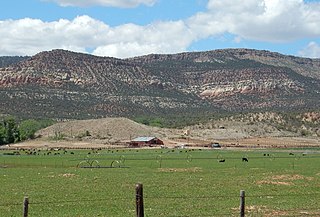
The Delaware Basin is a geologic depositional and structural basin in West Texas and southern New Mexico, famous for holding large oil fields and for a fossilized reef exposed at the surface. Guadalupe Mountains National Park and Carlsbad Caverns National Park protect part of the basin. It is part of the larger Permian Basin, itself contained within the Mid-Continent oil province.

The Cutler Formation or Cutler Group is a rock unit that is exposed across the U.S. states of Arizona, northwest New Mexico, southeast Utah and southwest Colorado. It was laid down in the Early Permian during the Wolfcampian epoch.
Caprock or cap rock is a more resistant rock type overlying a less resistant rock type, analogous to an upper crust on a cake that is harder than the underlying layer.
In geology, the Paradox Formation Is a Pennsylvanian age formation which consists of abundant evaporites with lesser interbedded shale, sandstone, and limestone. The evaporites are largely composed of gypsum, anhydrite, and halite. The formation is found mostly in the subsurface, but there are scattered exposures in anticlines in eastern Utah and western Colorado. These surface exposures occur in the Black Mesa, San Juan and Paradox Basins and the formation is found in the subsurface in southwestern Colorado, southeastern Utah, northeastern Arizona and northeastern New Mexico.
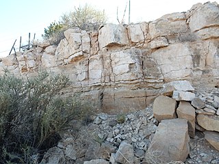
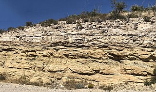
The Cherry Canyon Formation is a geologic formation found in the Delaware Basin of southeastern New Mexico and western Texas. It contains fossils characteristic of the Guadalupian Age of the Permian Period.
The Bell Canyon Formation is a geologic formation found in the Delaware Basin of southeastern New Mexico and western Texas. It contains fossils characteristic of the Guadalupian Age of the Permian Period.
The Bone Spring Formation is a geologic formation found in the Delaware Basin in Texas and New Mexico. It preserves fossils dating back to the Leonardian Age of the Permian Period.

The Capitan Formation is a geologic formation found in western Texas and southeastern New Mexico. It is a fossilized reef dating to the Guadalupian Age of the Permian period.
The Hueco Formation is a geologic formation in west Texas and southern New Mexico. It preserves fossils dating back to the early Permian period.
The San Andres Formation is a geologic formation found in New Mexico and Texas. It contains fossils characteristic of the late Leonardian (Kungurian) Age) of the Permian Period.

The Seven Rivers Formation is a geologic formation in southeastern New Mexico and west Texas. It preserves fossils dating back to the late Guadalupian Epoch of the Permian period.
The Tansill Formation is a geologic formation in southeastern New Mexico and west Texas, United States. It preserves fossils dating back to the late Guadalupian Age of the Permian period.
The Yates Formation is a geologic formation in southeast New Mexico and west Texas. It preserves fossils dating back to the late Guadalupian Age of the Permian period.

The Yeso Group is a group of geologic formations in New Mexico. It contains fossils characteristic of the Kungurian Age of the early Permian Period.
The Queen Formation is a geologic formation in southeastern New Mexico and west Texas. It preserves fossils dating back to the late Guadalupian Epoch of the Permian period.
The Victorio Peak Formation is a geologic formation found in the Delaware Basin in Texas and New Mexico. It preserves fossils dating back to the Leonardian Age of the Permian Period.
The Grayburg Formation is a geologic formation in west Texas and southern New Mexico. It preserves fossils dating back to the Guadalupian Epoch of the Permian Period.
The Salado Formation is a geologic formation in west Texas and southeastern New Mexico. It was deposited in the Ochoan Stage of the Permian period.
The Goat Seep Formation is a geologic formation found in western Texas and southeastern New Mexico. It is a fossilized reef dating to the Guadalupian Age of the Permian period.


