
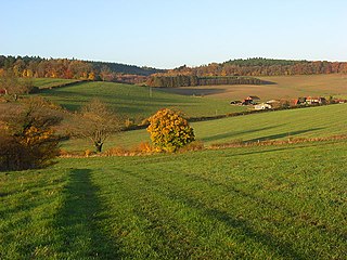
Ash to Brookwood Heaths is a 1,576.3-hectare (3,895-acre) biological Site of Special Scientific Interest west of Guildford in Surrey. It is a Nature Conservation Review site, Grade I. It is part of the Thames Basin Heaths Special Protection Area and the Thursley, Ash, Pirbright and Chobham Special Area of Conservation. An area of 1,392 hectares is managed as a nature reserve by the Surrey Wildlife Trust.

Bourley and Long Valley is a 823.5-hectare (2,035-acre) biological Site of Special Scientific Interest between Fleet and Aldershot in Hampshire. It is part of Thames Basin Heaths Special Protection Area for the conservation of wild birds.

Broadmoor to Bagshot Woods and Heaths is a 1,696.3-hectare (4,192-acre) biological Site of Special Scientific Interest (SSSI) in Berkshire and Surrey that extend from a minority of the parish of Crowthorne including around Broadmoor Hospital in the west to Bagshot south-east, Bracknell north-east, and Sandhurst, south. It is part of the Thames Basin Heaths Special Protection Area. Two nature reserves which are managed by the Surrey Wildlife Trust are in the SSSI, Barossa nature reserve and Poors Allotment. Broadmoor Bottom, which is part of Wildmoor Heath, also falls within the SSSI; this reserve is managed by the Berkshire, Buckinghamshire and Oxfordshire Wildlife Trust.

Colony Bog and Bagshot Heath is a 1,130.5-hectare (2,794-acre) biological Site of Special Scientific Interest between Camberley and Woking in Surrey, England. Part of it is a Nature Conservation Review site, Grade I. It is part of the Thames Basin Heaths Special Protection Area and the Thursley, Ash, Pirbright and Chobham Special Area of Conservation. It includes Brentmoor Heath, a Local Nature Reserve which is managed by the Surrey Wildlife Trust
Bix Bottom is a 102.3-hectare (253-acre) biological Site of Special Scientific Interest north-west of Henley-on-Thames in Oxfordshire. It is owned and managed as Warburg Nature Reserve by the Berkshire, Buckinghamshire and Oxfordshire Wildlife Trust.

Horsell Common is a 355-hectare (880-acre) open space in Horsell, near Woking in Surrey. It is owned and managed by the Horsell Common Preservation Society. An area of 152 hectares is a biological Site of Special Scientific Interest and part of the Thames Basin Heaths Special Protection Area.

Ockham and Wisley Commons is a 266-hectare (660-acre) biological Site of Special Scientific Interest east of Woking in Surrey. It is also a Local Nature Reserve and part of the Thames Basin Heaths Special Protection Area. It is part of the slightly larger area of 297-hectare (730-acre) Wisley & Ockham Commons & Chatley Heath nature reserve, which is owned by Surrey County Council and managed by the Surrey Wildlife Trust.

Whitmoor Common is a 166-hectare (410-acre) biological Site of Special Scientific Interest on the northern outskirts of Guildford in Surrey. It is part of the Thames Basin Heaths Special Protection Area and the 184.9-hectare (457-acre) Whitmoor and Rickford Commons Local Nature Reserve, which is owned by Surrey County Council and managed by the Surrey Wildlife Trust.

Sandhurst to Owlsmoor Bogs and Heaths is an 85.8-hectare (212-acre) biological Site of Special Scientific Interest (SSSI) on the northern outskirts of Sandhurst in Berkshire. Part of the SSSI is Wildmoor Heath nature reserve, which is managed by the Berkshire, Buckinghamshire and Oxfordshire Wildlife Trust. and the SSSI is part of Thames Basin Heaths Special Protection Area.
Castle Bottom is a British national nature reserve located near Yateley in Hampshire. It is part of Castle Bottom to Yateley and Hawley Commons, which is a Site of Special Scientific Interest, and Thames Basin Heaths Special Protection Area for the conservation of wild birds

Bridgham and Brettenham Heaths is a 439.9-hectare (1,087-acre) biological Site of Special Scientific Interest north-east of Thetford in Norfolk, England. It is a Nature Conservation Review site, Grade I, and part of the Breckland Special Area of Conservation and Special Protection Area. Brettenham Heath is a National Nature Reserve.

Bisley and West End Commons is a 37.2-hectare (92-acre) Local Nature Reserve west of Woking in Surrey. It is part of the 46-hectare (110-acre) Bisley & West End Commons and Reidon Hill nature reserve, which is owned by Surrey County Council and managed by Surrey Wildlife Trust. The site is also part of the Colony Bog and Bagshot Heath Site of Special Scientific Interest, the Thursley, Ash, Pirbright & Chobham Special Area of Conservation and the Thames Basin Heaths Special Protection Area,

Brentmoor Heath is a 28.6-hectare (71-acre) Local Nature Reserve east of Camberley in Surrey. It is part of Brentmoor Heath and Folly Bog nature reserve, the ownership of which is divided between the Ministry of Defence, Surrey County Council and Surrey Heath Borough Council, and is managed by Surrey Wildlife Trust. The site is also part of Colony Bog and Bagshot Heath site of Special Scientific Interest, Thursley, Ash, Pirbright & Chobham Special Area of Conservation and Thames Basin Heaths Special Protection Area.
Ash Ranges is a 1,392-hectare (3,440-acre) nature reserve west of Pirbright in Surrey. It is owned by the Ministry of Defence and managed by the Surrey Wildlife Trust. It is part of the Thames Basin Heaths Special Protection Area and the Ash to Brookwood Heaths Site of Special Scientific Interest
Barossa is a 498-hectare (1,230-acre) nature reserve north of Camberley in Surrey. It is owned by the Ministry of Defence and managed by the Surrey Wildlife Trust. It is part of the Thames Basin Heaths Special Protection Area and the Broadmoor to Bagshot Woods and Heaths Site of Special Scientific Interest

Poors Allotment is a 76-hectare (190-acre) nature reserve north of Camberley in Surrey. It is owned by Windlesham United Charities and managed by the Surrey Wildlife Trust. It is part of Thames Basin Heaths Special Protection Area and Broadmoor to Bagshot Woods and Heaths Site of Special Scientific Interest.
Bramshill is a 673.3-hectare (1,664-acre) biological Site of Special Scientific Interest near Bramshill, northeast of Basingstoke in Hampshire. It is part of Thames Basin Heaths Special Protection Area for the conservation of wild birds.

Broxhead and Kingsley Commons is a 105.1-hectare (260-acre) biological Site of Special Scientific Interest north of Lindford in Hampshire. It is part of Wealden Heaths Phase II Special Protection Area for the Conservation of Wild Birds and Broxhead Common is a 41.8-hectare (103-acre) Local Nature Reserve owned and managed by Hampshire County Council.

Eelmoor Marsh is a 66.3-hectare (164-acre) biological Site of Special Scientific Interest between Fleet and Farnborough in Hampshire. It is part of Thames Basin Heaths Special Protection Area for the conservation of wild birds.
Hazeley Heath is a 180.8-hectare (447-acre) biological Site of Special Scientific Interest west of Farnborough in Hampshire. It is part of Thames Basin Heaths Special Protection Area for the conservation of wild birds.
