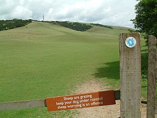
Butser Hill is a hill and nature reserve in Hampshire, England. South-west of Petersfield, it is a 239.7-hectare (592-acre) biological and geological Site of Special Scientific Interest. It is a national nature reserve and a Special Area of Conservation. Part of it is a Geological Conservation Review site and an area of 84.8 hectares is Oxenbourne Down, which is designated a Local Nature Reserve. Part of it is a Scheduled Monument.

Kingley Vale is a 204.4-hectare (505-acre) biological Site of Special Scientific Interest north of Chichester in West Sussex. It is also a Special Area of Conservation and a Nature Conservation Review site, Grade I. An area of 147.9 hectares is a national nature reserve.

Old Winchester Hill is a 66.2-hectare (164-acre) biological Site of Special Scientific Interest in Hampshire. It is a Nature Conservation Review site, Grade I, and a national nature reserve. Part of it is a scheduled monument.

Queendown Warren is a 22.2-hectare (55-acre) biological Site of Special Scientific Interest south-east of Rainham in Kent. It is a Local Nature Reserve, a Nature Conservation Review site, Grade 2, and a Special Area of Conservation. It is in the Kent Downs Area of Outstanding Natural Beauty. It is managed by the Kent Wildlife Trust, and part of it is owned by Plantlife.

Hackhurst and White Downs is a 185.1-hectare (457-acre) biological Site of Special Scientific Interest west of Dorking in Surrey. White Downs is a Nature Conservation Review site, Grade 2, and part of it is in the 200-hectare (490-acre) White Downs nature reserve, which is owned by the Wotton Estate and managed by the Surrey Wildlife Trust (SWT). Hackhurst Downs is a 29.9-hectare (74-acre) Local Nature Reserve, which part of the 40-hectare (99-acre) Hackhurst Downs nature reserve, which is owned by Surrey County Council and also managed by the SWT.

Mole Gap to Reigate Escarpment is a 1,016.4-hectare (2,512-acre) biological and geological Site of Special Scientific Interest west of Reigate in Surrey. It is a Geological Conservation Review site and a Special Area of Conservation. Part of it is a Nature Conservation Review site, Grade I. Two small private nature reserves in the site are managed by the Surrey Wildlife Trust, Dawcombe and Fraser Down.

Lewes Downs is a 165-hectare (410-acre) biological Site of Special Scientific Interest east of Lewes in East Sussex. It is a Nature Conservation Review site, Grade I and a Special Area of Conservation. Part of it is a national nature reserve, part is Malling Down nature reserve, which is managed by the Sussex Wildlife Trust, and part is Mount Caburn, an Iron Age hill fort which is a Scheduled Monument.

Castle Hill is a 114.6-hectare (283-acre) biological Site of Special Scientific Interest on the eastern outskirts of Brighton in East Sussex. It is a Special Area of Conservation and Nature Conservation Review site. The northern half is a national nature reserve

Seaford to Beachy Head is a 1,108.7-hectare (2,740-acre) biological and geological Site of Special Scientific Interest which stretches from Seaford to Eastbourne in East Sussex. It has several Geological Conservation Review sites. Part of it is a Nature Conservation Review site, Grade I. An area of 150 hectares is a Local Nature Reserve managed by the Sussex Wildlife Trust.
Lullington Heath is a 72.7-hectare (180-acre) biological Site of Special Scientific Interest west of Eastbourne in East Sussex. It is a national nature reserve and a Nature Conservation Review site, Grade I.

Wouldham to Detling Escarpment is a 311.2-hectare (769-acre) biological and geological Site of Special Scientific Interest which stretches from Wouldham to Detling, north of Maidstone in Kent. Part of it is a Geological Conservation Review site, and it is part of the North Downs Woodlands Special Area of Conservation and the Kent Downs Area of Outstanding Natural Beauty. It is a Nature Conservation Review site, Grade I and it includes three Kent Wildlife Trust nature reserves and a Local Nature Reserve,

Beeding Hill to Newtimber Hill is a 321-hectare (790-acre) biological and geological Downland Site of Special Scientific Interest (SSSI) north of Shoreham-by-Sea in West Sussex. It is a Nature Conservation Review site, Grade 2, and it includes Devil's Dyke Geological Conservation Review site.

Duncton to Bignor Escarpment is a 229-hectare (570-acre) biological Site of Special Scientific Interest west of Pulborough in West Sussex. It is a Special Area of Conservation and Bignor Hill is a Nature Conservation Review site, Grade I.

Harting Downs is a 336.3-hectare (831-acre) biological Site of Special Scientific Interest west of Midhurst in West Sussex. It is a Nature Conservation Review site, Grade I and an area of 206.6 hectares is a Local Nature Reserve which is owned and managed by the National Trust.

Aston Upthorpe Downs is a 38.5-hectare (95-acre) biological Site of Special Scientific Interest south of Aston Upthorpe in Oxfordshire. It is a Nature Conservation Review site, Grade I.

Emer Bog and Baddesley Common is a 50-hectare (120-acre) nature reserve north of North Baddesley in Hampshire. It is managed by the Hampshire and Isle of Wight Wildlife Trust. An area of 39.0 hectares is designated as Baddesley Common biological Site of Special Scientific Interest. An area of 37.6 hectares is designated Emer Bog Special Area of Conservation

Coulters Dean is a 2.2-hectare (5.4-acre) biological Site of Special Scientific Interest south-east of Buriton in Hampshire. It is part of the 4-hectare (9.9-acre) Coulters Dean nature reserve, which is managed by the Hampshire and Isle of Wight Wildlife Trust.

Lee-on-The Solent to Itchen Estuary is a 585.9-hectare (1,448-acre) biological and geological Site of Special Scientific Interest which stretches along the coast between Southampton and Gosport in Hampshire. It is a Geological Conservation Review site. It is part of Solent and Southampton Water Ramsar site and Special Protection Area, and of Solent Maritime Special Area of Conservation. Three areas are Local Nature Reserves, Chessel Bay, Hook with Warsash and Mercury Marshes. One area is Hamble Common Camp, a Scheduled Monument.

North Solent is a 1,186.7-hectare (2,932-acre) biological and geological Site of Special Scientific Interest along the north bank of the Solent between East End and Calshot in Hampshire. It is a Nature Conservation Review site, Grade I. Part of it is in North Solent National Nature Reserve and two areas are Geological Conservation Review sites. It is part of Solent and Southampton Water Ramsar site and Special Protection Area, and of Solent Maritime Special Area of Conservation. Boldre Foreshore is a local nature reserve.

Blashford Lakes is a 159-hectare (390-acre) nature reserve north of Ringwood in Hampshire, England, which is managed by the Hampshire and Isle of Wight Wildlife Trust. The site is part of the River Avon System Nature Conservation Review site, Grade I, Avon Valley Ramsar site, River Avon Special Area of Conservation and Special Protection Area, and of Avon Valley, which is a Site of Special Scientific Interest.
