
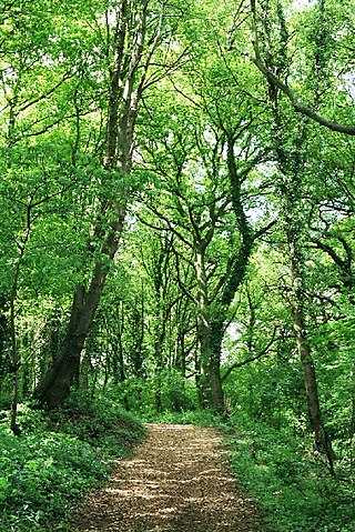
Aire Point to Carrick Du SSSI is a Site of Special Scientific Interest on the Penwith Peninsula, Cornwall, England. It is 5.98 square kilometres in extent, stretching from grid reference SW360279 to grid reference SW513410. The site is designated both for its biological and its geological interest.

Dinton Pastures Country Park is a country park in the civil parish of St Nicholas Hurst, in the borough of Wokingham, near Reading in the English county of Berkshire.

Lodmoor is a Site of Special Scientific Interest (SSSI), RSPB reserve and country park in Dorset, England. The country park features a visitor centre, model railway and pitch and putt golf course. The SSSI has a wetland habitat with native birds that are rare in the UK and a range of migratory species.

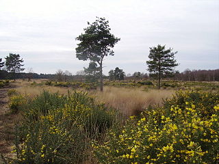
Broadmoor to Bagshot Woods and Heaths is a 1,696.3-hectare (4,192-acre) biological Site of Special Scientific Interest (SSSI) in Berkshire and Surrey that extend from a minority of the parish of Crowthorne including around Broadmoor Hospital in the west to Bagshot south-east, Bracknell north-east, and Sandhurst, south. It is part of the Thames Basin Heaths Special Protection Area. Two nature reserves which are managed by the Surrey Wildlife Trust are in the SSSI, Barossa nature reserve and Poors Allotment. Broadmoor Bottom, which is part of Wildmoor Heath, also falls within the SSSI; this reserve is managed by the Berkshire, Buckinghamshire and Oxfordshire Wildlife Trust.

Cors Caron is a raised bog in Ceredigion, Wales. Cors is the Welsh word for "bog". Cors Caron covers an area of approximately 349 hectares. Cors Caron represents the most intact surviving example of a raised bog landscape in the United Kingdom. About 44 different species groups inhabit the area including various land and aquatic plants, fish, insects, crustaceans, lichen, fungi, terrestrial mammals and birds.

Dersingham Bog is a 159.1-hectare (393-acre) biological and geological Site of Special Scientific Interest in Norfolk, England. It is a Nature Conservation Review site, Grade 2, a National Nature Reserve and a Ramsar site It is part of the Norfolk Coast Area of Outstanding Natural Beauty, and the Roydon Common & Dersingham Bog Special Area of Conservation Part of it is a Geological Conservation Review site.

Sandhurst to Owlsmoor Bogs and Heaths is an 85.8-hectare (212-acre) biological Site of Special Scientific Interest (SSSI) on the northern outskirts of Sandhurst in Berkshire. Part of the SSSI is Wildmoor Heath nature reserve, which is managed by the Berkshire, Buckinghamshire and Oxfordshire Wildlife Trust. and the SSSI is part of Thames Basin Heaths Special Protection Area.

Tring Reservoirs is a group of four reservoirs close to Tring on the border of Hertfordshire and Buckinghamshire, England. Their purpose is to feed the Grand Union Canal.
Järveküla Nature Reserve is a nature reserve founded in 1990, situated by Lake Vörtsjärv in southern Estonia near the village of Järveküla. The nature reserve has been established to protect the population of white-tailed eagles present in the area, and includes pine forest and patches of bog.

Englemere Pond is a 26.1-hectare (64-acre) biological Site of Special Scientific Interest on the southern outskirts of North Ascot in Berkshire. The site is also a Local Nature Reserve. It is owned by the Crown Estate and managed by Bracknell Forest Borough Council.

Maiden Erlegh Lakes is a 10.2-hectare (25-acre) Local Nature Reserve Earley, a suburb of Reading in Berkshire. It is owned and managed by Earley Town Council.

McIlroy Park is a 12-hectare (30-acre) Local Nature Reserve in Tilehurst, a suburb of Reading in Berkshire. It is owned and managed by Reading Borough Council. Along with Blundells Copse and Lousehill Copse it is part of West Reading Woodlands.
Lousehill Copse is a local nature reserve in the Tilehurst suburb of the English town of Reading. The nature reserve is 13.03 hectares in size, and is under the management of the Reading Borough Council. The majority of the site comprises natural mature woodland surrounded by housing and featuring a pond, whilst the northern section of the reserve, also known as Comparts Plantation, is a grassy meadow area. To the south the reserve is crossed by Dee Road.
Sole Common Pond is a 3-hectare (7.4-acre) nature reserve south-west of Boxford in Berkshire in Berkshire. It is managed by the Berkshire, Buckinghamshire and Oxfordshire Wildlife Trust.

Edgbarrow Woods is a 36.8-hectare (91-acre) Local Nature Reserve on the northern outskirts of Sandhurst in Berkshire. It is owned and managed by Wellington College.

Alder Moors is a 8.5-hectare (21-acre) Local Nature Reserve in Woodley, a suburb of Reading in Berkshire. It is owned and managed by Wokingham District Council.

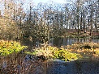
Lavells Lake is a 12.5-hectare (31-acre) Local Nature Reserve on the outskirts of Woodley, a suburb of Reading in Berkshire. It is owned by Wokingham District Council and managed by the council and The Friends of Lavell's Lake. The nature reserve is part of Dinton Pastures Country Park.

Kobuleti Strict Nature Reserve is a protected area in Kobuleti Municipality, Adjara region of Georgia along the Black Sea coast in the northern part of the resort town Kobuleti. Kobuleti Protected Areas were established in 1998 to preserve unique wetland ecosystems recognized by the Ramsar Convention. Because of these wetland ecosystems, ancient forests, and the high biodiversity found within the reserve, it was inscribed on the UNESCO World Heritage List as part of the Colchic Rainforests and Wetlands in 2021.
Castle Bottom to Yateley and Hawley Commons is a 922.7-hectare (2,280-acre) biological Site of Special Scientific Interest north of Fleet in Hampshire. It is part of Thames Basin Heaths Special Protection Area for the conservation of wild birds and an area of 30.8 hectares is designated a national nature reserve called Castle Bottom.
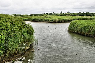
Titchfield Haven is a 134.5-hectare (332-acre) biological Site of Special Scientific Interest north-west of Gosport in Hampshire. Most of it is a local nature reserve and a national nature reserve. It is part of Solent and Southampton Water Ramsar site and Special Protection Area.
