Cave Spring, Virginia

Last updated
Cave Spring, Virginia
CDP
Shenandoah Valley.svg
Red pog.svg
Cave Spring
USA Virginia location map.svg
Red pog.svg
Cave Spring
Usa edcp location map.svg
Red pog.svg
Cave Spring
Coordinates: 37°13′59″N80°0′23″W / 37.23306°N 80.00639°W / 37.23306; -80.00639
CountryUnited States
State Virginia
County Roanoke
Area
  Total11.8 sq mi (30.6 km2)
  Land11.8 sq mi (30.6 km2)
  Water0.0 sq mi (0.0 km2)
Elevation
1,099 ft (335 m)
Population
 (2020)
  Total26,755
Time zone UTC−5 (Eastern (EST))
  Summer (DST) UTC−4 (EDT)
ZIP code
24018
Area code 540
FIPS code 51-13720 [1]
GNIS feature ID1493547 [2]

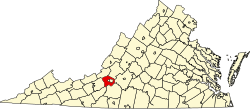
Cave Spring is a census-designated place (CDP) in Roanoke County, Virginia, United States. The population was 26,755 at the 2020 census. Cave Spring covers much of the area known locally as "Southwest County" which has the most affluent suburbs of Roanoke. It is part of the Roanoke Metropolitan Statistical Area.

Contents

Roanoke County's administrative offices are located in Cave Spring, though the independent city of Salem is officially the county seat.

The United States Postal Service considers most of the Cave Spring area to be unincorporated Roanoke City.
Geography

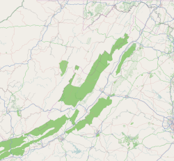
Cave Spring is located at 37°13′59″N80°0′23″W / 37.23306°N 80.00639°W / 37.23306; -80.00639 (37.233170, 80.006252). [3]

According to the United States Census Bureau, the CDP has a total area of 11.8 square miles (30.6 km2), all of it land.

Demographics

As of the census [1] of 2000, there were 24,941 people, 10,997 households, and 7,082 families residing in the CDP. The population density was 2,108.1 people per square mile (814.0/km2). There were 11,556 housing units at an average density of 976.8/sq mi (377.2/km2). The racial makeup of the CDP was 92.96% White, 2.43% African American, 0.08% Native American, 2.96% Asian, 0.02% Pacific Islander, 0.45% from other races, and 1.10% from two or more races. Hispanic or Latino of any race were 1.51% of the population.

There were 10,997 households, out of which 27.6% had children under the age of 18 living with them, 54.2% were married couples living together, 7.9% had a female householder with no husband present, and 35.6% were non-families. 30.5% of all households were made up of individuals, and 10.1% had someone living alone who was 65 years of age or older. The average household size was 2.26 and the average family size was 2.84.

In the CDP, the population was spread out, with 22.1% under the age of 18, 6.9% from 18 to 24, 27.9% from 25 to 44, 27.3% from 45 to 64, and 15.8% who were 65 years of age or older. The median age was 41 years. For every 100 females there were 89.8 males. For every 100 females age 18 and over, there were 86.6 males.

The median income for a household in the CDP was $51,182, and the median income for a family was $64,550. Males had a median income of $43,350 versus $29,242 for females. The per capita income for the CDP was $30,318. About 1.7% of families and 3.2% of the population were below the poverty line, including 2.6% of those under age 18 and 2.4% of those age 65 or over.

Education

Cave Spring is served by Roanoke County Public Schools and includes two high schools:

Notable residents

Related Research Articles

<span class="mw-page-title-main">Salem, Virginia</span> Independent city in Virginia, United States

Salem is an independent city in the U.S. commonwealth of Virginia. As of the 2020 census, the population was 25,346. It is the county seat of Roanoke County, although the two are separate jurisdictions. The Bureau of Economic Analysis combines the city of Salem with Roanoke County, which surrounds both Salem and the neighboring City of Roanoke, for statistical purposes. Salem has its own courthouse and sheriff's office, but shares a jail with Roanoke County, which is located in the Roanoke County Courthouse complex in Salem. The Roanoke County Sheriff's Office and Roanoke County Department of Social Services are also located within Salem, though the county administrative offices are located in unincorporated Cave Spring.

<span class="mw-page-title-main">Roanoke County, Virginia</span> County in Virginia, United States

Roanoke County is a county in the U.S. state of the Commonwealth of Virginia. As of the 2020 census, its population was 96,929. Its county seat is Salem, but the county administrative offices are located in the census-designated place of Cave Spring.

<span class="mw-page-title-main">Pelican Bay, Florida</span> Census-designated place in Florida

Pelican Bay is a census-designated place (CDP) in Collier County, Florida, United States. The population was 6,660 at the 2020 census, up from 6,346 at the 2010 census. It is part of the Naples–Marco Island Metropolitan Statistical Area.

<span class="mw-page-title-main">Pine Ridge, Collier County, Florida</span> Census-designated place in Florida

Pine Ridge is a census-designated place (CDP) in Collier County, Florida, United States. The population was 1,717 at the 2020 census, down from 1,918 at the 2010 census. It is part of the Naples–Marco Island Metropolitan Statistical Area.

<span class="mw-page-title-main">Westview, Florida</span> Census-designated place in Florida

Westview is a census-designated place (CDP) in Miami-Dade County, Florida, United States. It is part of the Miami metropolitan area of South Florida. The population was 9,923 at the 2020 census.

<span class="mw-page-title-main">Bennsville, Maryland</span> Census-designated place in Maryland, United States

Bennsville is a census-designated place (CDP) in Charles County, Maryland, United States. Per the 2020 census, the population was 15,288. The area is not an official postal designation, but is part of the Waldorf or Pomfret postal area. The Bennsville area is growing with new residential development, encouraged by the extension in the 1990s of Maryland Route 228 which provides quick access to Maryland Route 210. Bennsville has experienced the 2006 opening of North Point High School and the straightening of Middletown Road in 2008.

<span class="mw-page-title-main">Gulf Park Estates, Mississippi</span> Census-designated place in Mississippi, United States

Gulf Park Estates is an unincorporated community and census-designated place (CDP) located south of Ocean Springs in Jackson County, Mississippi, United States. It is part of the Pascagoula Metropolitan Statistical Area. The population was 5,719 at the 2010 census, up from 4,272 at the 2000 census.

<span class="mw-page-title-main">Oakville, Missouri</span> Place in Missouri, United States

Oakville is an unincorporated community and census-designated place (CDP) in south St. Louis County, Missouri, United States. The population was 36,301 at the 2020 census. Oakville is 18 miles south of the city of St. Louis and borders the Mississippi and Meramec rivers; the area is part of "South County".

Elgin is an unincorporated community and census-designated place (CDP) in Lancaster County, South Carolina, United States. The population was 2,607 at the 2010 census.

<span class="mw-page-title-main">Riverview, South Carolina</span> CDP in South Carolina, United States

Riverview is a census-designated place (CDP) in York County, South Carolina, United States, located southwest of Fort Mill along the Catawba River. The population was 708 at the 2000 census.

<span class="mw-page-title-main">Halls Crossing, Utah</span> CDP in Utah, United States

Halls Crossing is a census-designated place (CDP) on the western edge of San Juan County, Utah, United States. The population was six at the 2010 Census. State Route 276 crosses the Colorado River at Halls Crossing using the Charles Hall Ferry.

Cloverdale is a census-designated place (CDP) in southern Botetourt County, Virginia, United States. The population was 3,410 at the 2020 census. The community is located along State Route 654. It is part of the Roanoke Metropolitan Statistical Area.

Laymantown is a census-designated place (CDP) in southern Botetourt County, Virginia, United States. The population was 1,867 at the 2020 census. The community is located along State Route 658. It is part of the Roanoke Metropolitan Statistical Area.

North Shore is a census-designated place (CDP) in Franklin County, Virginia, United States. The community lies along State Route 616. It is part of the Roanoke Metropolitan Statistical Area.

Penhook is a census-designated place (CDP) in Franklin County, Virginia, United States. The population was 801 at the 2010 census, up from 726 in 2000. It is part of the Roanoke Metropolitan Statistical Area.

Westlake Corner is a census-designated place in Franklin County, Virginia, United States. The population was 1,553 at the 2020 census up fro 976 at the 2010 census. It is part of the Roanoke Metropolitan Statistical Area.

Elliston-Lafayette was a census-designated place (CDP) in Montgomery County, Virginia, United States. The population was 1,241 at the 2000 census; in 2010, Elliston and Lafayette were split into separate CDPs. It is part of the Blacksburg–Christiansburg Metropolitan Statistical Area, which encompasses all of Montgomery County, Virginia, including the towns of Blacksburg and Christiansburg, and the city of Radford. However, many residents of the eastern section of Montgomery County more often travel to Roanoke or Salem for work, shopping, and services since these cities are generally closer and do not require driving up Christiansburg Mountain on U.S. Route 460 or Interstate 81.

<span class="mw-page-title-main">Shawsville, Virginia</span> Census-designated place in Virginia, United States

Shawsville is a census-designated place (CDP) in Montgomery County, Virginia, United States. The population was 1,310 at the 2010 census. It is part of the Blacksburg–Christiansburg Metropolitan Statistical Area which encompasses all of Montgomery County, Virginia, and the city of Radford.

<span class="mw-page-title-main">Fairlea, West Virginia</span> Census-designated place in West Virginia, United States

Fairlea is a census-designated place (CDP) in Greenbrier County, West Virginia, United States. The population was 1,747 at the 2010 census. Fairlea is the location of the annual West Virginia State Fair, held in August.

Hollins is a census-designated place (CDP) in Botetourt and Roanoke County, Virginia, United States. Hollins covers much of the area known locally as "North County". The population was 15,574 at the 2020 census. It is part of the Roanoke Metropolitan Statistical Area. The area is also the home of Hollins University in addition to four properties listed on the National Register of Historic Places: the Black Horse Tavern-Bellvue Hotel and Office, Harshbarger House, the Hollins College Quadrangle, and Old Tombstone.

References

  1. 1 2 "U.S. Census website". United States Census Bureau . Retrieved 2008-01-31.
  2. "US Board on Geographic Names". United States Geological Survey. 2007-10-25. Retrieved 2008-01-31.
  3. "US Gazetteer files: 2010, 2000, and 1990". United States Census Bureau. 2011-02-12. Retrieved 2011-04-23.