Cheepie, Queensland

Last updated

Map all coordinates using: OpenStreetMap  
Download coordinates as: KML
Cheepie
Queensland
Australia Queensland location map.svg
Red pog.svg
Cheepie
Coordinates 26°37′44″S145°00′49″E / 26.6288°S 145.0136°E / -26.6288; 145.0136 (Cheepie (town centre)) Coordinates: 26°37′44″S145°00′49″E / 26.6288°S 145.0136°E / -26.6288; 145.0136 (Cheepie (town centre))
Postcode(s) 4475
Time zone AEST (UTC+10:00)
Location
LGA(s) Shire of Quilpie
State electorate(s) Warrego
Federal division(s) Maranoa

Cheepie is a town in the locality of Adavale in Shire of Quilpie, Queensland, Australia. [1] It has a population of 2 people. [2]

Contents

History

Margany (also known as Marganj, Mardigan, Marukanji, Maranganji) is an Australian Aboriginal language spoken by the Margany people. The Margany language region includes the landscape within the local government boundaries of the Quilpie Shire, taking in Quilpie, Cheepie and Beechal extending towards Eulo and Thargomindah, as well as the properties of Dynevor Downs and Ardoch. [3]

Gunya (also known as Kunya, Kunja, Kurnja) is an Australian Aboriginal language spoken by the Gunya people. The Gunya language region includes the landscape within the local government boundaries of the Paroo Shire Council, taking in Cunnamulla and extending north towards Augathella, east towards Bollon and west towards Thargomindah. [4]

Cheepie was originally a Cobb & Co station. [2]

Cheepie railway station ( 26°37′52″S145°00′49″E / 26.6311°S 145.0136°E / -26.6311; 145.0136 (Cheepie railway station) ) on the Western railway line was built between 1914 and 1916 and was named by Queensland Railways Department, using an Aboriginal word, meaning the call of the whistling duck. [5]

The town takes its name from the Cheepie railway station. [1]

Cheepie became a vibrant local township and in its heyday had a police station, hotel, school, blacksmith, railway station and yards, tent boarding houses, butcher shop, bakery and two market gardens along with numerous residences for people engaged in these operations.[ citation needed ]

Cheepie Provisional School opened on 14 October 1915 but closed in June 1917. On 9 June 1930, Cheepie Provisional School reopened at a new site. It became Cheepie State School in 1933. It closed on 11 April 1974. [6] The school was on Blakeney Street ( 26°37′47″S145°00′51″E / 26.6297°S 145.0142°E / -26.6297; 145.0142 (Cheepie State School (site)) ); that land is now leased to the Quilpie Shire Council as a community centre. [7] [8]

The Royal Mail was the first hotel in Cheepie, opening its door in 1926. [9]

In 1932, the Queensland Government offered for auction 50 town lots of 1 rood (11,000 sq ft; 1,000 m2) each in the town. [10]

Related Research Articles

<span class="mw-page-title-main">Cunnamulla</span> Town in Queensland, Australia

Cunnamulla is a town and a locality in the Shire of Paroo, Queensland, Australia. It is 206 kilometres (128 mi) south of Charleville, and approximately 750 kilometres (470 mi) west of the state capital, Brisbane. In the 2016 census, Cunnamulla had a population of 1,140 people.

<span class="mw-page-title-main">Quilpie, Queensland</span> Town in Queensland, Australia

Quilpie is a rural town and locality in the Shire of Quilpie, Queensland, Australia. In the 2016 census, Quilpie had a population of 595 people.

<span class="mw-page-title-main">Augathella</span> Town in Queensland, Australia

Augathella is a rural town and locality in the Shire of Murweh, Queensland, Australia.

<span class="mw-page-title-main">Thargomindah</span> Town in Queensland, Australia

Thargomindah is a rural town and locality in the Shire of Bulloo, Queensland, Australia. The town of Thargomindah is the administrative centre for the Shire of Bulloo. In the 2016 census, Thargomindah had a population of 270 people. It was founded on Wongkumara and Kalali territory.

<span class="mw-page-title-main">Warrego River</span> River in Australia

The Warrego River is an intermittent river that is part of the Darling catchment within the Murray–Darling basin, which is located in South West Queensland and in the Orana region of New South Wales, Australia. The Warrego River is the northernmost tributary of the Darling River.

<span class="mw-page-title-main">Laura, Queensland</span> Town in Queensland, Australia

Laura is a rural town and locality in the Shire of Cook, Queensland, Australia. In the 2016 census the locality of Laura had a population of 228 people.

<span class="mw-page-title-main">Shire of Paroo</span> Local government area in Queensland, Australia

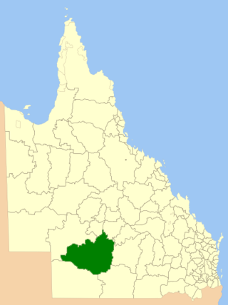
The Shire of Paroo is a local government area in South West Queensland, Australia. The administrative centre is the town of Cunnamulla. The Paroo Shire covers an area of 47,623 square kilometres (18,387 sq mi). In the 2021 census, the Shire had a population of 1,679.

<span class="mw-page-title-main">Kuranda, Queensland</span> Town in Queensland, Australia

Kuranda is a rural town and locality on the Atherton Tableland in the Shire of Mareeba, Queensland, Australia. In the 2016 census, Kuranda had a population of 3,008 people. It is 25 kilometres (16 mi) from Cairns, via the Kuranda Range road. It is surrounded by tropical rainforest and adjacent to the Wet Tropics of Queensland World Heritage listed Barron Gorge National Park.

<span class="mw-page-title-main">Shire of Quilpie</span> Local government area in Queensland, Australia

The Shire of Quilpie is a local government area in South West Queensland, Australia. It covers an area of 67,415 square kilometres (26,029 sq mi), and its administrative centre is the town of Quilpie.

<span class="mw-page-title-main">Shire of Bulloo</span> Local government area in Queensland, Australia

The Shire of Bulloo is a local government area in South West Queensland, Australia.

<span class="mw-page-title-main">Eulo, Queensland</span> Town in Queensland, Australia

Eulo is an outback town and locality in the Shire of Paroo, Queensland, Australia. In the 2016 census, Eulo had a population of 95 people. It is known for its opal mining.

Kalali, also written Kullili, Galali, Garlali, Kullilla and other variants, is a poorly attested Australian Aboriginal language. It is one of several geographically transitional "Karna–Mari fringe" languages that have not been convincingly classified, and is best considered an isolate branch within the Pama–Nyungan family. Gavan Breen provisionally includes Minkabari and the Ngura dialect Pitjara/Bidjara/Bitharra, which together have been called the Bulloo River language.

<span class="mw-page-title-main">Bollon, Queensland</span> Town in Queensland, Australia

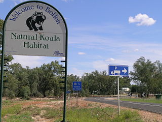
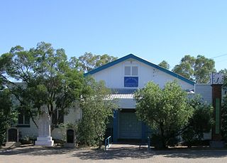
Bollon is a rural town and locality in the Shire of Balonne, Queensland, Australia. In the 2016 census, Bollon had a population of 221 people.

Bidjara, also spelt Bidyara or Pitjara, is an Australian Aboriginal language. In 1980, it was spoken by twenty elders in Queensland between the towns of Tambo and Augathella, or the Warrego and Langlo Rivers. There are many dialects of the language, including Gayiri and Gunggari. Some of them are being revitalised and is being taught in local schools in the region.

<span class="mw-page-title-main">South West Queensland</span> Region in Queensland, Australia

South West Queensland is a remote region in the Australian state of Queensland which covers 319,808 km2 (123,479 sq mi). The region lies to the south of Central West Queensland and west of the Darling Downs and includes the Maranoa district and parts of the Channel Country. The area is noted for its cattle grazing, cotton farming, opal mining and oil and gas deposits.

Cooladdi is a ghost town and rural locality in the Shire of Murweh, Queensland, Australia.

Dynevor is a former locality in the Shire of Bulloo, Queensland, Australia. In the 2016 census, Dynevor had a population of 21 people.

<span class="mw-page-title-main">Norley, Queensland</span> Suburb of Shire of Bulloo, Queensland, Australia

Norley is a former locality in the Shire of Bulloo, Queensland, Australia. In the 2016 census, Norley had a population of 0 people.

Toompine is a town in the locality of Quilpie in the Shire of Quilpie, Queensland, Australia.

The Maranganji were an indigenous Australian people of the state of Queensland.

References

  1. 1 2 "Cheepie – town in Shire of Quilpie (entry 6968)". Queensland Place Names. Queensland Government . Retrieved 26 December 2017.
  2. 1 2 "Cheepie". Quilpie Shire Council . Archived from the original on 10 April 2013. Retrieved 22 October 2020.
  3. CC BY icon-80x15.png This Wikipedia article incorporates CC-BY-4.0 licensed text from: "Margany". Queensland Aboriginal and Torres Strait Islander languages map. State Library of Queensland . Retrieved 15 January 2020.
  4. "Gunya". State Library of Queensland . 21 January 2020. Archived from the original on 4 February 2021.
  5. "Cheepie – railway station in Shire of Quilpie (entry 6969)". Queensland Place Names. Queensland Government . Retrieved 22 October 2020.
  6. Queensland Family History Society (2010), Queensland schools past and present (Version 1.01 ed.), Queensland Family History Society, ISBN   978-1-921171-26-0
  7. "Town of Cheepie" (Map). Queensland Government. 1975. Retrieved 6 June 2022.
  8. "Queensland Globe". State of Queensland . Retrieved 6 June 2022.
  9. www.australianexplorer.com. "Cheepie". Australian Explorer. Retrieved 12 October 2018.
  10. "Advertising". The Charleville Times . Queensland, Australia. 13 May 1932. p. 6. Retrieved 22 October 2020 via National Library of Australia.