Khaira is a village in Ludhiana district in the Indian state of Punjab.
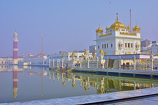
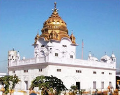
Tarn Taran Sahib is a city in the Majha region of the state of Punjab, in northern India. It is the district headquarters and hosts the municipal council of Tarn Taran district. Gurdwara Sri Tarn Taran Sahib, a prominent Sikh shrine, is located in the central part of the city.
Khem Karan is a town and a nagar panchayat in Tarn Taran district of Patti tehsil of the Majha region of the Indian state of Punjab.
Dhanaula is a city and a municipal council in Barnala district in the state of Punjab, India. Situated 18 km west of Sangrur, Ranjit kaur Sodhi w/o Harwinder singh Sodhi is president of nagar council Dhanaula lies on the Sangrur-Barnala road. It is about 12 km from Barnala. Dhanaula was founded by Gurditta, eldest son of Taloka, in 1718. It was the capital of the erstwhile Princely State of Nabha until 1755 when Raja Hamir Singh founded Nabha town and made it the capital of the state. He also built a fort which now houses the police station of Dhanaula. A temple of Hanuman exists here. It is said that a man was digging a ditch and found an idol of Hanuman. A temple was constructed at that place, the idol was placed there, and the people began to worship it. Dhanaula is a town of temples.
Bharoli Kalan is a village and locality on the outskirts of Pathankot City in the state of Punjab, India. Prior to creation of Pathankot district after 2011 census, Bharoli Kalan was part of Gurdaspur district. Postal code (PIN) number of Bharoli Kalan is 145025. Bharoli is a gram panchayat in Pathankot Community development block(CD). It is a well developed village in the Dist of Pathankot.
Bhikhiwind is a town and a nagar panchayat, just about 33 km from Tarn Taran Sahib in Tarn Taran district in the Majha region of state of Punjab, India. The town is located along the India-Pakistan border in Tarn Taran district of Punjab, India, 280 km from Chandigarh.
Dera Baba Nanak is a town and a municipal council in Gurdaspur district, in the state of Punjab, India. It is the sub-district headquarters of Dera Baba Nanak tehsil. It is 36 km away from Gurdaspur city, the capital of the district. Since November 2019, a corridor between India and Pakistan has been established at its shrine.
Handiaya is a town and a nagar panchayat in Barnala district in the Indian state of Punjab.
Raikot is a city and municipal council in Ludhiana district in Indian state of Punjab. Raikot is one of the tehsils in Ludhiana district of Punjab. there are total 76 villages in this tehsil.
Tarn Taran district is one of the districts in the Majha region of Punjab, India. The main cities are Tarn Taran Sahib, Bhikhiwind, Khadur Sahib and Patti. The City of Tarn Taran Sahib is a holy place for Sikhs. Tarn Taran's Sikh population makes it the most heavily concentrated district of Sikhs in India and the world.
Banga is a town and Municipal council in the Shaheed Bhagat Singh Nagar district of Punjab, India. Banga is also one of the sub-division (tehsil) headquarters of the district. Banga is located on Phagwara-Rupnagar section of National Highway 344A. It is currently estimated to have a population of about 23,000 and is classified as a class 2 Municipality. The town also incorporates the former village of Jindowal apart from Banga town.
Patti is an old city, near Tarn Taran Sahib city and a municipal council of the Tarn Taran district in the Majha region of Indian state of Punjab, located 47 Kilometres from Amritsar. Patti city is situated close to the Pakistani border. It is connected through a rail network starting from Amritsar station to Khem Karan station, with Khem Karan being its last station of India.
Fatehabad is a small town in the Tarn Taran district of Punjab State. in India, located about 20 km from Tarn Taran Sahib
Ramgarh is a medium size village in Phillaur tehsil of Jalandhar District of Punjab State, India. It is located 1 km away from postal head office Phillaur, 16 km from Ludhiana, 45 km from district headquarter Jalandhar and 118 km from state capital Chandigarh. The village is administrated by a sarpanch who is an elected representative of village as per Panchayati raj (India).
Hothian is a village in Tarn taran district of Punjab State, India. It is located 5 kilometres (3.1 mi) from Khadoor sahib, which is both district and sub-district headquarters of Hothian. The village is administrated by a Sarpanch, who is an elected representative.
Arifke or Arif Ke, is a village in Firozepur tehsil of the Firozpur district in Punjab, India. Arifke is located on the junction of new national highways NH 354 and NH 703A.

Harike is a village in Patti Tehsil in Tarn Taran district of the Indian state of Punjab. It is located 33 km from Tarn Taran Sahib city. The PIN code of Wakro is 143412. Harike is connected by two national highways, National Highway 54 and National Highway 703B.
Chung is a historical village in (Bhikhiwind), just 33 km from Tarn Taran Sahib in Patti tehsil of Tarn Taran district in the Indian state of Punjab. Before 1947, it was part of Kasur tehsil of Lahore district. Rice and wheat are the most cultivated crops.
Khadur Sahib is a town and a nagar panchayat in Tarn Taran district of Khadur Sahib tehsil of the Majha region of Indian state of Punjab. Khadur Sahib is a historical place in view of eight out of ten sikh gurus having visited this place. The postal index number of Khadur Sahib is 143117.
Hansali Sahib village is located in the tehsil of Fatehgarh Sahib in Fatehgarh Sahib district in the state of the Punjab, India. It is situated 11.5 km (7.1 mi) away from Fatehgarh Sahib, which is both district and sub-district headquarters for Hansali village. Governance of the village is by gram panchayat. The total geographical area of Hansali is 278 hectares. Fatehgarh Sahib is also the nearest town to Hansali.
