Chyhyryn

Last updated • 3 min readFrom Wikipedia, The Free Encyclopedia
Chyhyryn
Чигирин
Rezidentsiia Bogdana Khmel'nits'kogo, istoriko-arkhitekturnii kompleks, aerofoto.jpg
View of Chyhyryn
Flag of Chyhyryn.svg
Coat of arms of Chyhyryn.png
Cherkasy Oblast location map.svg
Red pog.svg
Chyhyryn
Location of Chyhyryn
Map of Ukraine under russian occupation, grey (2014-2022).svg
Red pog.svg
Chyhyryn
Chyhyryn (Ukraine)
Coordinates: 49°04′38″N32°38′57″E / 49.07722°N 32.64917°E / 49.07722; 32.64917
Country Flag of Ukraine.svg  Ukraine
Oblast Cherkasy Oblast
Raion Cherkasy Raion
Hromada Chyhyryn urban hromada
City rights1592
Government
   Mayor Serhiy Oleksiiovych Tymchenko
Area
  Total14 km2 (5 sq mi)
Elevation
124 m (407 ft)
Population
 (2022)
  Total8,539
  Density854/km2 (2,210/sq mi)
Postal code
20900-20906
Area code +380 4730
Remnants of fortification walls in 19th century (not preserved) Chigirin.jpeg
Remnants of fortification walls in 19th century (not preserved)

Chyhyryn (Ukrainian : Чигирин, pronounced [tʃɪɦɪˈrɪn] ; Polish : Czehryń, pronounced [ˈt͡ʂɛ.xrɨɲ] ) is a city in Cherkasy Raion, Cherkasy Oblast, central Ukraine. It is located on Tiasmyn river not far where it enters Dnieper.

Contents

From 1648 to 1669, the city served as the residence of the hetman of the Zaporizhian Host. After a forced relocation of the Ruthenian Orthodox metropolitan see from Kyiv in 1658, it became a full-fledged capital of the Cossack Hetmanate. Among Metropolitans who served out of Chyhyryn were family of Tukalsky: Dionysius Balaban-Tukalskyi and Joseph Tukalskyi-Nelyubovych. Chyhyryn also became a traditional place for the appointment to the office of the hetman of the Zaporizhian Host.

Since the 17th century, the significance of the settlement was diminished to a semi-rural populated place. It hosts the administration of Chyhyryn urban hromada, one of the hromadas of Ukraine. [1] Population: 8,539 (2022 estimate). [2]

Names

Chyhyryn (Ukrainian : Чигирин; Turkish: Çigirin or Çehrin; Russian : Чигирин; Polish : Czehryń). On older maps it is often shown in Polish/Turkish-like transcription Czehrin (see Ch (digraph)).

History

Map-scheme of the Chyhyryn fortress on the eve of the siege of 1678
I - Central bastion or "bulwark" of the New Castle
II - Bastion ("dungeon") of Doroshenko
III - Bastion with the Crimean Tower
IV - The Spassky Gate with a wooden tower and a double ravelin in front of them
V - Wooden tower on a stone foundation, "New Goat Horn"
VI - Tower and the well
VII - Stone corner bastion
VIII - Stone round tower
IX - The Kyiv Tower with a gate to the bridge
X - Noname tower (just built in 1678)
XI - The Korsun or Mill Tower
XII - Gate to the Lower Town Chyhyryn-3-eng.svg
Map-scheme of the Chyhyryn fortress on the eve of the siege of 1678
I - Central bastion or "bulwark" of the New Castle
II - Bastion ("dungeon") of Doroshenko
III - Bastion with the Crimean Tower
IV - The Spassky Gate with a wooden tower and a double ravelin in front of them
V - Wooden tower on a stone foundation, "New Goat Horn"
VI - Tower and the well
VII - Stone corner bastion
VIII - Stone round tower
IX - The Kyiv Tower with a gate to the bridge
X - Noname tower (just built in 1678)
XI - The Korsun or Mill Tower
XII - Gate to the Lower Town

The area (1320–1569) had been part of the Grand Duchy of Lithuania. It was ceded to the Polish–Lithuanian Commonwealth (in the Kijów Voivodeship of the Crown of Poland) before the Union of Lublin. It was granted Magdeburg Rights in 1592 by Sigismund III Vasa.

Chyhyryn on the Tiasmyn. A fragment of the Tractus Borysthenis Vulgo Dniepr at Niepr dicti map by Joannii Janssonii (Amsterdam, 1663) Czehryn, by Jan Jansson, circa 1663.jpg
Chyhyryn on the Tiasmyn. A fragment of the Tractus Borysthenis Vulgo Dniepr at Niepr dicti map by Joannii Janssonii (Amsterdam, 1663)

Chyhyryn is first mentioned as a fortified Cossack winter station. In 1638, Bohdan Khmelnytsky became its starosta (regional leader), and in 1648 it became the newly elected Hetman's residence and the capital of the Cossack state, the Zaporozhian Host. During the Russo-Turkish War (1676–1681) it was the center of two bloody campaigns (1675–76 and 1677–78). In 1678 the castle of Chyhyryn was blown up by the retreating Russian garrison that was stationed there, while the Turkish forces sacked the rest of the city. After this, it gradually lost its significance. The city fell under Ottoman occupation but was later recovered by the Cossacks while the Ottomans were busy in the Battle of Vienna. It remained the center of the Chyhyryn regiment until 1712. In 1790 the 8th Polish National Cavalry Brigade was stationed in Czehryń and in 1792 the 4th Polish Vanguard Regiment was stationed there. [3] It was annexed by the Russian Empire in the Second Partition of Poland (1793), and became part of the Kyiv region.

In 1917 a congress of Free Cossacks took place in Chyhyryn. At that congress by tradition Pavlo Skoropadsky was elected as the Hetman of the Cossacks (later in 1918 in Kyiv, he was elected the Hetman of Ukraine as well).

During World War II, Chyhyryn was occupied by the German Army from August 7, 1941 to December 12, 1943.

In 1989 the population of the city was 12,853. [4]

Until 18 July 2020, Chyhyryn served as an administrative center of Chyhyryn Raion. The raion was abolished in July 2020 as part of the administrative reform of Ukraine, which reduced the number of raions of Cherkasy Oblast to four. The area of Chyhyryn Raion was merged into Cherkasy Raion. [5] [6]

The town hosts an unfinished Chyhyryn Nuclear Power Plant.

Population

Language

Distribution of the population by native language according to the 2001 census: [7]

LanguagePercentage
Ukrainian 93.14%
Russian 5.37%
other/undecided1.49%

Geography

Location

The city is on the banks of Tiasmyn River and lies at an altitude of 124 metres above mean sea level. Minor industries, such as food and furniture factories, are the basis of the town economy in the 21st century.

Climate

Climate data for Chyhyryn (1981–2010)
MonthJanFebMarAprMayJunJulAugSepOctNovDecYear
Mean daily maximum °C (°F)−0.9
(30.4)
−0.1
(31.8)
5.5
(41.9)
14.4
(57.9)
21.3
(70.3)
24.3
(75.7)
26.3
(79.3)
25.9
(78.6)
20.0
(68.0)
13.0
(55.4)
5.0
(41.0)
0.4
(32.7)
12.9
(55.2)
Daily mean °C (°F)−3.5
(25.7)
−3.1
(26.4)
1.7
(35.1)
9.4
(48.9)
15.9
(60.6)
19.2
(66.6)
21.2
(70.2)
20.4
(68.7)
14.9
(58.8)
8.8
(47.8)
2.3
(36.1)
−2.1
(28.2)
8.8
(47.8)
Mean daily minimum °C (°F)−6.1
(21.0)
−5.9
(21.4)
−1.5
(29.3)
4.8
(40.6)
10.4
(50.7)
14.3
(57.7)
16.1
(61.0)
15.0
(59.0)
10.4
(50.7)
5.4
(41.7)
−0.2
(31.6)
−4.4
(24.1)
4.9
(40.8)
Average precipitation mm (inches)34.4
(1.35)
32.9
(1.30)
35.5
(1.40)
36.7
(1.44)
49.7
(1.96)
77.1
(3.04)
65.2
(2.57)
54.2
(2.13)
55.9
(2.20)
42.1
(1.66)
39.4
(1.55)
37.0
(1.46)
560.1
(22.05)
Average precipitation days (≥ 1.0 mm)7.47.17.37.07.28.57.16.36.55.76.87.484.3
Average relative humidity (%)83.580.876.666.963.268.068.066.471.976.984.085.174.3
Source: World Meteorological Organization [8]

Landmarks

The Trinity Monastery, built near Chyhyryn in 1627, was later destroyed by the Soviet authorities. Other historical landmarks, such as the town hall and Khmelnytsky's palace, did not survive either. After Ukraine regained independence, Hetman's residence was restored and became a museum.

Notable people

International relations

Twin towns — Sister cities

Chyhyryn is twinned with:

CityCountryYear of Signing
Sebastopol, California Flag of the United States.svg United States 1993

See also

Related Research Articles

<span class="mw-page-title-main">Bohdan Khmelnytsky</span> Hetman of Zaporozhian Cossacks

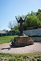
Bohdan Zynoviy Mykhailovych Khmelnytsky was a Ruthenian nobleman and military commander of Zaporozhian Cossacks as Hetman of the Zaporozhian Host, which was then under the suzerainty of the Polish–Lithuanian Commonwealth. He led an uprising against the Commonwealth and its magnates (1648–1654) that resulted in the creation of an independent Cossack state in Ukraine. In 1654, he concluded the Treaty of Pereiaslav with the Russian Tsar and allied the Cossack Hetmanate with Tsardom of Russia, thus placing central Ukraine under Russian protection. During the uprising the Cossacks led a massacre of thousands of Poles and Jews during 1648–1649, making it one of the most traumatic events in the history of the Jews and antisemitism in Ukraine.

<span class="mw-page-title-main">Kaniv</span> City in Cherkasy Oblast, Ukraine

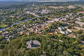
Kaniv is a city in Cherkasy Raion, Cherkasy Oblast, central Ukraine. The city rests on the Dnieper River, and is one of the main inland river ports on the Dnieper. It is an urban hromada of Ukraine. Population: 23,172.

<span class="mw-page-title-main">Pereiaslav Agreement</span> 1654 meeting between Cossacks and Russia

The Pereiaslav Agreement or Pereyaslav Agreement was an official meeting that convened for a ceremonial pledge of allegiance by Cossacks to the Russian tsar, then Alexis, in the town of Pereiaslav in central Ukraine, in January 1654. The ceremony took place concurrently with ongoing negotiations that started on the initiative of Hetman Bohdan Khmelnytsky to address the issue of the Cossack Hetmanate with the ongoing Khmelnytsky Uprising against the Polish–Lithuanian Commonwealth and which concluded the Treaty of Pereiaslav. The treaty itself was finalized in Moscow in April 1654.

<span class="mw-page-title-main">Hetman of Zaporizhian Cossacks</span> Historical term

Hetman of Zaporizhian Cossacks is a historical term that has multiple meanings.

<span class="mw-page-title-main">Zaporozhian Sich</span> 16th to 18th-century Cossack polity in modern southern Ukraine

The Zaporozhian Sich was a semi-autonomous polity and proto-state of Cossacks that existed between the 16th to 18th centuries, including as an autonomous stratocratic state within the Cossack Hetmanate for over a hundred years, centred around the region now home to the Kakhovka Reservoir and spanning the lower Dnieper river in Ukraine. In different periods the area came under the sovereignty of the Polish–Lithuanian Commonwealth, the Ottoman Empire, the Tsardom of Russia, and the Russian Empire.

<span class="mw-page-title-main">Nikopol, Ukraine</span> City in Dnipropetrovsk Oblast, Ukraine

Nikopol is a city and municipality (hromada) in Nikopol Raion in the south of Ukraine, on the right bank of the Dnieper River, about 63 km south-east of Kryvyi Rih and 48 km south-west of Zaporizhzhia. Population: 105.160.

<span class="mw-page-title-main">Cossack Hetmanate</span> 1649–1764 Cossack state in Ukraine

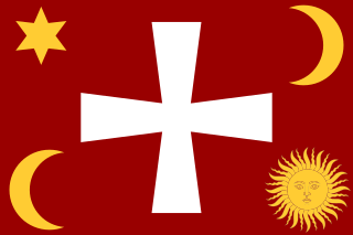
The Cossack Hetmanate, officially the Zaporozhian Host, is a historical term for the 17th–18th centuries Zaporozhian Cossacks state located in today's central Ukraine. It existed between 1649 and 1764, although its administrative-judicial system persisted until 1781.

<span class="mw-page-title-main">Zvenyhorodka</span> City in Cherkasy Oblast, Ukraine

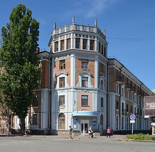
Zvenyhorodka is a city in Cherkasy Oblast, central Ukraine, situated on the Hnylyi Tikych River. The town is the administrative center of Zvenyhorodka Raion. It hosts the administration of Zvenyhorodka urban hromada, one of the hromadas of Ukraine. The city has a population of 16,269.

Stebliv is a rural settlement in Zvenyhorodka Raion, Cherkasy Oblast, central Ukraine. It hosts the administration of Stebliv settlement hromada, one of the hromadas of Ukraine. The townlet rests at a bend on the Ros River, some 16 kilometres (9.9 mi) from Korsun-Shevchenkivskyi. Population: 3,280.

<span class="mw-page-title-main">Yurii Khmelnytsky</span> Ukrainian Cossack leader (1641–1685)

Yurii Khmelnytsky, younger son of the famous Ukrainian Hetman Bohdan Khmelnytsky and brother of Tymofiy Khmelnytsky, was a Zaporozhian Cossack political and military leader. Although he spent half of his adult life as a monk and archimandrite, he also was Hetman of Ukraine on several occasions — in 1659-1660 and 1678–1681 and starost of Hadiach, becoming one of the most well-known Ukrainian politicians of the "Ruin" period for the Cossack Hetmanate.

<span class="mw-page-title-main">Stavyshche</span> Rural locality in Kyiv Oblast, Ukraine

Stavyshche is a rural settlement in Bila Tserkva Raion, Kyiv Oblast (province) in northern Ukraine, on the Hnylyi Tikych river. It hosts the administration of Stavyshche settlement hromada, one of the hromadas of Ukraine. Population: 6,056 . In 2001, population was 7,929.

<span class="mw-page-title-main">History of Cherkasy Oblast</span>

The History of Cherkasy Oblast of central Ukraine has a long history spanning all the way back to prehistoric times. Archaeological discoveries, have shown that people have inhabited the valley of the Dnieper (Dnipro) River since the times immemorial. The oldest objects excavated on the territory of the region date back to the Stone Age.

<span class="mw-page-title-main">Battle of Zhovti Vody</span> Battle fought in the Khmelnytsky Uprising

The Battle of Zhovti Vody was the first significant battle of the Khmelnytsky Uprising. Near the site of the present-day city of Zhovti Vody on the Zhovta River in Ukraine, the forces of the Zaporozhian Host and Crimean Khanate under the command of Hetman Bohdan Khmelnytsky, Colonels Mykhailo Krychevsky, Maksym Kryvonis, and Fylon Dzhalaliy with Tugay Bey attacked and defeated the Polish–Lithuanian Commonwealth's forces under the command of Hetman Stefan Potocki and General Stefan Czarniecki, both of them were captured in the battle by the Zaporozhian Cossacks and Crimean Tatars.

<span class="mw-page-title-main">Battle of Korsuń</span> 1648 battle during the Khmelnytsky Uprising

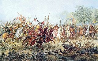
The Battle of Korsuń was the second significant battle of the Khmelnytsky Uprising. Near the site of the present-day city of Korsun-Shevchenkivskyi in Ukraine, a forces of the Zaporozhian Host and Crimean Khanate under the command of Hetman Bohdan Khmelnytsky, Colonels Mykhailo Krychevsky, Ivan Bohun, Maksym Kryvonis, Martyn Pushkar, Matviy Hladky and Mykhailo Hromyka with Tugay Bey attacked and defeated the Polish–Lithuanian Commonwealth’s forces under the command of Hetmans Mikołaj Potocki and Marcin Kalinowski, both of them was captured in the battle by the Zaporozhian Cossacks and Crimean Tatars. As in the Battle of Zhovti Vody in 29 April — 16 May, 1648 the Polish–Lithuanian Commonwealth’s forces took a defensive position, retreated and were thoroughly routed and destroyed by the forces of the Zaporozhian Host and Crimean Khanate.

<span class="mw-page-title-main">Subotiv</span> Ukrainian village

Subotiv is a village (selo) in central Ukraine. It is located in Cherkasy Raion (district) of Cherkasy Oblast (province), near the town of Chyhyryn. It belongs to Chyhyryn urban hromada, of which the administration is located in Chyhyryn.

<span class="mw-page-title-main">Chyhyryn Regiment</span> Military unit

The Chyhyryn Regiment was one of the seventeen territorial-administrative subdivisions of the Hetman State. The regiment's capital was the city of Chyhyryn, now in the Cherkasy Oblast of central Ukraine. The military units of the regiment were also known as the Hetman's Guard serving as personal guards of the Hetman of Ukraine in 1648–1676.

<span class="mw-page-title-main">Ottoman Ukraine</span> Ottoman territory in Eastern Europe

Ottoman Ukraine, Khan Ukraine, Hanshchyna was the right-bank Ukraine, also known by its Turkic name Yedisan. The first recorded use of the term Khanska Ukraina are traced to 1737 when the Russian secret-agent Lupul urged Empress Anna of Russia to attack Ottoman Ukraine.

<span class="mw-page-title-main">Truce of Zamość</span> 1648 treaty between Poland and Zaporizhia

The Truce of Zamość was signed on November 20, 1648 during the siege of Zamość between the King of Poland John II Casimir of Poland and the Hetman of Zaporizhian Host Bohdan Khmelnytsky.

<span class="mw-page-title-main">Joseph Tukalskyi-Nelyubovych</span> Metropolitan of Kiev, Galicia and all Ruthenia (17th century)

Joseph Tukalskyi-Nelyubovych, was a political and religious leader of the Cossack Hetmanate and the last Metropolitan of Kyiv, Galicia and all Rus in the Ecumenical Patriarchate of Constantinople in the Eastern Orthodox Church.

<span class="mw-page-title-main">Kaniv Regiment</span> Military unit

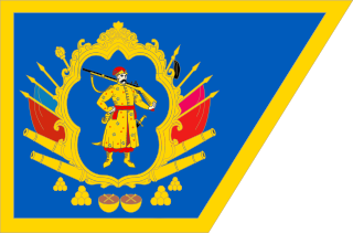
The Kaniv Regiment was a regiment of the Registered Cossacks (1625–1638) and later also an administrative subdivision of the Cossack Hetmanate. It was centred around the town of Kaniv in central Ukraine, on the banks of the Dnieper river.

References

  1. "Чигиринська територіальна громада" (in Ukrainian). decentralization.gov.ua.
  2. Чисельність наявного населення України на 1 січня 2022 [Number of Present Population of Ukraine, as of January 1, 2022](PDF) (in Ukrainian and English). Kyiv: State Statistics Service of Ukraine. Archived (PDF) from the original on 4 July 2022.
  3. Gembarzewski, Bronisław (1925). Rodowody pułków polskich i oddziałów równorzędnych od r. 1717 do r. 1831 (in Polish). Warszawa: Towarzystwo Wiedzy Wojskowej. pp. 10, 12.
  4. Всесоюзная перепись населения 1989 г. Численность городского населения союзных республик, их территориальных единиц, городских поселений и городских районов по полу
  5. "Про утворення та ліквідацію районів. Постанова Верховної Ради України № 807-ІХ". Голос України (in Ukrainian). 2020-07-18. Retrieved 2020-10-03.
  6. "Нові райони: карти + склад" (in Ukrainian). Міністерство розвитку громад та територій України.
  7. "Рідні мови в об'єднаних територіальних громадах України".
  8. "World Meteorological Organization Climate Normals for 1981–2010". World Meteorological Organization. Archived from the original on 17 July 2021. Retrieved 17 July 2021.