"},"leader_party":{"wt":""},"leader_title":{"wt":"[[List of mayors of Chortkiv|City Mayor]]"},"leader_name":{"wt":"Volodymyr Shmatko"},"unit_pref":{"wt":"Metric"},"area_footnotes":{"wt":""},"area_total_km2":{"wt":"30"},"area_land_km2":{"wt":""},"area_water_km2":{"wt":""},"area_water_percent":{"wt":""},"area_note":{"wt":""},"elevation_footnotes":{"wt":"{{cite web|title= Chortkiv (Ternopil Oblast, Chortkiv Raion)|url=http://weather.in.ua/en/ternopol'skaja/28552|work=weather.in.ua|access-date=2 February 2012|language=uk}}"},"elevation_m":{"wt":"218"},"population_total":{"wt":"28279"},"population_as_of":{"wt":"2022"},"population_footnotes":{"wt":""},"population_density_km2":{"wt":"auto"},"population_note":{"wt":""},"postal_code_type":{"wt":"[[Postal code]]"},"postal_code":{"wt":"48500—48509"},"area_code":{"wt":"+380 3552"},"area_code_type":{"wt":"[[Telephone numbering plan|Area code]]"},"website":{"wt":"[http://www.chortkivmr.gov.ua/]"},"footnotes":{"wt":""},"timezone":{"wt":"EET"},"utc_offset":{"wt":"+2"},"timezone_DST":{"wt":"EEST"},"utc_offset_DST":{"wt":"+3"},"pushpin_relief":{"wt":"y"},"module":{"wt":"{{Infobox mapframe |wikidata=yes |zoom=12|height= |width= | stroke-width=1 |coord={{WikidataCoord|display=i}}}}"},"subdivision_type3":{"wt":"[[Hromada]]"},"subdivision_name3":{"wt":"[[Chortkiv urban hromada]]"}},"i":0}}]}" id="mwBg">City in Ternopil Oblast, Ukraine
Chortkiv Чортків | |
---|---|
![]() St. Stanislaus Church | |
Coordinates: 49°00′27″N25°47′26″E / 49.00750°N 25.79056°E | |
Country | ![]() |
Oblast | Ternopil Oblast |
Raion | Chortkiv Raion |
Hromada | Chortkiv urban hromada |
Magdeburg rights | 1533 |
City status | 1939 [1] |
Government | |
• City Mayor | Volodymyr Shmatko |
Area | |
• Total | 30 km2 (10 sq mi) |
Elevation | 218 m (715 ft) |
Population (2022) | |
• Total | 28,279 |
• Density | 940/km2 (2,400/sq mi) |
Time zone | UTC+2 (EET) |
• Summer (DST) | UTC+3 (EEST) |
Postal code | 48500—48509 |
Area code | +380 3552 |
Website | |
![]() |
Chortkiv (Ukrainian : Чортків, IPA: [tʃortˈkiu̯] ⓘ ; Polish : Czortków; Yiddish : טשארטקאוו, romanized: Tshortkov) is a city in Chortkiv Raion, Ternopil Oblast, western Ukraine. It is the administrative center of Chortkiv Raion, housing the district's local administration buildings. Chortkiv hosts the administration of Chortkiv urban hromada, one of the hromadas of Ukraine. [3] Population: 28,279 (2022 estimate). [4]
Chortkiv is located in the northern part of the historic region of Galician Podolia on the banks of the Seret River. [1] [5]
In the past Chortkiv was the home of many Hasidic Jews; it was a notable shtetl and had a significant number of Jews residing there prior to the Holocaust. Today, Chortkiv is a regional commercial and small-scale manufacturing center. [5] Among its architectural monuments is a fortress built in the 16th and 17th centuries [6] as well as historic wooden churches of the 17th and 18th centuries. [7]
The first historical mention of Chortkiv dates to 1522, [1] when Polish King Sigismund I the Old granted an ownership order for Jerzy Czortkowski over the town and allowed him to name it after himself—Czortków. [7] The small community, numbering at 50 families, were almost all massacred during the Chmielnicki Uprisings of 1648–9. Jewish leadership opposed the resettlement of Jews in Chortkiv until 1705. [8] During that time, the town was also granted Magdeburg rights. [5] However, Chortkiv would later decline in the second half of the 17th century during Ottoman Expansion of central Europe. The town was taken over by Ottoman Empire, [5] whose rule lasted 27 years. It was part of the short-lived Turkish Podolia Eyalet, which lasted from 1672 to 1699. During this period, it was nahiya centre in Yazlofça sanjak as Çortkuv (Spelled as Chortkoov in Turkish). [9] After First Partition of Poland Chortkiv came under Austro-Hungarian rule which lasted from 1772 to 1918, during the time of which it was the center of the Chortkiv Bezirk except brief Russian rule between 1809 and 1815 as part of Tarnopol Governorate. On June 8, 1919 the Ukrainian Galician Army broke for couple months through the Polish front at Chortkiv and began the Chortkiv offensive. [5] Soon afterwards, the town was seized by the Poles. It was ceded to sovereign Poland in the Peace Treaty of Riga between Poland, Soviet Russia (acting also on behalf of Soviet Belarus) and Soviet Ukraine, and remained part of the Tarnopol Voivodeship of the Second Polish Republic until the Soviet invasion of Poland in September 1939.
In 1931, the town had 19,000 inhabitants, 46.4 percent of whom were Polish Roman Catholics, 30 percent of whom were Ukrainian and Polish Jews, and 22.8 percent of whom were Ukrainian Greek Catholics.[ citation needed ]
Chortkiv was an important garrison of the Polish Border Defence Corps Brigade "Podole", whose commandant from 1935 to 1938 was General Stefan Rowecki. Furthermore, it was home to the 36th Reserve Infantry Division.
The town was annexed by the Soviet Union from September 17, 1939 until June 1941. Its Polish inhabitants, particularly students of the local high school, organized a failed uprising in January 1940, [10] which would serve as the first Polish uprising of World War II. In the last days of June 1941, following the German invasion of the USSR, the Soviets executed an estimated 100 to 200 prisoners held in the local prison. The remaining prisoners were evacuated further east, either by train or on foot, while hundreds died due to the inhumane conditions of transport or at the hands of guards. [11]
From 1941-1944 Chortkiv was annexed to Nazi Germany. The Jewish residents were persecuted and deported as part of the Holocaust. When the Nazis arrived, they proceeded to execute many of the local Jews, including the family of Charles Schumer, American Senate Majority Leader. The surviving Polish residents of the town were transferred to the Recovered Territories in the immediate postwar period (see Polish population transfers (1944–1946)). After the defeat of the Nazis by the Red Army in 1944, the town returned to Soviet control until in 1991 it became part of independent Ukraine.
Due to heavy destruction of Ternopil, in 1944 Chortkiv served as a regional seat. [12]
In January 1989 the population was 26 681 people. [13] [1]
In January 2013 the population was 29 640 people. [14]
In 2019, at the 40-meter height of the tower of the Saint Stanislaus church in Chortkiv, archaeologist, researcher of fortifications and antiquities Volodymyr Dobrianskyi discovered a detonator of a shrapnel projectile, according to its flight trajectory determined that the 1st, 3rd, 4th and 7th cannon regiments (64 guns) under the command of Ataman Kirill Karas during the Chortkiv offensive (June 7–28, 1919) were stationed in the woods west of the village of Shmankivtsi in the Chortkiv district. [15]
Until 18 July 2020, Chortkiv was designated as a city of oblast significance and did not belong to Chortkiv Raion even though it was the center of the raion. As part of the administrative reform of Ukraine, which reduced the number of raions of Ternopil Oblast to three, the city was merged into Chortkiv Raion. [16] [17]
The former Chortkiv Air Base is located nearby.
Climate data for Chortkiv (1981–2010) | |||||||||||||
---|---|---|---|---|---|---|---|---|---|---|---|---|---|
Month | Jan | Feb | Mar | Apr | May | Jun | Jul | Aug | Sep | Oct | Nov | Dec | Year |
Mean daily maximum °C (°F) | −0.7 (30.7) | 0.9 (33.6) | 6.0 (42.8) | 13.9 (57.0) | 20.1 (68.2) | 22.6 (72.7) | 24.7 (76.5) | 24.2 (75.6) | 18.9 (66.0) | 12.9 (55.2) | 5.3 (41.5) | 0.2 (32.4) | 12.4 (54.3) |
Daily mean °C (°F) | −3.5 (25.7) | −2.5 (27.5) | 1.8 (35.2) | 8.5 (47.3) | 14.3 (57.7) | 17.1 (62.8) | 19.0 (66.2) | 18.3 (64.9) | 13.5 (56.3) | 8.2 (46.8) | 2.2 (36.0) | −2.4 (27.7) | 7.9 (46.2) |
Mean daily minimum °C (°F) | −6.1 (21.0) | −5.3 (22.5) | −1.6 (29.1) | 4.0 (39.2) | 9.2 (48.6) | 12.3 (54.1) | 14.1 (57.4) | 13.4 (56.1) | 9.1 (48.4) | 4.5 (40.1) | −0.3 (31.5) | −4.8 (23.4) | 4.0 (39.2) |
Average precipitation mm (inches) | 31.3 (1.23) | 39.1 (1.54) | 35.7 (1.41) | 47.8 (1.88) | 80.7 (3.18) | 90.3 (3.56) | 92.0 (3.62) | 72.8 (2.87) | 59.9 (2.36) | 37.4 (1.47) | 37.8 (1.49) | 39.0 (1.54) | 663.8 (26.13) |
Average precipitation days (≥ 1.0 mm) | 7.8 | 8.4 | 8.6 | 8.4 | 10.0 | 10.1 | 10.2 | 8.6 | 8.3 | 6.9 | 8.0 | 9.4 | 104.7 |
Average relative humidity (%) | 84.1 | 81.6 | 76.5 | 68.2 | 67.7 | 72.5 | 73.0 | 73.9 | 77.4 | 80.2 | 85.2 | 86.4 | 77.2 |
Source: World Meteorological Organization [18] |
Okopy is a selo in western Ukraine. It is located in Chortkiv Raion (district) of Ternopil Oblast (province), and had its origins as a Polish fortress at the meeting of the Zbruch and Dniester rivers. It belongs to Melnytsia-Podilska settlement hromada, one of the hromadas of Ukraine.
Buchach is a city located on the Strypa River in Chortkiv Raion of Ternopil Oblast (province) of Western Ukraine. It hosts the administration of Buchach urban hromada, one of the hromadas of Ukraine. Buchach rests 135 kilometres south-east of Lviv, in the historic region of Halychyna (Galicia). The city was located in the Polish–Lithuanian Commonwealth until the partitions, followed by the Habsburg monarchy (1772–1804), Austrian Empire (1804–1867), Austria-Hungary (1867–1918), West Ukrainian People's Republic (1918–1919), the Second Polish Republic (1919–1939), and the Ukrainian SSR of the Soviet Union (1939–1991). The population was estimated at 12,171.
Budaniv is a village in Chortkiv Raion, Ternopil Oblast, in western Ukraine, near Terebovlya. It belongs to Bilobozhnytsia rural hromada, one of the hromadas of Ukraine. The population of Budaniv is 1,634 (2005). Before World War II, the village and its surroundings were part of the Second Polish Republic.
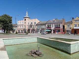
Husiatyn is a rural settlement in Chortkiv Raion, Ternopil Oblast, western Ukraine. It hosts the administration of Husiatyn settlement hromada, one of the hromadas of Ukraine. Husiatyn is located on the west bank of the Zbruch River, which once formed the old boundary between Austria-Hungary and the Russian Empire in the 19th century, and the boundary between Poland and the Soviet Union during the 1920s and 1930s. The population is 7,032.
Pidhaitsi is a small city in Ternopil Raion, Ternopil Oblast, western Ukraine. It is located approximately 15.5 miles (24.9 km) south of Berezhany, 43.5 miles (70.0 km) from Ternopil, and 62 miles (100 km) south-east of Lviv. In 1939, Pidhaitsi obtained the formal status of a city. It hosts the administration of Pidhaitsi urban hromada, one of the hromadas of Ukraine. Population: 2,609.
Borshchiv is a city in Chortkiv Raion, Ternopil Oblast, western Ukraine. It was previously the administrative center of the former Borshchiv Raion until 2020. Borshchiv hosts the administration of Borshchiv urban hromada, one of the hromadas of Ukraine. In 2022, the population was estimated to be 10,632.
Yazlovets is a village in Chortkiv Raion, Ternopil Oblast, Ukraine. It is a Roman Catholic pilgrimage centre of local significance. The village belongs to the Buchach urban hromada. It lies on the Vilchivchik river, a tributary of the Strypa and is located 16 km south of Buchach and presently has around 600 inhabitants. From 1947-91, it was known as Yablunivka. Apart from the ruined fortifications, there is little sign now that in the 15th and 16th centuries this was a thriving trading centre, on major international mercantile routes between the Black Sea and Northern Europe, and host to multiple merchant families of diverse ethnicities and religions. It was an instance of a privately owned settlement, such as was Zamość in Poland. The city's square has been entirely obliterated.
Skala-Podilska or Skala upon Zbruch is a rural settlement in Chortkiv Raion, Ternopil Oblast, Ukraine over the Zbruch River. It hosts the administration of Skala-Podilska settlement hromada, one of the hromadas of Ukraine. Population: 4,094.
Tovste is a rural settlement in Chortkiv Raion, Ternopil Oblast, western Ukraine. The town is located on the Ternopil—Chernivtsi automobile road in the historic region of Podolia, on the banks of the Tupa River, a tributary of the Seret. It hosts the administration of Tovste settlement hromada, one of the hromadas of Ukraine. Population: 3,156.
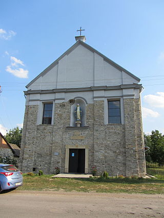
Saint Stanislaus Church is a Roman Catholic Church in Chortkiv of the Chortkiv urban hromada of the Chortkiv Raion of the Ternopil Oblast.
Krohulets is a village in Ukraine, Ternopil Oblast, Chortkiv Raion, Vasylkivtsi rural hromada.
Oleksyntsi is a village in Bilche-Zolote rural hromada, Chortkiv Raion, Ternopil Oblast, Ukraine.
Tudoriv is a village in Kopychyntsi urban hromada, Chortkiv Raion, Ternopil Oblast, Ukraine.
Mala Luka is a village in Hrymailiv settlement hromada, Chortkiv Raion, Ternopil Oblast, Ukraine.
Soroka is a village in Khorostkiv urban hromada, Chortkiv Raion, Ternopil Oblast, Ukraine.
Rozhanivka is a village in Tovste settlement hromada, Chortkiv Raion, Ternopil Oblast, Ukraine.
Solone is a village in Tovste settlement hromada, Chortkiv Raion, Ternopil Oblast, Ukraine.
Sokoliv is a village in Zolotyi Potik settlement hromada, Chortkiv Raion, Ternopil Oblast, Ukraine.
Vynohradne is a village in Zalishchyky urban hromada, Chortkiv Raion, Ternopil Oblast, Ukraine.
Bobulyntsi is a village in Buchach urban hromada, Chortkiv Raion, Ternopil Oblast, Ukraine.
8. Czortków KehilaLinks Site - JewishGen http://kehilalinks.jewishgen.org/Suchostaw/sl_czortkow.htm