Cimarron National Grassland

Last updated
Cimarron National Grassland
Cimarron grassland.jpg
Plant cover on sandy soils of the Cimarron National Grassland.
USA Kansas relief location map.svg
Red pog.svg
Location within Kansas
Location Elkhart, Kansas, Kansas, United States
Coordinates 37°07′27″N101°47′24″W / 37.12417°N 101.79000°W / 37.12417; -101.79000
Area108,175 acres (437.77 km2)
Elevation1,033 m (3,389 ft)
Established United States National Grassland
Operator U.S. Forest Service, Kansas Department of Wildlife, Parks and Tourism
Website www.fs.usda.gov/detail/psicc/about-forest/offices/?cid=fsm9_032733

Cimarron National Grassland is a National Grassland located in Morton County, Kansas, United States, with a very small part extending eastward into Stevens County. Cimarron National Grassland is located near Comanche National Grassland which is across the border in Colorado. The grassland is administered by the Forest Service together with the Pike and San Isabel National Forests and the Comanche National Grassland, from common headquarters located in Pueblo, Colorado. There are local ranger district offices in Elkhart, Kansas. The grassland is the largest area of public land in the state of Kansas. [1]

Contents

Geography

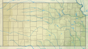
The Cimarron National Grassland once consisted of 108,175 acres (43,777 ha) of Great Plains bisected by the Cimarron River, though after the flood on January 29th, 2023 this no longer remains true. The elevations on the Grassland range from 3,100 to 3,700 feet (940 to 1,130 m). The terrain is mostly flat, sloping downward west to east, although bluffs rise about one hundred feet (30 m) above the valley of the Cimarron. [2] Vegetation is mostly shortgrass prairie grassland, dominated by sand sagebrush in salty soils. Groves of cottonwood and other trees are found near the river. [3]

The climate of the National Grassland is semi-arid, receiving about 18 inches (460 mm) of precipitation annually, mostly in summer. High winds are common and further desiccate the soil. Summer temperatures are hot, with an average high of 93 °F (34 °C) and an average low of 64 °F (18 °C) in July. Winters are cold with an average high of 45 °F (7 °C) and an average low of 18 °F (−8 °C) in January. The all-time high temperature is 110 °F (43 °C) and the all-time low is −22 °F (−30 °C). [4]

The Cimarron River flows through the grassland. From late summer through winter it is usually dry above ground, yet lush vegetation still grows on the banks. Middle Spring flows year round and beaver dams create pools of water nearby. Point of Rocks, a large rock outcropping overlooking the Cimarron River valley, was an important landmark for travelers heading west on the Cimarron Cutoff, and for modern day ranchers, because many springs exist in the area. Point of Rocks has an elevation of 3,540 feet (1,080 m). [2]

History

Map of states and counties affected by the Dust Bowl between 1935 and 1938 originally prepared by the Soil Conservation Service. The most severely affected counties are colored  . Map of states and counties affected by the Dust Bowl, sourced from US federal government dept. (NRCS SSRA-RAD).svg
Map of states and counties affected by the Dust Bowl between 1935 and 1938 originally prepared by the Soil Conservation Service. The most severely affected counties are colored .

The present-day Cimarron National Grassland was the territory of the Comanche and other Indian tribes allied to them. In 1822, William Becknell was the first to traverse the Santa Fe Trail by wagon, pioneering the alternate route called the Cimarron cut-off which passed through the National Grassland. Middle Spring was one of the three reliable sources of good water along more than 150 miles (240 km) of the Cimarron Cutoff trail. [5] In or near the Grassland, mountain man Jedediah Smith was killed by Comanches in 1831. [6]

In 1879, the Beaty Brothers established Point of Rocks Ranch, the first in the area. Wheat farmers soon moved in and prospered in wet years, but the drought of the 1930s caused the Dust Bowl. Morton County, Kansas was the most devastated county in the nation. The Federal government bought land from bankrupt farmers, restored the original prairie, and in 1960 the Cimarron National Grassland was created. The grassland is dedicated to "water conservation, wildlife management, recreation, cattle grazing, and mineral production." [6] Cattle are grazed and oil and gas wells are found on the Grassland. [1]

In May 2011, there was a substantial wildfire known as the Tunner Fire, which blanketed approximately one half of the park along with several thousands of acres of private prairie and the campground. However, rains in the spring of 2012 brought about a significant turnaround. The land greened up and the park's management reopened many of its sections. [7]

Recreation

Point of Rocks. In the background is the wooded valley of the Cimarron River. Point of rocks.jpg
Point of Rocks. In the background is the wooded valley of the Cimarron River.

Access to most of the recreation opportunities in the Cimarron National Grassland are reached 7 mi (11 km) north of Elkhart via highway 27. Activities include camping, hiking, horseback riding, fishing, hunting, and a car tour.

The grassland includes 23 miles (37 km) of the Santa Fe National Historic Trail. The ruts left by wagon trains are still visible. [8] A mowed strip of land, called a companion trail, 19 miles (31 km) long, runs alongside the Santa Fe Trail. The Turkey Trail is 10.5 miles (16.9 km) long and runs through the wooded area along the Cimarron River. The Cimarron Recreation area offers tent and trailer camping, picnicking, a group site, and access to the Turkey Trail.

Several fishing ponds, including four at the Cimarron Recreation Area, are stocked with rainbow trout in the winter and channel catfish in the summer. Other sport fish include crappie, sunfish, and largemouth bass. [9] Animals hunted include whitetail deer, pronghorn, quail, pheasant, prairie dog and jack rabbit.

A car tour of approximately 30 miles (48 km) on mostly dirt roads leads to most of the points of interest on the Grassland, including a prairie dog town, Point of Rocks, and the Santa Fe Trail.

The Cimarron Grassland has a population of rare lesser prairie chickens and has two viewing areas. The males perform their courting rituals from mid-March until early June. Elk were reintroduced into the Grassland in 1981 and a herd of 50 is maintained. Hunting by special permit is sometimes allowed to thin the herd. [10] [11]

See also

Related Research Articles

<span class="mw-page-title-main">Morton County, Kansas</span> County in Kansas, United States

Morton County is a county in the southwestern corner of the U.S. state of Kansas. Its county seat and largest city is Elkhart. As of the 2020 census, the county population was 2,701. The county was named after Oliver Morton, the 14th governor of the state of Indiana.

<span class="mw-page-title-main">Baca County, Colorado</span> County in Colorado, United States

Baca County is a county located in the U.S. state of Colorado. As of the 2020 census, the population was 3,506. The county seat is Springfield. Located at the southeast corner of Colorado, the county shares state borders with Kansas, New Mexico, and Oklahoma.

<span class="mw-page-title-main">Elkhart, Kansas</span> City in Morton County, Kansas

Elkhart is a city in and the county seat of Morton County, Kansas, United States. As of the 2020 census, the population of the city was 1,888. The south edge of the city is the Kansas-Oklahoma state border, and the city is 8.5 miles (13.7 km) from the Kansas-Colorado border.

<span class="mw-page-title-main">Clayton, New Mexico</span> Town in New Mexico, United States

Clayton is a town and county seat of Union County, New Mexico, United States. As of the 2010 census, the city population was 2,980.

<span class="mw-page-title-main">Santa Fe Trail</span> 19th-century route through central North America between Franklin, MO, and Santa Fe, NM

The Santa Fe Trail was a 19th-century route through central North America that connected Franklin, Missouri, with Santa Fe, New Mexico. Pioneered in 1821 by William Becknell, who departed from the Boonslick region along the Missouri River, the trail served as a vital commercial highway until 1880, when the railroad arrived in Santa Fe. Santa Fe was near the end of El Camino Real de Tierra Adentro which carried trade from Mexico City. The trail was later incorporated into parts of the National Old Trails Road and U.S. Route 66.

<span class="mw-page-title-main">Cimarron River (Arkansas River tributary)</span> River in the United States

The Cimarron River extends 698 miles (1,123 km) across New Mexico, Oklahoma, Colorado, and Kansas. The headwaters flow from Johnson Mesa west of Folsom in northeastern New Mexico. Much of the river's length lies in Oklahoma, where it either borders or passes through eleven counties. There are no major cities along its route. The river enters the Oklahoma Panhandle near Kenton, Oklahoma, crosses the corner of southeastern Colorado into Kansas, reenters the Oklahoma Panhandle, reenters Kansas, and finally returns to Oklahoma where it joins the Arkansas River at Keystone Reservoir west of Tulsa, Oklahoma, its only impoundment. The Cimarron drains a basin that encompasses about 18,927 square miles (49,020 km2).

<span class="mw-page-title-main">Wagon Bed Spring</span> United States historic place

Wagon Bed Spring, also known historically as the Lower Spring or Lower Cimarron Spring, is a historic former spring in Grant County, Kansas, United States. It is located about 12 miles (19 km) south of Ulysses, on the west side of United States Route 270. In the 19th century it was an important watering spot on the Cimarron Cutoff of the Santa Fe Trail, where migrants on the trail often camped. The spring is now dry, primarily due to irrigation lowering the water table in the area. It was declared a National Historic Landmark in 1961.

<span class="mw-page-title-main">Point of Rocks (Kansas)</span> United States historic place

Point of Rocks is a cliff in Morton County, Kansas which was one of three landmarks by the same name on the Santa Fe Trail. This one was on the Cimarron Cutoff. It is now part of Cimarron National Grassland.

<span class="mw-page-title-main">Felt, Oklahoma</span> Census-designated place in Oklahoma, United States

Felt is a small unincorporated community and census-designated place (CDP) in Cimarron County, Oklahoma, United States. As of the 2020 census, the town’s population was 77. It was named for C.F.W. Felt of the Santa Fe Railroad. Nearby is the Cedar Breaks Archeological District, included on the National Register of Historic Places listings in Cimarron County, Oklahoma. The community is served by a post office and a school. During the Great Depression in 1936 a farm in Felt was the site of the iconic Dust Bowl photograph known as Dust Bowl Cimarron County, Oklahoma.

<span class="mw-page-title-main">Comanche National Grassland</span> Protected area in southeast Colorado

Comanche National Grassland is a National Grassland located in southeastern Colorado, United States. It is the sister grassland of Cimarron National Grassland and contains both prairie grasslands and canyons. It is separated into two sections, each operated by a local ranger district, one of which is in Springfield and the other of which is in La Junta. The grassland is administered by the Forest Service together with the Pike and San Isabel National Forests, and the Cimarron National Grassland, from common headquarters located in Pueblo, Colorado.

<span class="mw-page-title-main">Kiowa National Grassland</span> Protected area in northeast New Mexico

Kiowa National Grassland is a National Grassland, located in northeastern New Mexico. The southwestern Great Plains grassland includes prairie and part of the Canadian River Canyon.

<span class="mw-page-title-main">Clayton Lake State Park</span>

Clayton Lake State Park is a state park of New Mexico, United States, featuring a 170-acre (69 ha) recreational reservoir and a fossil trackway of dinosaur footprints. It is located 15 miles (24 km) north of Clayton, close to New Mexico's border with Colorado, Oklahoma, and Texas. The park is accessed via New Mexico State Road 455. The landscape is characterized by rolling grasslands, volcanic rocks, and sandstone bluffs, set on the western edge of the Great Plains. The park area was a stopover point for travelers along the Cimarron Cutoff of the Santa Fe Trail.

<span class="mw-page-title-main">Rayado, New Mexico</span> Place in New Mexico, United States

Rayado or Reyado was the first permanent settlement in Colfax County, New Mexico, United States and an important stop on the Santa Fe Trail. The name Rayado derives from the Spanish term for "streaked", perhaps in reference to the lot lines marked out by Lucien Maxwell.

<span class="mw-page-title-main">Aiken Canyon Preserve</span> State property in Colorado, U.S.

Aiken Canyon Preserve is a 1,621-acre (6.56 km2) Nature Conservancy-managed state property in Colorado. It was first observed and named after Charles Aiken, a 19th-century U.S. surveyor, pioneer, and ornithologist who first surveyed the region in the 1870s and identified more than 75 bird species. The preserve consists of foothills, shrub and woodland ecosystems and is 12.4 miles (20.0 km) southeast from Colorado Springs located on the eastern slope of the Rampart Range which is within a smaller foothill system of the Front Range. The surrounding mountain ranges of the Rampart Range and Palmer Divide created the nature preserves sustainable ecosystem. There is also a four-mile (6 km)-loop hiking trail on the preserve.

<span class="mw-page-title-main">Black Kettle National Grassland</span> Protected prairie in Roger Mills County, Oklahoma and Hemphill County, Texas

The Black Kettle National Grassland, in Roger Mills County, Oklahoma, and Hemphill County, Texas, contains 31,286 acres (12,661 ha) of which 30,710 acres (12,430 ha) are in Oklahoma.

Osage State Fishing Lake is a lake located in northern Osage County, Kansas. It is a mile east of U.S. Route 75. Scranton, Kansas, is to the lake's northwest and Overbrook, Kansas, is to the northeast. Osage Lake is a freshwater man-made lake, constructed in 1955. It has a surface area of 140 acres (57 ha), The parkland in which the lake is contained has 366 acres (148 ha) of land, mostly tall grass prairie with numerous wooded areas. The lake is owned by the State of Kansas.

Philmont Scout Ranch is located in the Sangre de Cristo Mountains of the Rocky Mountains of New Mexico. Philmont is about 12 miles (19 km) across at its widest point, and about 30 miles (48 km) long. The southern part of the ranch is mostly grasslands/prairie, while the north is rocky and rugged, but a small part of the eastern area is prairie.

<span class="mw-page-title-main">Enchanted Circle Scenic Byway</span>

The Enchanted Circle Scenic Byway is a New Mexico Scenic Byway and National Forest Scenic Byway located in Northern New Mexico. It begins and ends in Taos, New Mexico.

The Manitou Park Recreation Area is a recreation area in the Pike National Forest, located 5.2 miles (8.4 km) north of Woodland Park along Colorado State Highway 67 in Teller County, Colorado. The recreation area includes several campgrounds and a picnic area, the Manitou Lake Picnic Area.

References

  1. 1 2 "Cimarron National Grassland". Leisure and Sports Review. Retrieved January 9, 2011.
  2. 1 2 Map, DeLorme Topo 6.0
  3. "Cimarron National Grassland" (PDF). Retrieved Jan 8, 2011.
  4. "Climatic statistics for Elkhart, KS" . Retrieved Jan 8, 2011.
  5. "Cimarron Cutoff of Santa Fe Trail" . Retrieved Jan 8, 2011.[ permanent dead link ]
  6. 1 2 "Cimarron National Grassland". Natural Kansas. Retrieved Jan 8, 2011.
  7. "Pike and San Isabel National Forest, Cimarron and Comanche National Grasslands". U.S. Forest Service.
  8. "Cimarron National Grassland". TravelElks. Retrieved January 9, 2011.
  9. "Cimarron Grasslands Fishing Pits / Region 3 / Fishing Locations - Public Waters / Where to Fish in Kansas / Fishing / KDWP - KDWP". kdwp.state.ks.us. Retrieved 2008-07-29.
  10. "Cimarron Grasslands Fishing Pits". Kansas Department of Wildlife, Parks and Tourism. Retrieved January 9, 2011.
  11. "Cimarron National Grassland". U.S. Forest Service. Retrieved January 9, 2011.