The Wasatch Range or Wasatch Mountains is a mountain range in the western United States that runs about 160 miles (260 km) from the Utah-Idaho border south to central Utah. It is the western edge of the greater Rocky Mountains, and the eastern edge of the Great Basin region. The northern extension of the Wasatch Range, the Bear River Mountains, extends just into Idaho, constituting all of the Wasatch Range in that state.

Mount Nebo is the southernmost and highest mountain in the Wasatch Range of Utah, in the United States, and the centerpiece of the Mount Nebo Wilderness, inside the Uinta National Forest. It is named after the biblical Mount Nebo in Jordan, overlooking Israel from the east of the Jordan River, which is said to be the place of Moses' death.

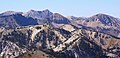
Big Cottonwood Canyon is a canyon in the Wasatch Range 12 miles (19 km) southeast of Salt Lake City in the U.S. state of Utah. The 15-mile (24 km)-long canyon provides hiking, biking, picnicking, rock-climbing, camping, and fishing in the summer. Its two ski resorts, Brighton and Solitude, are popular among skiers and snowboarders. The canyon is accessed by The Big Cottonwood Canyon Scenic Byway (SR-190), which runs its length to Guardsman Pass at the top of the canyon, allowing travel to Park City in the summer months.

The Pfeifferhorn is the 11,326 feet (3,452 m) triangularly-shaped peak located in the most isolated part of the Lone Peak Wilderness Area of the Wasatch Mountains in northern Utah, United States. This rugged Utah mountain, commonly referred to as the Little Matterhorn, is the eighth-highest peak in the Wasatch Range. The summit can be reached by hiking, though some scrambling is required. There are several technical rock climbing routes with the north ridge being the most popular. This summit also makes an excellent winter mountaineering adventure.

Mount Superior is an 11,045 feet (3,367 m) mountain peak in the Uinta-Wasatch-Cache National Forest in Salt Lake County, Utah, United States.

Dead Horse Peak is a 12,642-foot elevation (3,853 m) mountain summit located on the common border that Duchesne County shares with Summit County in the U.S. state of Utah.

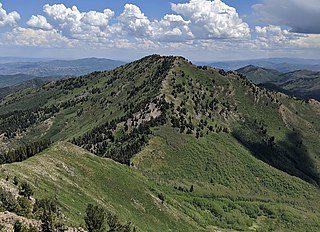
Mount Raymond is a 10,241-foot elevation (3,121 m) mountain summit located in Salt Lake County, Utah, United States.
Gobblers Knob is a 10,246-foot elevation (3,123 m) mountain summit located in Salt Lake County, Utah, United States.

Kesler Peak is a 10,403-foot elevation (3,171 m) mountain summit located in Salt Lake County, Utah, United States.

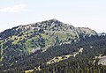
Grandeur Peak is an 8,299-foot-elevation (2,530-meter) mountain summit in the Wasatch Range in Salt Lake County, Utah, United States.

Mount Aire is an 8,621-foot-elevation (2,628-meter) mountain summit located in Salt Lake County, Utah, United States.

O'Sullivan Peak, also known as Sunrise Peak, is an 11,275-foot-elevation (3,437-meter) mountain summit located in Salt Lake County, Utah, United States.

Sugarloaf Mountain is an 11,051-foot-elevation (3,368-meter) summit on the boundary that Salt Lake County shares with Utah County, in Utah, United States.

Mount Baldy is an 11,068-foot-elevation (3,374-meter) summit on the boundary that Salt Lake County shares with Utah County, in Utah, United States.

Mount Millicent is a 10,452-foot-elevation (3,186-meter) summit in Salt Lake County, Utah, United States.

Mount Wolverine is a 10,795-foot-elevation (3,290-meter) summit in Salt Lake County, Utah, United States.

Sunset Peak is a 10,648-foot-elevation (3,246-meter) summit in Utah, United States.

Notch Mountain is an 11,263-foot-elevation (3,433-meter) mountain summit in Summit County, Utah, United States.

Dromedary Peak is an 11,107-foot-elevation (3,385-meter) mountain summit located in Salt Lake County, Utah, United States.

Mount Tuscarora is a 10,646-foot-elevation (3,245-meter) summit in Salt Lake County, Utah, United States.