Sugarloaf Mountain (Utah)

Last updated
Sugarloaf Mountain
Sugarloaf Mountain (Utah).jpg
North aspect
Highest point
Elevation 11,051 ft (3,368 m) [1]
Prominence 551 ft (168 m) [1]
Parent peak Mount Baldy [1]
Isolation 0.71 mi (1.14 km) [1]
Coordinates 40°33′57″N111°37′29″W / 40.5658608°N 111.6248150°W / 40.5658608; -111.6248150 [2]
Naming
Etymology Sugarloaf
Geography
USA Utah relief location map.svg
Red triangle with thick white border.svg
Sugarloaf Mountain
Location in Utah
Usa edcp relief location map.png
Red triangle with thick white border.svg
Sugarloaf Mountain
Sugarloaf Mountain (the United States)
CountryUnited States
State Utah
County Salt Lake / Utah
Parent range Wasatch Range [3]
Rocky Mountains
Topo map USGS Brighton / Dromedary Peak
Climbing
Easiest route class 1+ hiking [1]

Sugarloaf Mountain is an 11,051-foot-elevation (3,368-meter) summit on the boundary that Salt Lake County shares with Utah County, in Utah, United States.

Contents

Description

Sugarloaf Mountain is located 20 miles (32 km) southeast of downtown Salt Lake City at the Alta Ski Area in the Wasatch–Cache National Forest. [3] The peak is set in the Wasatch Range which is a subset of the Rocky Mountains. Precipitation runoff from the mountain's north slope drains to Little Cottonwood Creek, whereas the south slope drains to American Fork River. Topographic relief is significant as the summit rises 2,250 feet (686 meters) above American Fork Canyon in one mile (1.6 km). This mountain's toponym has been officially adopted by the United States Board on Geographic Names. [2]

Climate

Sugarloaf Mountain has a subarctic climate (Köppen Dfc), bordering on an Alpine climate (Köppen ET), with long, cold, snowy winters, and cool to warm summers. [4] Due to its altitude, it receives precipitation all year, as snow in winter, and as thunderstorms in summer. There is no weather station at the summit, but this climate table contains interpolated data for an area around the summit.

Climate data for Sugarloaf Mountain (Alta) 40.5641 N, 111.6236 W, Elevation: 10,482 ft (3,195 m) (1991–2020 normals)
MonthJanFebMarAprMayJunJulAugSepOctNovDecYear
Mean daily maximum °F (°C)26.1
(−3.3)
27.3
(−2.6)
32.2
(0.1)
38.1
(3.4)
47.5
(8.6)
59.0
(15.0)
68.3
(20.2)
66.6
(19.2)
57.8
(14.3)
44.8
(7.1)
33.3
(0.7)
26.4
(−3.1)
44.0
(6.6)
Daily mean °F (°C)17.9
(−7.8)
18.1
(−7.7)
22.7
(−5.2)
27.8
(−2.3)
37.0
(2.8)
47.6
(8.7)
57.1
(13.9)
55.7
(13.2)
47.3
(8.5)
35.1
(1.7)
24.8
(−4.0)
18.1
(−7.7)
34.1
(1.2)
Mean daily minimum °F (°C)9.8
(−12.3)
8.9
(−12.8)
13.3
(−10.4)
17.6
(−8.0)
26.4
(−3.1)
36.1
(2.3)
45.9
(7.7)
44.8
(7.1)
36.7
(2.6)
25.4
(−3.7)
16.2
(−8.8)
9.8
(−12.3)
24.2
(−4.3)
Average precipitation inches (mm)7.05
(179)
6.03
(153)
6.09
(155)
5.91
(150)
4.32
(110)
1.95
(50)
1.32
(34)
2.11
(54)
2.83
(72)
4.13
(105)
5.18
(132)
6.08
(154)
53
(1,348)
Source: PRISM Climate Group [5]

Related Research Articles

<span class="mw-page-title-main">Alta Ski Area</span> Ski resort in Alta, Utah, United States

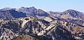
Alta is a ski area in the western United States, located in the town of Alta in the Wasatch Mountains of Utah, in Salt Lake County. With a skiable area of 2,614 acres (10.58 km2), Alta's base elevation is 8,530 ft (2,600 m) and rises to 11,068 ft (3,374 m) for a vertical gain of 2,538 ft (774 m). One of the oldest ski resorts in the country, it opened its first lift in early 1939. Alta is known for receiving more snow than most Utah resorts, with an average annual snowfall of 545 inches (13.8 m). It is also regularly ranked as having the best snow in North America. Alta is one of three remaining ski resorts in the U.S. that prohibits snowboarders, along with nearby competitor Deer Valley and Vermont's Mad River Glen.

<span class="mw-page-title-main">Mount Nebo (Utah)</span> Mountain in Utah, United States

Mount Nebo is the southernmost and highest mountain in the Wasatch Range of Utah, in the United States, and the centerpiece of the Mount Nebo Wilderness, inside the Uinta National Forest. It is named after the biblical Mount Nebo, overlooking Israel from the east of the Jordan River, which is said to be the place of Moses' death.

<span class="mw-page-title-main">Fish Lake (Utah)</span> Lake in the state of Utah, United States

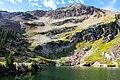
Fish Lake is a high alpine lake located in the Fishlake/ Southern Wasatch Plateau region of south-central Utah, United States. It lies within and is the namesake of the Fishlake National Forest.

<span class="mw-page-title-main">Truchas Peak</span>

Truchas Peak is the second highest peak in the U.S. State of New Mexico behind Wheeler Peak. It is in the Sangre de Cristo Mountains 26 miles (42 km) northeast of Santa Fe. It lies within the Pecos Wilderness, part of the Santa Fe National Forest. The name of the peak is Spanish for "trout" (plural). It is the highest point in both Rio Arriba and Mora counties. It is also the most southerly peak and land area in the continental United States to rise above 13,000 feet (3,962 m).

<span class="mw-page-title-main">Pfeifferhorn</span> Mountain in the American state of Utah

The Pfeifferhorn is the 11,331 feet (3,454 m) triangularly-shaped peak located in the most isolated part of the Lone Peak Wilderness Area of the Wasatch Mountains in northern Utah, United States. This rugged Utah mountain, commonly referred to as the Little Matterhorn, is the fifth-highest peak in the Wasatch Range. The summit can be reached by hiking, though some scrambling is required. There are several technical rock climbing routes with the north ridge being the most popular. This summit also makes an excellent winter mountaineering adventure.

<span class="mw-page-title-main">Bull Mountain (Box Elder County, Utah)</span>

Bull Mountain, an officially unnamed summit in northern Utah, United States, has an elevation of 9,938 feet (3,029 m). It is the highest point in the Raft River Mountains and Box Elder County.

<span class="mw-page-title-main">Highland Peak (California)</span> Mountain in the American state of California

Highland Peak is a prominent 10,936-foot-elevation (3,333-meter) mountain summit located in the Sierra Nevada mountain range, in Alpine County of northern California, United States. It is situated 3.5 miles east of Ebbetts Pass in the Carson-Iceberg Wilderness, on land managed by Humboldt–Toiyabe National Forest. Although it ranks as the 680th-highest summit in California, it ranks 36th-highest of those with at least 500 meters of topographic prominence. Also, there is no higher peak than Highland Peak to the north within the Sierra Nevada. Highland Peak has a subsidiary South Peak, with one-half mile separation between summits. The Pacific Crest Trail traverses the western foot of this mountain, providing an approach option. Precipitation runoff from this mountain drains into tributaries of the East Fork Carson River.. Topographic relief is significant as the summit rises over 2,900 feet above Noble Canyon in 1.6 mile (2.6 km).

<span class="mw-page-title-main">Broads Fork Twin Peaks</span> Mountain in the American state of Utah

The Twin Peaks are a pair of mountain high points located on the Cottonwood Ridge within the Wasatch Range in Salt Lake County, Utah. They are usually referred to as the Broads Fork Twin Peaks, to distinguish them from the nearby American Fork Twin Peaks and Avenues Twin Peaks. Consisting of two sub-peaks, only the eastern peak has the prominence to be considered a true summit. The summit has an elevation of 11,303 feet (3,445 m), making it the second-highest peak in Salt Lake County, only behind the American Fork Twins. The summit rises directly from the Salt Lake Valley, making it easily visible and recognizable.

<span class="mw-page-title-main">American Fork Twin Peaks</span> Mountain in the American state of Utah

The Twin Peaks are a set of mountain high points located on the Alpine Ridge within the Wasatch Range in Utah, on the border between Salt Lake and Utah County. They are usually referred to as the American Fork Twin Peaks, to distinguish them from the nearby Broads Fork Twin Peaks and Avenues Twin Peaks. Consisting of several sub-peaks, only one has the prominence to be considered a true summit. The summit has an elevation of 11,461 feet (3,493 m), making it the highest point in Salt Lake County. The peak is also the most prominent in Salt Lake County, and one of the most prominent in the Wasatch Range.

<span class="mw-page-title-main">Ostler Peak</span> Mountain in the American state of Utah

Ostler Peak is a 12,718-foot elevation (3,876 m) mountain summit located in Summit County, Utah, United States.

<span class="mw-page-title-main">Mount Lovenia</span> Mountain in the American state of Utah

Mount Lovenia is a 13,219-foot elevation (4,029 m) mountain summit located on the common border that Duchesne County shares with Summit County in the U.S. state of Utah.

<span class="mw-page-title-main">Mount Beulah</span> Mountain in the American state of Utah

Mount Beulah is a 12,557-foot elevation (3,827 m) mountain summit located in Summit County, Utah, United States.

<span class="mw-page-title-main">Gobblers Knob (Utah)</span> Mountain in the American state of Utah

Gobblers Knob is a 10,246-foot elevation (3,123 m) mountain summit located in Salt Lake County, Utah, United States.

<span class="mw-page-title-main">Haystack Peak</span>

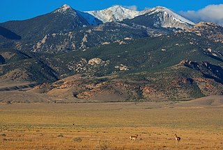
Haystack Peak is a 12,020-foot elevation (3,664 m) mountain summit located in Juab County, Utah, United States.

<span class="mw-page-title-main">Jim Mountain</span> Mountain in Wyoming, United States

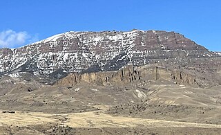
Jim Mountain is a 10,430-foot-elevation (3,179-meter) summit in Park County, Wyoming, United States.

<span class="mw-page-title-main">Spanish Fork Peak</span> Mountain peak in Utah County, United States

Spanish Fork Peak is a 10,192-foot elevation (3,107 m) mountain summit located in Utah County, Utah, United States.

<span class="mw-page-title-main">Mount Baldy (Salt Lake County, Utah)</span>

Mount Baldy is an 11,068-foot-elevation (3,374-meter) summit on the boundary that Salt Lake County shares with Utah County, in Utah, United States.

<span class="mw-page-title-main">Clayton Peak</span> Mountain in Utah, United States

Clayton Peak, also known unofficially as Mount Majestic, is a 10,721-foot-elevation (3,268-meter) summit on the boundary that Salt Lake County shares with Wasatch County, in Utah, United States.

<span class="mw-page-title-main">Mount Wolverine</span>

Mount Wolverine is a 10,795-foot-elevation (3,290-meter) summit in Salt Lake County, Utah, United States.

<span class="mw-page-title-main">Sunset Peak (Utah)</span>

Sunset Peak is a 10,648-foot-elevation (3,246-meter) summit in Utah, United States.

References

  1. 1 2 3 4 5 "Sugarloaf Mountain - 11,051' UT". listsofjohn.com. Retrieved 2024-06-03.
  2. 1 2 "Sugarloaf Mountain". Geographic Names Information System . United States Geological Survey, United States Department of the Interior . Retrieved 2024-05-31.
  3. 1 2 "Sugarloaf Mountain, Utah". Peakbagger.com. Retrieved 2024-06-03.
  4. Peel, M. C.; Finlayson, B. L.; McMahon, T. A. (2007). "Updated world map of the Köppen−Geiger climate classification". Hydrol. Earth Syst. Sci. 11. ISSN   1027-5606.
  5. "PRISM Climate Group, Oregon State University". PRISM Climate Group, Oregon State University. Retrieved November 6, 2023. To find the table data on the PRISM website, start by clicking Coordinates (under Location); copy Latitude and Longitude figures from top of table; click Zoom to location; click Precipitation, Minimum temp, Mean temp, Maximum temp; click 30-year normals, 1991-2020; click 800m; click Retrieve Time Series button.