Clearfield, Kansas | |
|---|---|
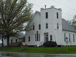 Clearfield United Methodist Church (2011) | |
 | |
 Clearfield  Clearfield | |
| Coordinates: 38°49′34″N95°05′37″W / 38.82611°N 95.09361°W [1] | |
| Country | United States |
| State | Kansas |
| County | Douglas |
| Elevation | 1,001 ft (305 m) |
| Time zone | UTC-6 (CST) |
| • Summer (DST) | UTC-5 (CDT) |
| Area code | 785 |
| FIPS code | 20-13850 [1] |
| GNIS ID | 484894 [1] |
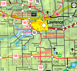
Clearfield is an unincorporated community in Douglas County, Kansas, United States, [1] and is located northeast of Baldwin City at the intersection of E 2200 and N 600 roads.
