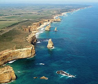
The Port Campbell National Park is a national park in the south-western district of Victoria, Australia. The 1,750-hectare (4,300-acre) national park is situated approximately 190 kilometres (120 mi) south-west of Melbourne and approximately 10 kilometres (6.2 mi) east of Warrnambool. The park is located adjacent to the Great Otway National Park and the Bay of Islands Coastal Park.
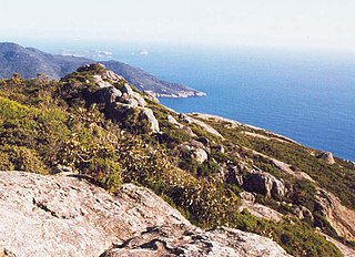
Wilsons Promontory, is a peninsula that forms the southernmost part of the Australian mainland, located in the state of Victoria.
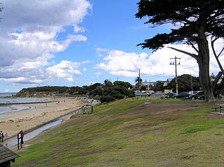
Point Lonsdale is a coastal township on the Bellarine Peninsula, near Queenscliff, Victoria, Australia. The town is divided between the Borough of Queenscliffe and the City of Greater Geelong. Point Lonsdale is also one of the headlands which, with Point Nepean, frame The Rip, the entrance to Port Phillip. The headland is dominated by the Point Lonsdale Lighthouse. At the 2016 census, Point Lonsdale had a population of 2,684. The population grows rapidly over the summer months through to the Easter period due to its popularity as a holiday destination.

The Ninety Mile Beach is a sandy stretch of beach on the south-eastern coastline of the East Gippsland region of Victoria in Australia. The beach faces Bass Strait and backs the Gippsland Lakes. The beach is just over 151 kilometres (94 mi) in length, running north-eastward from a spit near Port Albert to the man-made channel at Lakes Entrance.

The Gippsland Lakes are a network of coastal lakes, marshes and lagoons in East Gippsland, Victoria, Australia covering an overall area of about 354 km2 (137 sq mi) between the rural towns of Lakes Entrance, Bairnsdale and Sale. The largest of the lakes are Lake Wellington, Lake King and Lake Victoria. The lakes are collectively fed by the Avon, Thomson, Latrobe, Mitchell, Nicholson and Tambo Rivers, and drain into the Bass Strait through a short canal about 2 km (1.2 mi) southwest of Lakes Entrance town centre.
Sandy Point is a township in south Gippsland, Victoria near Wilsons Promontory. At the 2016 census, Sandy Point had a population of 270, growing to several thousand during the holiday period. It is surrounded by areas of significant natural heritage.

Sunday Island is a low-lying, sandy, 16.2 km2 barrier island on the coast of Victoria, Australia. It is about 8 km long by 3 km wide and rises to a maximum height of no more than 15 m above mean sea level. It lies in Corner Inlet, South Gippsland, 4 km south-west of Port Albert and 215 km south-east of Melbourne. Although the island is surrounded by the Nooramunga Marine and Coastal Park, it is private freehold property, a game reserve owned by the Para Park Co-operative Game Reserve Limited. It contains an airstrip and a jetty as well as accommodation buildings for resident caretakers, visiting members, and their guests.

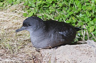
Bennison Island is an uninhabited granite island in Corner Inlet near the northern coast of Wilsons Promontory, in Victoria, Australia.
Corner Island is located in Corner Inlet Marine National Park, approximately 2.5 kilometres (1.6 mi) north of Millers Landing on Wilsons Promontory in Victoria, Australia. The island is accessible only at high tide by boat.
Snake Island is a sand island, located in Corner Inlet in the Gippsland region of Victoria, Australia. It has an area of 35-square-kilometre (14 sq mi) and is the largest island in Corner Inlet. Snake Island lies within the Nooramunga Marine and Coastal Park and is part of a complex of barrier islands that protect a large marine embayment from the pounding waves of Bass Strait. The Aboriginal Gunai name for the island is Negima.

The Corner Inlet is a 600-square-kilometre (230 sq mi) bay located 200 kilometres (120 mi) south-east of Melbourne in the South Gippsland region of Victoria, Australia. Of Victoria's large bays it is both the easternmost and the warmest. It contains intertidal mudflats, mangroves, salt marsh and seagrass meadows, sheltered from the surf of Bass Strait by a complex of 40 sandy barrier islands, the largest of which are Snake, Sunday and Saint Margaret Islands.
Saint Margaret Island lies in Corner Inlet, in the Gippsland region of Victoria, Australia. It lies at the eastern end of the Nooramunga Marine and Coastal Park, close to Ninety Mile Beach.
Jack Kenneth Loney was an amateur Australian marine historian who published over one hundred books and numerous newspaper and magazine articles. He was a schoolteacher and principal until his retirement. He became interested in maritime history after preparing several general history booklets covering the Otway region of western Victoria, Australia.
The Wilsons Promontory Islands Important Bird Area comprises a loose cluster of 19 small, granite islands, with a collective area of 658 ha, scattered around Wilsons Promontory in the state of Victoria, south-eastern Australia. The three southernmost islands are part of the state of Tasmania. They are important for their breeding seabirds.
The Corner Inlet Marine National Park is a protected marine national park located in the South Gippsland region of Victoria, Australia. The 1,550-hectare (3,800-acre) marine park is situated approximately 200 kilometres (120 mi) southeast of Melbourne and contains part of Corner Inlet.
The Wilsons Promontory Marine National Park is a protected marine national park located in the South Gippsland region of Victoria, Australia. The 15,500-hectare (38,000-acre) marine park is situated off the southern tip of Wilsons Promontory and extends along the coastline from Norman Bay, near Tidal River, in the west around the southern tip of the promontory to Cape Wellington in the east. It extends offshore to the Glennie and Anser groups of offshore islands.
McLoughlins Beach is a small settlement in South Gippsland, Victoria. It has an estimated permanent population of less than 300 and a number of holiday houses.
Clonmel was a three-masted wooden paddle steamer built in Birkenhead, England, in 1836. Clonmel was one of the first steam-powered vessels on the Australian coast. It ran aground in the early hours of 2 January 1841, or the 3rd. and was wrecked on what is now known as Clonmel Island in Corner Inlet, Victoria. This was only its second voyage from Sydney.
Granite Island is a small, uninhabited granite island in Corner Inlet near the northern coast of Wilsons Promontory, in Victoria, Australia.

Westhaven Marine Reserve is a marine reserve covering an area of 536 hectares in the Whanganui Inlet at the top of New Zealand's South Island. It was established in 1994 and is administered by the Department of Conservation.