
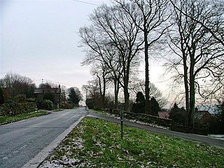
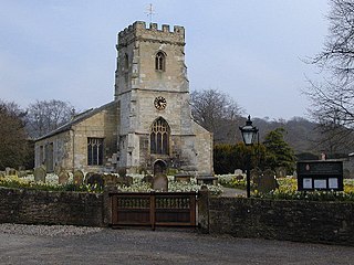
Lythe is a small village and large civil parish, in North Yorkshire, England, situated near Whitby within the North York Moors National Park. The name of the village derives from Old Norse and means hill or slope.

Scarborough and Whitby is a constituency in North Yorkshire represented in the House of Commons of the UK Parliament since 2024 by Alison Hume, a Labour MP.
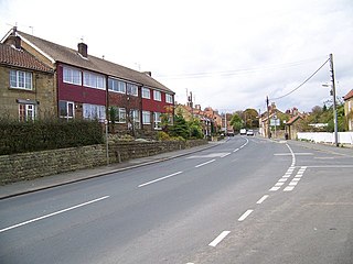
Aislaby is a village and civil parish in North Yorkshire, England. It is situated near the town of Whitby on the northern slopes of Eskdale just off the A171.
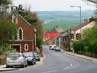
Brotton is a village in the civil parish of Skelton and Brotton, in the Redcar and Cleveland district, in the ceremonial county of North Yorkshire, England It is situated approximately 2.5 miles (4 km) south-east of Saltburn-by-the-Sea, 9 miles from Redcar, 12 miles (19 km) east of Middlesbrough and 14 miles (23 km) north-west of Whitby.
Scalby, a village on the north edge of Scarborough, North Yorkshire, England, is part of the civil parish of Newby and Scalby. From 1902 to 1974, Scalby was an urban district in the North Riding of Yorkshire.

Norton-on-Derwent, commonly referred to as simply Norton, is a town and civil parish in North Yorkshire, England. Norton borders the market town of Malton, and is separated from it by the River Derwent. The 2001 Census gave the population of the parish as 6,943, increasing at the 2011 Census to 7,387.

Brearton is a village and civil parish in the Harrogate borough of North Yorkshire, England, situated about 3 miles (4.8 km) north of Knaresborough. The village is mentioned in the Domesday Book and its name derives from the Old English Brer-Tun, which means the town where the briars grew.
Burniston is a village and civil parish in the Scarborough borough of North Yorkshire, England. It is situated about four miles north of Scarborough itself, on the A171 road. According to the 2011 UK census Burniston parish had a population of 1,523, an increase on the 2001 UK census figure of 1,389. With all the new houses at River Meadows, the population is now roughly 1,500. The parish council is Burniston Parish Council.

The A171 is a road in England that links the North Yorkshire towns of Middlesbrough, Guisborough, Whitby, Robin Hood's Bay and Scarborough. Locally it is known as The Moor Road. The road is mostly single carriageway but has some sections of dual carriageway. The distance between the two towns is 47 miles (75 km)

The Scarborough & Whitby Railway was a railway line from Scarborough to Whitby in North Yorkshire, England. The line followed a difficult but scenic route along the North Yorkshire coast.

Rylstone is a village and civil parish in the former Craven district of North Yorkshire, England. It is situated very near to Cracoe and about 6 miles (9.7 km) south west of Grassington. The population of the civil parish as of the 2001 census was 122, and had risen to 160 by the time of the 2011 census. In 2015, the population was estimated to be 180.

Wrelton is a village and civil parish in North Yorkshire, England. It is on the A170 road and 2 miles west of Pickering.

Nafferton is a village and civil parish in the East Riding of Yorkshire, England. It is situated approximately 2 miles (3.2 km) north-east of Driffield town centre and lies just south of the A614 road.
Settrington is a village and civil parish in North Yorkshire, England, about 3 miles (5 km) east of Malton. It was historically part of the East Riding of Yorkshire until 1974 and part of the Ryedale district from 1974 until 2023.

Salton is a village and civil parish in North Yorkshire, England. The population of the village at the 2011 census was 110, but the details can be found listed in the civil parish of Edstone.

Flixton is a village in North Yorkshire, England. Until 1974 the village lay in the historic county boundaries of the East Riding of Yorkshire and from 1974 to 2023 it was part of the Borough of Scarborough. There is a public house, the Foxhound Inn.

Staintondale is a small village and civil parish in the Scarborough district of North Yorkshire, England. The village is situated 7 miles (11 km) north west of Scarborough town centre. The parish also includes the village of Ravenscar, 2 miles (3 km) north of the village of Staintondale, and the whole parish lies within the North York Moors National Park.

Hawsker is the name for the combined villages of High and Low Hawsker that straddle the A171 road 2.5 miles (4 km) southeast of Whitby, in North Yorkshire, England.

Kettleness, is a hamlet in the Scarborough District of North Yorkshire, England. The settlement only consists of half-a-dozen houses, but up until the early 19th century, it was a much larger village. However, most of that village, which was on the headland, slipped into the sea as a result of instability caused by quarrying for the alum industry. Kettleness became a smaller settlement, with houses rebuilt slightly further inland.
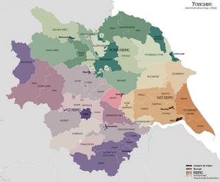
Pickering Lythe was one of twelve wapentakes within the historical county of the North Riding of Yorkshire, England. It was recognised within the Domesday Book as Dic, an area covering the Vale of Pickering, and swathes of land east towards the North Yorkshire coast.


