Cloverland, Wisconsin | |
---|---|
Coordinates: 46°40′37″N91°40′45″W / 46.67694°N 91.67917°W Coordinates: 46°40′37″N91°40′45″W / 46.67694°N 91.67917°W | |
Country | |
State | |
County | Douglas |
Town | Cloverland |
Elevation | 245 m (804 ft) |
Time zone | UTC-6 (Central (CST)) |
• Summer (DST) | UTC-5 (CDT) |
Area code(s) | 715 and 534 |
GNIS feature ID | 1577549 [1] |
Cloverland is an unincorporated community located in the town of Cloverland, Douglas County, Wisconsin, United States. [1]
In law, an unincorporated area is a region of land that is not governed by a local municipal corporation; similarly an unincorporated community is a settlement that is not governed by its own local municipal corporation, but rather is administered as part of larger administrative divisions, such as a township, parish, borough, county, city, canton, state, province or country. Occasionally, municipalities dissolve or disincorporate, which may happen if they become fiscally insolvent, and services become the responsibility of a higher administration. Widespread unincorporated communities and areas are a distinguishing feature of the United States and Canada. In most other countries of the world, there are either no unincorporated areas at all, or these are very rare; typically remote, outlying, sparsely populated or uninhabited areas.
Cloverland is a town in Douglas County, Wisconsin, United States. The population was 247 at the 2000 census. The unincorporated community of Cloverland is located in the town.
Douglas County is a county located at the northwest corner of the U.S. state of Wisconsin. As of the 2010 census, the population was 44,159. Its county seat is Superior.
Wisconsin Highway 13 serves as a main route in the community. Cloverland is located 24 miles east of the city of Superior.
State Trunk Highway 13 is a Wisconsin state highway running north–south across northwest and central Wisconsin. WIS 13 serves as a major north–south route connecting the communities of Wisconsin Dells, Wisconsin Rapids, Marshfield and Ashland. Highway 13 is part of the Lake Superior Circle Tour from its northern/western terminus to Ashland at is eastern junction with U.S. Highway 2. The road also provides access to the Apostle Islands National Lakeshore off the Lake Superior shoreline at Bayfield. The highway is two-lane surface road with the exception of various urban multilane road sections.
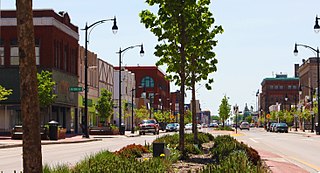
Superior is a city in, and the county seat of, Douglas County in the state of Wisconsin. The population was 27,244 at the 2010 census. Located at the junction of U.S. Highway 2 and U.S. Highway 53, it is immediately north of and adjacent to both the Village of Superior and the Town of Superior. Its neighborhoods include Billings Park, North End, South Superior, Central Park, East End, Allouez, and Itasca. Billings Park, South Superior, East End, and North End each have small business districts.
This article about a location in Douglas County, Wisconsin is a stub. You can help Wikipedia by expanding it. |
Vilas County is a county in the state of Wisconsin, United States. As of the 2010 census, the population was 21,430. Its county seat is Eagle River.
Cloverland is a town in Vilas County, Wisconsin, United States. The population was 919 at the 2000 census.
Cloverland may refer to places in the U.S, state of Wisconsin:
Upper Peninsula Power Company (UPPCO), is no longer a subsidiary of Integrys Energy Group. UPPCO is a utility company serving most of the Upper Peninsula of Michigan. UPPCO provides electric power to consumers.
Edison Sault Electric Company was a public utility that provided electricity to the eastern portion of Michigan's Upper Peninsula. Its service area covered four counties.
Cloverland is a neighborhood located on the south side of Houston, Texas, United States.
Cloverland is an unincorporated community in Posey Township, Clay County, Indiana. It is part of the Terre Haute Metropolitan Statistical Area.
Ashton is an unincorporated community located in the town of Springfield, in Dane County, Wisconsin, United States. The community was named after Thomas Ashton, the president of the British Temperance Emigration Society.
South Beaver Dam is an unincorporated community in Dodge County, Wisconsin, United States, in the town of Calamus. The community is located just south of the city of Beaver Dam. The ZIP code is 53916. It is part of the Beaver Dam Micropolitan Statistical Area. The community lies on the southern shore of Beaver Dam Lake.
Alderley is an unincorporated community located in the town of Ashippun, Dodge County, Wisconsin, United States. Alderley is located on Highway O approximately 7 miles (11 km) north of Stone Bank, 3 miles (5 km) north of the unincorporated community of Mapleton, and 3 miles (5 km) east of Ashippun. The community was named by early settlers for Alderley Edge, England.
Portland is an unincorporated community located partially in the town of Portland in Dodge County, Wisconsin and partially in the town of Waterloo in Jefferson County, Wisconsin, United States.
Hatchville is an unincorporated community located in the towns of Lucas and Weston in Dunn County, Wisconsin, Spring Lake in Pierce County, Wisconsin, and Cady in St. Croix County, Wisconsin, United States. The community was named for two brothers, Frank and Ed Hatch, who owned and operated a combined store and community center. Frank Hatch opened the post office in November of 1889.
Token Creek is an unincorporated community located in the village of Windsor, Dane County, Wisconsin, United States. Wisconsin Highway 19 crosses east to west through the community
Chaffey is an unincorporated community located in the town of Summit, Douglas County, Wisconsin, United States.
Kalinke is an unincorporated community located in the town of Easton, Marathon County, Wisconsin, United States. The community is named for Gottlieb Kalinke, the farmer who had owned the land surrounding the community.
The Forest Route 157–Tamarack River Bridge, also known as the San Souci Bridge, was a bridge located on Federal Forest Highway 157 over the Tamarack River in Stambaugh Township, Michigan. It was listed on the National Register of Historic Places in 1999, and demolished in 2008.
Cloverland is an unincorporated community in Asotin County, Washington, United States. Cloverland is 11.5 miles (18.5 km) southwest of Asotin.