
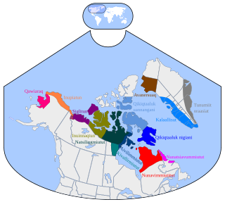
The Qikiqtaaluk Region, Qikiqtani Region or Baffin Region is the easternmost administrative region of Nunavut, Canada. Qikiqtaaluk is the traditional Inuktitut name for Baffin Island. Although the Qikiqtaaluk Region is the most commonly used name in official contexts, several notable public organizations, including Statistics Canada prefer the older term Baffin Region.
The following rivers have the name Clyde River:

Clyde River is an Inuit hamlet located on the shore of Baffin Island's Patricia Bay, off Kangiqtugaapik, an arm of Davis Strait in the Qikiqtaaluk Region, of Nunavut, Canada. It lies in the Baffin Mountains which in turn form part of the Arctic Cordillera mountain range. The community is served by air and by annual supply sealift.
James Arreak is a territorial and municipal level politician in Canada. He has served as a member of both the Nunavut and Northwest Territories legislatures.
Tommy Enuaraq is a published author and former territorial level politician from Clyde River, Nunavut, Canada.
Pauloosie Paniloo was a territorial level politician. He served as a member of the Northwest Territories Legislature from 1983 to 1987. He was also a member of the Canadian Rangers, serving as a ranger for 28 years.

Kangiqtugaapik formerly Clyde Inlet is a body of water in eastern Baffin Island, Qikiqtaaluk Region, Nunavut. Its mouth opens into the Davis Strait from the west.

Dexterity Island is an uninhabited island in the Qikiqtaaluk Region of Nunavut, Canada. It is located in Baffin Bay off the northeastern coast of Baffin Island. Adams Island is 19.3 km (12.0 mi) to the south, while Bergesen Island is 17.2 km (10.7 mi) to the west, across Isbjorn Strait.
Kogalu River is a waterway on the eastern coast of Baffin Island in the Qikiqtaaluk Region of Nunavut, Canada. The river outflows from Ayr Lake and travels 40 kilometres (25 mi) before reaching Baffin Bay. The nearest settlement, Clyde River, is approximately 30 kilometres (19 mi) away.
Cape Christian is a land point on eastern Baffin Island, in Qikiqtaaluk Region, Nunavut, Canada. The nearest settlement is Clyde River to the north. Cape Christian was used as a weather station. From 1954 until 1974, it was also an Arctic military site that was run by the U.S. Coast Guard as a LORAN station which supported ships and aircraft that operated out of Thule, Greenland.
Cape Hewitt is a peninsula on eastern Baffin Island, Qikiqtaaluk Region, Nunavut, Canada. Located on Baffin Bay near Clyde Inlet, the closest settlement is Clyde River, 39.6 kilometres (24.6 mi) away.
Cape Aston is a large peninsula on eastern Baffin Island, Qikiqtaaluk Region, Nunavut, Canada. Located on Baffin Bay just south of Clyde Inlet, the closest settlement is Clyde River. The cape includes an ice-derived delta.
The North Baffin dialect of Inuktitut is spoken on the northern part of Baffin Island, at Igloolik and the adjacent part of the Melville Peninsula, and in other Inuit communities in the far north of Nunavut, like Resolute, Grise Fiord, Pond Inlet, Clyde River, and Arctic Bay.
Sam Ford Fiord is an isolated, elongated Arctic fjord on Baffin Island's northeastern coast in the Qikiqtaaluk Region of Nunavut, Canada. The Inuit settlement of Pond Inlet is 320 km (200 mi) to the northwest and Clyde River is 80 km (50 mi) to the east.
Ayr Lake is a land-locked freshwater fjord on Baffin Island's northeastern coast in the Qikiqtaaluk Region of Nunavut, Canada. The Inuit settlement of Pond Inlet is 360 km (220 mi) to the northwest and Clyde River is 35 km (22 mi) to the east.
Eglinton Fiord is a fjord on Baffin Island's northeastern coast in the Qikiqtaaluk Region of Nunavut, Canada. The Inuit settlement of Pond Inlet is 355 km (221 mi) to the northwest and Clyde River is 55 km (34 mi) to the east.

The Remote Peninsula is a peninsula located on the eastern coast of Baffin Island. It is part of the Qikiqtaaluk Region of the Canadian territory of Nunavut. The Inuit settlement of Pond Inlet is 295 km (183 mi) to the northwest and Clyde River is 90 km (56 mi) to the southeast.
The Walker Arm is a tributary fjord of the Sam Ford Fjord located on the northeast coast of Baffin Island in the Qikiqtaaluk region in Nunavut, Canada. The Inuit settlement of Pond Inlet is about 325 km to the northeast and that of Clyde River is about 100 km to the east.
