The Coast Province was one of Kenya's eight provinces. It contained all of the country's coastline on the Indian Ocean. Its capital city was Mombasa. It was inhabited by the Mijikenda and Swahili peoples, among others. The province covered an area of 79,686.1 km2.

The Ilchamus, are a Maa-speaking people living south and southeast of Lake Baringo, Kenya. They numbered approximately 32,949 people in 2019 and are closely related to the Samburu living more to the north-east in the Rift Valley Province. They are one of the smallest ethnic groups in Kenya.

Nyahururu is a town in Kenya, lying north east of Nakuru. The town derives its name from the Maasai word e-naiwurruwurr, meaning waterfall and/or windy or place of storms. It is allegedly located in Laikipia County. Despite this, Nyahururu formerly functioned as the administrative capital of Nyandarua District, before it became a county, until the headquarters was shifted to Ol Kalou. There have been calls for a reversal. The town has an urban population of 36,450. The town still continues to be a central economic power of the immediate former district of Nyandarua. For that reason, the town has strong economic ties to the two counties.

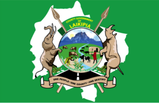
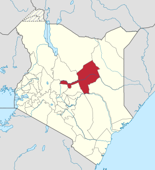
Laikipia County is one of the 47 Counties of Kenya, located on the Equator in the former Rift Valley Province of the Country. Laikipia is a cosmopolitan County and is Listed as County number 31. The county has two major urban centres: Nanyuki to the southeast, and Nyahururu to the southwest. Its County government headquarters town is Rumuruti. The County lies between latitudes 0° 18" South and 0° 51" North and between longitudes 36° 11" and 37° 24' East. It borders Samburu County to the North, Isiolo County to the North East, Meru County to the East, Nyeri County to the South East, Nyandarua County to the South, Nakuru County to the South West and Baringo County to the West.
Wundanyi is a town in the Taita-Taveta County of Kenya. Other urban centres in the county include Voi, Taveta and Mwatate.

Kilifi County was formed in 2010 as a result of a merger of Kilifi District and Malindi District, Kenya. Its capital is Kilifi and its largest town is Malindi. Kilifi county is one of the five counties that make up the Kenyan Coast. The county has a population of 1,453,787 people following the 2019 census which covers an area of 12,245.90 km2 (4,728.17 sq mi).

Taita–Taveta County is a county in Kenya. Located approximately 200 km northwest of Mombasa, and 360 km southeast of Nairobi, it is a port and major gateway to the United Republic of Tanzania through Taveta. The county headquarters are located in Mwatate. It is one of the six counties in the Coastal region of Kenya. Major towns include Voi, Taveta, Mwatate, and Wundanyi.

Isiolo County is a county in the former Eastern Province of Kenya. Its population is 268,002 and its capital and largest city is Isiolo. Isiolo County is to be the first county to be developed as part of the Kenya Vision 2030 program. Other upcoming urban centres are: Garbatulla, Modogashe, Kinna, Merti and Oldonyiro. The county is home to Sakuye and Borana tribes but also has a significant number of people from Turkana, Samburu, Gabra, Garre and Meru communities.

Kajiado County is a county in the former Rift Valley Province of Kenya. As of 2019, Kajiado county spanned an area of 21,292.7 km2, with a recorded population of 1,117,840. The county borders Nairobi and to its south it borders the Tanzanian regions of Arusha and Kilimanjaro. The county capital is Kajiado, but the largest town is Ongata Rongai. Its main tourist attraction is its wildlife.
Taveta is a town in the Taita-Taveta County, Kenya.

Local authorities in Kenya are the bodies controlling local governance in urban areas in Kenya.
Nanyuki Airfield is an airport in Nanyuki, Kenya.

The districts of Kenya were divided into 262 divisions (matarafa). Divisions of Kenya were further subdivided into locations. Today's counties of Kenya are based on the merging of some of the districts on this list and since the divisions are one level under the districts they are now the sub-counties. This is because Kenya recently changed its constitution and 47 Counties emerged. Here are the divisions listed below, by district :

Sub-counties, also known as Districts, are the decentralised units through which government of Kenya provides functions and services. At national level, sub-counties take a more administrative function like security, statistical purposes, provision of government services, etc. Even though the sub-counties are divisions of counties, powers to create new national sub-counties lies with the national government. As of 2023, there are 314 sub-counties, compared to 290 constituencies. A deputy county commissioner is appointed by the state to lead each sub-county. The sub-counties are further divided into divisions, locations and sub-locations.
The list shows flags for the forty-seven counties of Kenya. Some counties adopted the flag of the defunct municipal or district governments. Other flags adopted in the year after the first county governments were elected which was between 4 March 2013 to the same date on 2014. As of 17 December 2014, not all county assemblies have passed the design of the county flags. It is expected that all counties will adopt their own flags soon.
The Kenya Schools and Colleges Drama Festival is a series of student theatre competitions in Kenya, held from January to April each year, advancing through local, county and regional stages to the National Drama Festival. Students from primary schools to colleges take part, with a total annual participation of roughly five million students, making it the biggest educational theatre event in Africa.
The Anglican dioceses of Mombasa are the Anglican presence in and around Mombasa and south-east Kenya; they are part of the Anglican Church of Kenya. The remaining dioceses of the Church are in the areas of Maseno, of Mount Kenya, and of Nakuru.
Granton Graham Samboja is a Kenyan politician and media executive who served as the second governor of Taita Taveta County from 2017 to 2022. He is a member of the Jubilee Party of Kenya. Samboja capitalized on his background in the media and his links with President Uhuru Kenyatta to get into politics. His education background remains the subject of controversy.

The history of East Africa has been divided into its prehistory, the major polities flourishing, the colonial period, and the post-colonial period, in which the current nations were formed. East Africa is the eastern region of Africa, bordered by North Africa, Central Africa, Southern Africa, the Indian Ocean, and the Sahara Desert. Colonial boundaries are reflected in the modern boundaries between contemporary East African states, cutting across ethnic and cultural lines, often dividing single ethnic groups between two or more states.
The genetic history of Eastern Africa encompasses the genetic history of the people of Eastern Africa. The Sahara served as a trans-regional passageway and place of dwelling for people in Africa during various humid phases and periods throughout the history of Africa.


