Coin | |
---|---|
Coordinates: 45°44′06″N93°18′24″W / 45.73500°N 93.30667°W | |
Country | United States |
State | Minnesota |
County | Kanabec |
Township | Brunswick Township |
Elevation | 971 ft (296 m) |
Time zone | UTC-6 (Central (CST)) |
• Summer (DST) | UTC-5 (CDT) |
ZIP code | 55006 |
Area code | 320 |
GNIS feature ID | 654649 [1] |
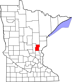
Coin is an unincorporated community in Brunswick Township, Kanabec County, Minnesota, United States.
Kanabec County Road 4 (103rd Avenue) and Kanabec County Road 16 (King Road) are two of the main routes in the community. Nearby places include Braham, Mora, Brunswick, Lewis Lake, Stanchfield, and Cranberry Wildlife Management Area.
ZIP codes 55006 (Braham) and 55051 (Mora) meet near Coin.
Stanchfield Brook–Ties Creek flows through the community. State Highway 65 (MN 65) is nearby.
Coin is located in section 35 of Brunswick Township, which earlier had a post office from 1898 to 1904. The name Coin was suggested by Ole E. Olson, the storekeeper and postmaster, during the William Jennings Bryan debate of Free Silver in 1896. [2]
The boundary line between Kanabec and Isanti counties is near Coin.
Kanabec County is a county in the East Central part of U.S. state of Minnesota. As of the 2020 census, the population was 16,032. Its county seat is Mora.
Isanti County is a county in the east-central part of the U.S. state of Minnesota. As of the 2020 census, the population was 41,135. Its county seat is Cambridge.
Mora is a city and the county seat of Kanabec County, Minnesota It is located at the junction of Minnesota highways 23 and 65 and is along the Snake River. The population was 3,665 at the 2020 Census.
Braham is a city in Isanti and Kanabec counties in the U.S. state of Minnesota. The population was 1,769 at the 2020 census.
Minnesota State Highway 107 is a 17.571-mile-long (28.278 km) highway in east-central Minnesota, which runs from its intersection with State Highway 65 in Stanchfield Township near Braham and continues north to its northern terminus at its intersection with State Highway 23 in Pine County near Brook Park.
Minnesota State Highway 118 was a highway route number in the U.S. state of Minnesota that was used previously during two different time periods: once during the 1930s and once during the 1990s.
Brunswick is an unincorporated community in Brunswick Township, Kanabec County, Minnesota, United States. The community is located between Mora and Rock Creek at the junction of State Highway 65 and State Highway 70.
Lewis Lake is an unincorporated community in Brunswick Township, Kanabec County, Minnesota, United States. The community is located between Braham and Ogilvie.
Warman is an unincorporated community in Peace Township, Kanabec County, Minnesota, United States.
Dalbo is an unincorporated community in Dalbo Township, Isanti County, Minnesota, United States.
Andree is an unincorporated community in Stanchfield Township, Isanti County, Minnesota, United States.
Day is an unincorporated community in Maple Ridge Township, Isanti County, Minnesota, United States.
Grandy is an unincorporated community in Cambridge Township, Isanti County, Minnesota, United States.
Stanchfield is an unincorporated community and census-designated place (CDP) in Stanchfield Township, Isanti County, Minnesota, United States. As of the 2020 census, its population was 103.
Springvale is an unincorporated community in Springvale Township, Isanti County, Minnesota, United States.
Greeley is an unincorporated community in Royalton Township, Pine County, Minnesota, United States.
Kroschel is an unincorporated community in Kanabec County, Minnesota, United States.
Woodland is an unincorporated community in Ford Township, Kanabec County, Minnesota, United States.
Rush Point is an unincorporated community in Nessel Township, Chisago County, Minnesota, United States.