Knife Lake Township, Kanabec County, Minnesota

Last updated

Knife Lake Township, Minnesota
USA Minnesota location map.svg
Red pog.svg
Knife Lake Township
Location within Minnesota and the United States
Usa edcp location map.svg
Red pog.svg
Knife Lake Township
Knife Lake Township (the United States)
Coordinates: 45°56′52″N93°17′55″W / 45.94778°N 93.29861°W / 45.94778; -93.29861
Country United States
State Minnesota
County Kanabec
Area
  Total31.8 sq mi (82.4 km2)
  Land30.7 sq mi (79.4 km2)
  Water1.1 sq mi (3.0 km2)
Elevation
1,056 ft (322 m)
Population
 (2020)
  Total1,212
  Density39.4/sq mi (13.2/km2)
Time zone UTC-6 (Central (CST))
  Summer (DST) UTC-5 (CDT)
ZIP code
55051
Area code 320
FIPS code 27-33560 [1]
GNIS feature ID0664641 [2]

Knife Lake Township is a township in Kanabec County, Minnesota, United States. The population was 1,212 at the 2020 census.

Contents

Geography

According to the United States Census Bureau, the township has a total area of 31.8 square miles (82 km2), of which 30.7 square miles (80 km2) is land and 1.1 square miles (2.8 km2) (3.61%) is water.

Demographics

At the 2020 census, [1] there were 1,212 people, 488 households, and 359 families residing in the township. The population density was 39.4 per square mile (15.2/km2). There were 649 housing units at an average density of 21.1 per square mile (8.1/km2). The racial make-up of the township was 96.20% White, 0.33% African American, 0.41% Native American, 0.58% Asian, 0.33% from other races and 2.15% from two or more races. Hispanic or Latino of any race were 1.16% of the population.

There were 488 households, of which 29.9% had children under the age of 18 living with them, 56.6% were married couples living together, 5.1% had a female householder with no spouse present and 11.9% had a male householder with no spouse present. 26.4% were non-families. 18.9% of all households were made up of individuals and 8.2% had someone living alone who was 65 years of age or older. The average household size was 2.66 and the average family size was 3.03.

24.2% of the population were under the age of 18, 4.5% from 18 to 24, 21.3% from 25 to 44, 32.5% from 45 to 64 and 17.6% were 65 years of age or older. The median age was 45 years. For every 100 females, there were 90.9 males.

The median household income was $102,692 and the median family income was $106,417. Males had a median income of $74,250 and females $21,625. The per capita income $42,132. About 6.7% of the population were below the poverty line, including 5.1% of those under age 18 and 3.5% of those age 65 or over.

Related Research Articles

Crow Wing Township is a township in Crow Wing County, Minnesota, United States. The population was 1,212 at the 2000 census.

<span class="mw-page-title-main">Springvale Township, Isanti County, Minnesota</span> Township in Minnesota, United States

Springvale Township is a township in Isanti County, Minnesota, United States. The population was 1,384 at the 2000 census.

Silver Creek Township is a township in Lake County, Minnesota, United States. The population was 1,178 at the 2000 census.

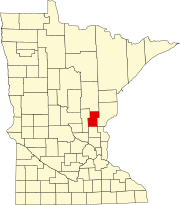
Cannon City Township is a township in Rice County, Minnesota, United States. The population was 1,212 at the 2000 census.

<span class="mw-page-title-main">Covedale, Ohio</span> Census-designated place in Ohio, United States

Covedale is a census-designated place (CDP) in Green Township, Hamilton County, Ohio, United States. The population was 6,472 at the 2020 census. The CDP represents the part of the former village of Covedale that was not annexed by the city of Cincinnati in 1930.

<span class="mw-page-title-main">Dillonvale, Hamilton County, Ohio</span> Census-designated place in Ohio, United States

Dillonvale is a census-designated place (CDP) in Sycamore Township, Hamilton County, Ohio, United States. The population was 3,436 at the 2020 census.

<span class="mw-page-title-main">Forest Park, Ohio</span> City in Ohio, United States

Forest Park is the second most populous city in Hamilton County, Ohio, United States. It is a suburb of Cincinnati. The population was 20,189 at the 2020 census.

<span class="mw-page-title-main">Kenwood, Ohio</span> Census-designated place in Ohio, United States

Kenwood is a census-designated place (CDP) in Sycamore Township, Hamilton County, Ohio, United States. The population was 7,570 at the 2020 census. It is a major shopping destination for the Cincinnati area, featuring properties such as Kenwood Towne Centre and The Kenwood Collection.

<span class="mw-page-title-main">Newtown, Ohio</span> Village in Ohio, United States

Newtown is a village in southeastern Hamilton County, Ohio, United States, near Cincinnati. The population was 2,702 at the 2020 census. Newtown was settled in 1792 and incorporated as a village in 1901.

<span class="mw-page-title-main">Northgate, Ohio</span> Census-designated place in Ohio, United States

Northgate is a census-designated place (CDP) in Colerain Township, Hamilton County, Ohio, United States. The population was 7,277 at the 2020 census.

<span class="mw-page-title-main">Pleasant Run, Ohio</span> Census-designated place in Ohio, United States

Pleasant Run is a census-designated place (CDP) in Colerain Township, Hamilton County, Ohio, United States. The population was 4,861 at the 2020 census.

<span class="mw-page-title-main">Pleasant Run Farm, Ohio</span> Census-designated place in Ohio, United States

Pleasant Run Farm is a census-designated place (CDP) in Springfield Township, Hamilton County, Ohio, United States. The population was 4,779 at the 2020 census.

<span class="mw-page-title-main">Turpin Hills, Ohio</span> Census-designated place in Ohio, United States

Turpin Hills is a census-designated place (CDP) in Anderson Township, Hamilton County, Ohio, United States. The population was 5,162 at the 2020 census.

<span class="mw-page-title-main">White Oak, Ohio</span> Census-designated place in Ohio, United States

White Oak is a census-designated place (CDP) in Hamilton County, Ohio, United States. It is seven miles northwest of Cincinnati. The population was 19,541 at the 2020 census. White Oak is situated in both Green Township and Colerain Township.

<span class="mw-page-title-main">Siletz, Oregon</span> City in Oregon, United States

Siletz is a city in Lincoln County, Oregon, United States. The population was 1,212 at the 2010 census. The city is located next to the Siletz Reservation and is the site of the annual Nesika Illahee Pow Wow in August.

<span class="mw-page-title-main">Franklin Township, Susquehanna County, Pennsylvania</span> Township in Pennsylvania, United States

Franklin Township is a township in Susquehanna County, Pennsylvania, United States. The population was 833 at the 2020 census. Salt Springs State Park, a Pennsylvania state park, is in Franklin Township.

<span class="mw-page-title-main">Loveland Park, Ohio</span> Census-designated place in Ohio, United States

Loveland Park is a census-designated place (CDP) located in Symmes Township, Hamilton County and Deerfield Township, Warren County, in the southwestern part of the U.S. state of Ohio. The CDP is named after the city of Loveland. The population was 1,737 at the 2020 census.

<span class="mw-page-title-main">Dallas City Township, Hancock County, Illinois</span> Township in Illinois, United States

Dallas City Township is one of twenty-five townships in Hancock County, Illinois, USA. As of the 2020 census, its population was 864 and it contained 488 housing units. It was formed from Pontoosuc Township in 1860.

<span class="mw-page-title-main">Dahlgren Township, Hamilton County, Illinois</span> Township in Illinois, United States

Dahlgren Township is one of twelve townships in Hamilton County, Illinois, USA. As of the 2020 census, its population was 1,137 and it contained 511 housing units.

<span class="mw-page-title-main">Twigg Township, Hamilton County, Illinois</span> Township in Illinois, United States

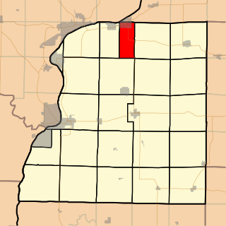
Twigg Township is one of twelve townships in Hamilton County, Illinois, USA. As of the 2020 census, its population was 488 and it contained 208 housing units.

References

  1. 1 2 "U.S. Census website". United States Census Bureau . Retrieved 31 January 2008.
  2. "US Board on Geographic Names". United States Geological Survey. 25 October 2007. Retrieved 31 January 2008.