Collinsfield is a locality in the Port Pirie Regional Council in the Mid North of South Australia, Australia.
Collinsfield is a locality in the Port Pirie Regional Council in the Mid North of South Australia, Australia.
As of the 2021 Australian census, 6 people resided in Collinsfield, [1] as well as in the 2016 census. [5] The median age of persons in Collinsfield was 57 years. There were more males than females, with 62.5% of the population male and 37.5% female. The average household size was 0 people per household. [5]

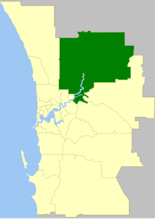
The City of Swan is a local government area of Western Australia. It is in the eastern metropolitan region of Perth and includes the Swan Valley and 42 suburbs. It is centred approximately 20 km north-east of the Perth central business district. The City covers an area of 1,042 km² and had an estimated population of 155,653 in 2020.

City of Cessnock is a local government area in the Hunter region of New South Wales, Australia. The area under administration is located to the west of Newcastle. The largest population centre and council seat is the city of Cessnock.
Shenton Park is a suburb of Perth, Western Australia, located within the City of Nedlands and City of Subiaco and 4 km (2.5 mi) west of the central business district. Its postcode is 6008. The suburb is named after the park that it contains, Shenton Park, which was named after George Shenton who originally owned the land that is now the suburb of Shenton Park.
Jolimont is a small western suburb of Perth, Western Australia, located within the City of Subiaco, although a small portion of the suburb is administered by the Town of Cambridge west of the CBD. The suburb is believed to be named after the Melbourne suburb of Jolimont, which was in turn named after "Jolimont" - the residence of Governor La Trobe. Its postcode is 6014.

Rose Park is a suburb with a population of 1,374 in the South Australian capital city of Adelaide. It is located 1 kilometre (0.62 mi) east of Adelaide's central business district. Rose Park is a leafy, tree-lined and wealthy inner suburb containing a number of historical and contemporary attractions. Much of the area's 19th-century housing stock has been recognised with heritage protection.
Skye is an eastern suburb of Adelaide, South Australia. It is located in the City of Burnside.

Cheltenham is a suburb of Adelaide, South Australia. It is located on Kaurna Land in the City of Charles Sturt.

Bowden is an inner northern suburb of Adelaide, South Australia. It is located in the City of Charles Sturt.
Indulkana is an Aboriginal community in the Anangu Pitjantjatjara Yankunytjatjara Lands in South Australia, comprising one of the six main communities on "The Lands". At the 2016 Australian census, Indulkana had a population of 256.

Beverley is a western suburb of Adelaide, South Australia. It is located in the City of Charles Sturt.
New Port is a north-western suburb of Adelaide.
Geraldton is the central suburb of the City of Greater Geraldton in the Mid West region of Western Australia.

Sebastian is a town in northern Victoria, Australia. The town is located 22 km north of Bendigo and is in the City of Greater Bendigo.
Golden Gully is a town in northern Victoria, Australia. The town is located in the City of Greater Bendigo.
Struan is a locality located within the Naracoorte Lucindale Council in the Limestone Coast region of South Australia.
Fernances is a suburb of Sydney, within the Hawkesbury electorate of the state of New South Wales, Australia.
Keilira is a locality located within the Kingston District Council in the Limestone Coast region of South Australia.
West Ballina is a suburb of Ballina located in the Northern Rivers Region of New South Wales.

Saltia is a locality in the Australian state of South Australia located on the western side of the Flinders Ranges about 279 kilometres (173 mi) north of the state capital of Adelaide and about 19 kilometres (12 mi) east of the city of Port Augusta.
Ventnor is a small town on Phillip Island in Victoria, Australia. It is the location of the Phillip Island Grand Prix Circuit.