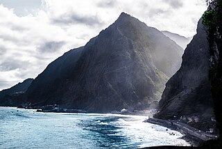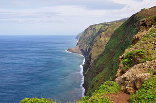
Madeira, officially the Autonomous Region of Madeira, is one of two autonomous regions of Portugal, the other being the Azores. It is an archipelago situated in the North Atlantic Ocean, in a region known as Macaronesia, just under 400 kilometres (250 mi) to the north of the Canary Islands and 520 kilometres (320 mi) west of the Kingdom of Morocco. Madeira is geologically located on the African Tectonic Plate, although its people are descended from Portuguese settlers. Its population was 251,060 in 2021. The capital of Madeira is Funchal, which is located on the main island's south coast.

Funchal is the largest city, the municipal seat and the capital of Portugal's Autonomous Region of Madeira, bordered by the Atlantic Ocean. The city has a population of 105,795, making it the sixth largest city in Portugal. Because of its high cultural and historical value, Funchal is one of Portugal's main tourist attractions; it is also popular as a destination for New Year's Eve, and it is the leading Portuguese port on cruise liner dockings.

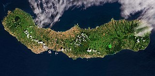
São Miguel Island, nicknamed "The Green Island", is the largest and most populous island in the Portuguese archipelago of the Azores. The island covers 760 km2 (290 sq mi) and has around 140,000 inhabitants, with 45,000 people residing in Ponta Delgada, the archipelago's largest city.

Terceira is a volcanic island in the Azores archipelago, in the middle of the North Atlantic Ocean. It is one of the larger islands of the archipelago, with a population of 53,311 inhabitants in an area of approximately 396.75 km². It is the location of the Azores' oldest city, Angra do Heroísmo, the historical capital of the archipelago and UNESCO World Heritage Site; the seat of the judicial system ; and the main Air Force base, Base Aérea nº 4 at Lajes, with a United States Air Force detachment.

Calheta is a municipality on the southwest coast of Madeira, Portugal. The population in 2011 was 11,521, in an area of 111.50 km2.

Santa Cruz das Flores is a municipality situated in the north half of the island of Flores, in the Portuguese archipelago of the Azores. Situated in the sparsely populated Western Group, the population in 2021 was 2,020 inhabitants in an area that covers approximately 70.91 square kilometres (27.38 sq mi), bordering the southern municipality of Lajes das Flores.

Ribeira Grande is a municipality in the northern part of the island of São Miguel in the Portuguese Azores. The population in 2011 was 32,112, in an area of 180.15 km2. The municipal seat is located in the civil parish of Matriz, with a population of about 4000 inhabitants, part of the urbanized core of what is commonly referred to as the city of Ribeira Grande.

Povoação is a municipality located in the southeastern corner of the island of São Miguel in the Portuguese archipelago of the Azores. The population in 2011 was 6,327, in an area of 106.41 km².

Furnas is a civil parish in the municipality of Povoação on the island of São Miguel in the Portuguese Azores. The population in 2011 was 1,439, in an area of 34.43 km2. The parish is one of the largest in the island and in the Azores. It is located east of Lagoa and Ponta Delgada, west of Povoação and southeast of Ribeira Grande.

Machico is a municipality, parish and city in the southeast part of the island of Madeira, in the Autonomous Region of Madeira. The easternmost municipality on the island, it is also the third-most populous area with a population of 21,828 in 2011. The town, proper, had a population of 10,894 in 2001.

Caniçal is a civil parish in the municipality of Machico in the Portuguese island of Madeira. The population in 2011 was 3,924, in an area of 11.85 km2. Equidistant from Funchal and Santana (20 km), the community is connected to these centres by the Regional 109 roadway. Caniçal is now the principal cargo port in Madeira. Living in this parish is a 109 year old man as of March 7, 2021.

São Vicente is a municipality along the north-west coast of the island of Madeira.

Ponta do Pargo is a civil parish in the municipality of Calheta in the Portuguese island of Madeira. The population in 2011 was 909, in an area of 24.71 km2. It is located west of the municipal seat of Calheta, and southwest of the municipality of Porto Moniz.

Serra de Água is a civil parish in the municipality of Ribeira Brava on the Portuguese island of Madeira. The population in 2011 was 1,049, in an area of 24.16 km².

João Gonçalves Zarco is a Portuguese explorer who established settlements and recognition of the Madeira Islands, and was appointed first captain of Funchal by Henry the Navigator.

The District of Ponta Delgada was a district of the Ilhas Adjacentes, consisting of the dependent eastern islands of the Azores, located in the Atlantic Ocean. The district of Ponta Delgada, not to be confused with the modern municipality of Ponta Delgada, existed from 1835 until 1976 when it was abolished in the favour of the autonomy charter of the 1975 Portuguese Constitution.
João Soares de Albergaria, also referred to as João Soares, was the second Portuguese Dontary-Captain of the islands of Santa Maria and São Miguel, succeeding his maternal uncle Gonçalo Velho Cabral in the title. After selling his rights to the Captaincy of São Miguel to Rui Gonçalves da Câmara, he continued as Donatary-Captain of Santa Maria.
The Captaincies of the Portuguese Empire were the socio-administrative territorial divisions and hereditary lordships established initially by Henry the Navigator, as part of the Donatário system in order to settle and developed the Portuguese overseas Empire. Pioneered on the island of Madeira and institutionalized in the archipelago of the Azores, the captaincy system was eventually adapted to the New World.
Rui Gonçalves da Câmara, was the second son of João Gonçalves Zarco, and inherited the title of Donatary-Captain of the island of São Miguel in the Portuguese archipelago of the Azores. Rui Gonçalves da Câmara was made the third person to administer/manage the colonization of the island of São Miguel by regal charter on 10 March 1474. After his 21-year mandate to administer the island of São Miguel, in which he was successful in promoting and establishing settlements throughout the colony, the Vila Franca do Campo received a foral (charter) as town.
Rui Gonçalves da Câmara, was the son of João Rodrigues da Câmara and successor to the Donatary-Captaincy of the island of São Miguel in the Portuguese archipelago of the Azores.


