
Little Jack is a 6,745-foot-elevation mountain summit in the North Cascades of Washington, United States. It is located within the Pasayten Wilderness. It is situated one mile south of its namesake Jack Mountain, west of Crater Mountain, and east of Ross Lake. Like many North Cascade peaks, Little Jack is more notable for its large, steep rise above local terrain than for its absolute elevation. In the early 1900s, the Forest Service built the Little Jack Trail for the purpose of grazing pack animals on the meadows of Little Jack Mountain. The name "Jack" refers to Jack Rowley, a gold prospector in the area during the late 1800s, who was credited with finding gold at Ruby Creek.

Graybeard Peak is a 7,965-foot (2,428-metre) mountain summit located in Skagit County, Washington.

Cutthroat Peak is an 8,066-foot-elevation (2,459-meter) granitic mountain located on the boundary of Chelan County and Skagit County, in Washington state. The mountain is part of the Okanagan Range which is a subrange of the Cascade Range, and it is situated within the Okanogan–Wenatchee National Forest. Cutthroat Peak is set about two miles west of Washington Pass and one mile east of Rainy Pass. It is a prominent landmark along the North Cascades Highway with an accessible climbing route. Topographic relief is significant as the summit rises over 3,000 feet above State Creek in one mile (1.6 km). There is also a Cutthroat Lake, Cutthroat Creek, and Cutthroat Pass on its north and east aspects. This landform's toponym was officially adopted in 1988 by the United States Board on Geographic Names. Molar Tooth is a granite pillar half a mile north on the ridge extending to Cutthroat Pass.

Tomyhoi Peak is a 7,439-foot (2,267-metre) Skagit Range mountain situated one mile south of the Canada–United States border, in the North Cascades of Washington state. It is located west of Mount Larrabee and within the Mount Baker Wilderness, which is part of the Mount Baker-Snoqualmie National Forest. This mountain's toponym was officially adopted in 1913 by the U.S. Board on Geographic Names.

Ruby Mountain is a prominent 7,412-foot (2,259-metre) mountain summit located in the North Cascades Range of Washington state. It is situated in Ross Lake National Recreation Area which is part of the North Cascades National Park Complex. The Diablo Lake Overlook along the North Cascades Highway is at the foot of the mountain. The nearest higher peak is Colonial Peak, 4.2 miles (6.8 km) to the southwest. Precipitation runoff on the east side of the mountain drains to Ross Lake via Ruby Creek, whereas the west side of the mountain drains to Diablo Lake via Thunder Creek. Topographic relief is significant as the summit rises 6,200 feet above Diablo Lake in approximately two miles.

Paul Bunyans Stump is a 7,513 ft (2,290 m) mountain summit in the North Cascades Range of Washington, United States. It is located within North Cascades National Park. It rises steeply from Diablo Lake, one of the reservoirs on the Skagit River. It is part of a group of peaks that form the northern end of a chain running south through climbing destinations such as Colonial Peak and Snowfield Peak. The nearest peak to Paul Bunyans Stump is Pinnacle Peak, 0.37 mi (0.60 km) to the north, and the nearest higher peak is Neve Peak, 0.9 mi (1.4 km) to the southeast. Like many North Cascade peaks, Paul Bunyans Stump is more notable for its large, steep rise above local terrain than for its absolute elevation. Precipitation runoff from the mountain drains into Diablo Lake and Skagit River.
Pyramid Peak is a 7,189-foot (2,191-metre) mountain summit in the North Cascades Range of Washington, United States. It is located within North Cascades National Park. It rises steeply from Diablo Lake, one of the reservoirs on the Skagit River. It is part of a group of peaks that form the northern end of a chain running south through climbing destinations such as Colonial Peak, Paul Bunyans Stump, and Snowfield Peak. Like many North Cascade peaks, Pyramid Peak is more notable for its large, steep rise above local terrain than for its absolute elevation. Topographic relief is significant as the summit rises 6,400 feet above the Skagit River in 2.5 miles (4 km). Precipitation runoff from the mountain drains into Diablo Lake and Skagit River.

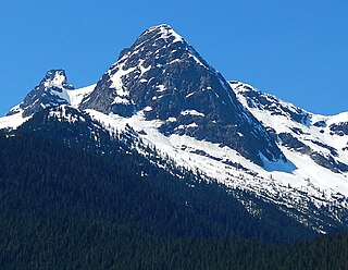
Mount Ross is a 6,052-foot (1,845 m) mountain summit located in the North Cascades, in Whatcom County, Washington, United States.

The Roost is a 6,705 ft summit in the Picket Range which is a sub-range of the North Cascades of Washington, United States. It is located within North Cascades National Park and Stephen Mather Wilderness, and it is situated one mile north of Mount Ross. Like many North Cascades peaks, The Roost is more notable for its large, steep rise above local terrain than for its absolute elevation. The Roost was first climbed on July 12, 1966 by John and Taffy Roper. The nearest higher neighbor is Glee Peak, 1.76 miles (2.83 km) to the north. Precipitation runoff from the mountain drains into the Skagit River.

Red Mountain is a 7,662-foot (2,335-metre) summit in the North Cascades of Washington, United States. It is located in Skagit County, within North Cascades National Park and the Stephen Mather Wilderness. It is situated on a smooth ridge of brick-red color at the western culmination of Ragged Ridge. The nearest higher peak is Cosho Peak, 2.6 miles (4.2 km) to the east-southeast.

Styloid Peak is the unofficial name of a 6,972-foot (2,125-metre) mountain summit located in North Cascades National Park in Skagit County of Washington state. Its nearest higher peak is Mantis Peak, 0.33 mi (0.53 km) to the west, and Snowfield Peak rises 1.7 mi (2.7 km) to the west. Precipitation runoff from Styloid Peak drains into Neve Creek and McAllister Creek, both tributaries of Thunder Creek. The first ascent of Styloid Peak was made on May 31, 1981, by John Roper and party, on the same day that they climbed Distal Phalanx. Roper, being a doctor, named some of his many first ascents for anatomical parts of the body.

Big Devil Peak is a 7,055-foot-elevation mountain summit located in North Cascades National Park in Skagit County of Washington state. The peak lies midway between Marblemount and Newhalem and can be seen from the North Cascades Highway at the road pullout for Big Devil Falls. The peak rises 6,600+ feet above the valley floor at this viewing location in the valley. Big Devil is the highest peak of Teebone Ridge, and other peaks on this ridge include Little Devil Peak, Fallen Angel, and The Trapezoid. Precipitation runoff from the mountain drains into tributaries of the Skagit River.

The Triad is a mountain with three peaks located in the North Cascades, in Skagit County of Washington state. Situated in North Cascades National Park, The Triad is positioned west of the crest of the Cascade Range, approximately 12 miles east of the town of Marblemount. The middle peak (highest) has an elevation of 7,520+ ft, the west peak 7,440+ ft, and the east peak 7,520+ ft. The popular hiking objective, Hidden Lake Peak Lookout, lies three miles to the southwest, and the nearest higher peak, Eldorado Peak, two miles to the northeast, is a popular mountaineering objective. Precipitation runoff from The Triad drains into tributaries of the Cascade River which in turn is a tributary of the Skagit River. The first ascent of the mountain was made in 1949 by Dick Eilertsen, Dick Lowery, Dick Scales, and Don Wilde. This climbing party which had three identical first names, named it the Three Dicks. However, in the interest of good taste, the more suitable and similar name was adopted since "triad" means a group or set of three connected people or things.

Castle Peak is a prominent 8,343-foot (2,543-metre) mountain summit located in the Hozameen Range of the North Cascades, on the shared border between Okanogan County and Whatcom County of Washington state. The mountain is situated one mile (1.6 km) south of the Canada–United States border, on the Cascade crest, in the Pasayten Wilderness, on land managed by the Okanogan–Wenatchee National Forest. The nearest higher peak is Jack Mountain, 14.8 miles (23.8 km) to the south-southwest. Castle Peak is the second highest summit of the Hozameen Range following Jack Mountain. Castle Peak is the sixth-highest mountain in the Pasayten Wilderness. Precipitation runoff from the mountain drains east into Castle Creek, a tributary of the Similkameen River, or west into tributaries of the Skagit River. Topographic relief is significant as the summit rises nearly 3,000 feet above Crow Creek in 0.75 mile (1.2 km).

Pinnacle Peak is a 7,386 ft (2,251 m) mountain summit in the North Cascades Range of Washington, United States. It is located within North Cascades National Park, between Pyramid Peak and Paul Bunyans Stump, which is the nearest higher peak. It rises steeply from Diablo Lake, one of the reservoirs on the Skagit River. It is part of a group of peaks that form the northern end of a chain running south through climbing destinations such as Colonial Peak and Snowfield Peak. Like many North Cascade peaks, Pinnacle Peak is more notable for its large, steep rise above local terrain than for its absolute elevation. Precipitation runoff from the mountain drains into Diablo Lake and Skagit River. The approach is via the Pyramid Lake Trail, starting near Diablo Dam on the North Cascades Highway. From the lake, there is route-finding up Pyramid Arm to Colonial Glacier.

Sharkfin Tower is an 8,120+ ft summit located in North Cascades National Park, in Skagit County of Washington state. It is set in the scenic North Cascades, which is a sub-range of the Cascade Range. The peak is situated midway on the high ridge which connects Forbidden Peak with Boston Peak. The Quien Sabe Glacier lies below its southern cliffs, and the immense Boston Glacier spreads out below the north aspect. Surface runoff from Sharkfin Tower drains into the Cascade River and Thunder Creek, both of which are tributaries of the Skagit River.

Skagit Peak is a 6,824-foot (2,080-metre) mountain summit located in the North Cascades, in Whatcom County of Washington state. It is situated on the western side of the Cascade crest, at the western edge of the Pasayten Wilderness, on land managed by the Okanogan–Wenatchee National Forest. Skagit Peak is part of the Hozameen Range, a subset of the North Cascades which also includes Hozomeen Mountain to the north, and Jack Mountain to the south. Precipitation runoff from this mountain drains into the Skagit River via Three Fools Creek and Ross Lake.

Mantis Peak is the unofficial name of a 7,614-foot (2,321-metre) double-summit mountain located in North Cascades National Park in Skagit County of Washington state. The nearest higher peak is Snowfield Peak, 1.23 mi (1.98 km) to the west, and Styloid Peak rises 0.48 mi (0.77 km) to the east. Precipitation runoff from Mantis Peak drains into Neve Creek and McAllister Creek, both tributaries of Thunder Creek. With a steep north face sculpted by the Neve Glacier, relief is significant as the summit rises 4,000 feet above the head of Neve Creek valley in less than one mile, and the south side rises 5,400 feet above McAllister Creek valley in 1.5 mi (2.4 km). The first ascent of Mantis Peak was made August 16, 1973 by Marilyn and Stan Jensen. "Distal Phalanx", the slightly higher twin summit, was first climbed on May 31, 1981, by John Roper and party, on the same day that he climbed Styloid Peak. Roper, being a doctor, named some of his many first ascents for anatomical parts of the body.

Gabriel Peak is a prominent 7,920-foot (2,410 m)-elevation mountain summit located in North Cascades National Park, in Skagit County of Washington state. It is part of the North Cascades which is a subset of the Cascade Range. The nearest higher neighbor is Cosho Peak, 2.7 miles (4.3 km) to the south, Beebe Mountain is set 2.5 miles (4.0 km) to the north, and Red Mountain is 3 miles (4.8 km) to the southwest. Precipitation runoff from this feature drains to Ross Lake via Gabriel and Panther Creeks. Like many North Cascade peaks, Gabriel Peak is more notable for its large, steep rise above local terrain than for its absolute elevation. Topographic relief is significant as it rises 4,700 feet (1,400 m) above the Panther Creek valley in approximately one mile. This geographical feature is named after the archangel Gabriel, which is a reference to Tommy Rowland who settled in the Skagit River area in 1895 and later pronounced himself the "Prophet Elisha." Mount Prophet, Genesis Peak, and nearby Elija Ridge were also named in association with Rowland.

Little Devil Peak is a 6,985-foot-elevation (2,129 m) mountain summit located in Skagit County of Washington state. It is set within North Cascades National Park and Stephen Mather Wilderness, where it is situated 3.1 miles northeast of Lookout Mountain. Little Devil is the second-highest peak of Teebone Ridge, and other peaks on this ridge include line parent Big Devil Peak, Fallen Angel, and The Trapezoid. Precipitation runoff from the mountain drains into tributaries of the Skagit River. Like many North Cascades peaks, it is more notable for its large, steep rise above local terrain than for its absolute elevation. Topographic relief is significant as the south aspect rises 5,400 feet above Marble Creek in three miles, and the east aspect rises 4,200 feet above Newhalem Creek in approximately 1.5 mile.


