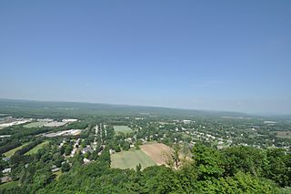
The Farmington River is a river, 46.7 miles (75.2 km) in length along its main stem, located in northwest Connecticut with major tributaries extending into southwest Massachusetts. The longest route of the river, from the origin of its West Branch, is 80.4 miles (129.4 km) long, making it the Connecticut River's longest tributary by 2.3 miles (3.7 km) over the major river directly to its north, the Westfield River. The Farmington River's watershed covers 609 square miles (1,580 km2). Historically, the river played an important role in small-scale manufacturing in towns along its course, but it is now mainly used for recreation and drinking water.

Moundville Archaeological Site, also known as the Moundville Archaeological Park, is a Mississippian culture archaeological site on the Black Warrior River in Hale County, near the modern city of Tuscaloosa, Alabama. Extensive archaeological investigation has shown that the site was the political and ceremonial center of a regionally organized Mississippian culture chiefdom polity between the 11th and 16th centuries. The archaeological park portion of the site is administered by the University of Alabama Museums and encompasses 185 acres (75 ha), consisting of 29 platform mounds around a rectangular plaza.

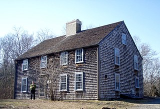
This is a list of the National Register of Historic Places listings in Plymouth County, Massachusetts.

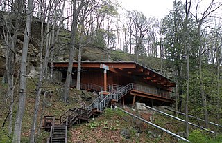
The Meadowcroft Rockshelter is an archaeological site which is located near Avella in Jefferson Township, Pennsylvania. The site is a rock shelter in a bluff overlooking Cross Creek, and contains evidence that the area may have been continually inhabited for more than 19,000 years. If accurately dated, it would be one of the earliest known sites with evidence of a human presence and continuous human occupation in the New World.

Tantiusques ("Tant-E-oos-kwiss") is a 57-acre (230,000 m2) open space reservation and historic site registered with the National Register of Historic Places. The reservation is located in Sturbridge, Massachusetts, and is owned and managed by The Trustees of Reservations; it is notable for its historic, defunct graphite mines. This is a rural area with much of the adjacent and surrounding area undeveloped and forested. The reservation is entirely forested with oak-hickory forest and red maple in the wet areas and mountain laurel abundant throughout the understory. The name Tantiusques comes from a Nipmuc word meaning “the place between two low hills." The Nipmuc used the graphite to make ceremonial paints. The property also contains the ruins of a 19th-century period house that belonged to a mine worker of mixed African American and Native American ancestry.

The U.S. National Register of Historic Places (NRHP) classifies its listings by various types of properties. Listed properties generally fall into one of five categories, though there are special considerations for other types of properties which do not fit into these five broad categories or fit into more specialized subcategories. The five general categories for NRHP properties are: building, district, object, site, and structure.

Pueblo Grande Ruin and Irrigation Sites are pre-Columbian archaeological sites and ruins, located in Phoenix, Arizona. They include a prehistoric platform mound and irrigation canals. The City of Phoenix manages these resources as the S’edav Va’aki Museum.

Minisink Archeological Site, also known as Minisink Historic District, is an archeological site of 1320 acres located in both Sussex County, New Jersey and Pike County, Pennsylvania. It was part of a region occupied by Munsee-speaking Lenape that extended from southern New York across northern New Jersey to northeastern Pennsylvania. The Munsee were speakers of one of the three major language dialects of the Lenape Native American tribe. This interstate territory became the most important Munsee community for the majority of the 17th and 18th centuries.

The Furnace Hill Brook Historic and Archeological District in a historic district in Cranston, Rhode Island.

Graham Cave is a Native American archeological site near Mineola, Missouri in Montgomery County in the hills above the Loutre River. It is located in the 356 acre Graham Cave State Park. The entrance of the sandstone cave forms a broad arch 120 feet (37 m) wide and 16 feet (5 m) high. Extending about 100 feet (30 m) into the hillside, the cave protects an historically important Pre-Columbian archaeological site from the ancient Dalton and Archaic period dating back to as early as 10,000 years ago.

Colonial Pemaquid State Historic Site is a publicly owned historic property operated by the state of Maine near Pemaquid Beach in Bristol, Maine. The site includes the reconstructed Fort William Henry, archaeological remains of 17th- and 18th-century village buildings and fortifications, and a museum with artifacts found on the site including musket balls, coins, pottery, and early hardware.

The John and Priscilla Alden Family Sites is a National Historic Landmark consisting of two separate properties in Duxbury, Massachusetts. Both properties are significant for their association with John Alden, one of the settlers of the Plymouth Colony who came to America on board the Mayflower and held numerous posts of importance in the colony. Alden and his relationship with Priscilla Mullins were memorialized by Henry Wadsworth Longfellow in The Courtship of Miles Standish, a fictionalized narrative poem that made the story a piece of American folklore.

Cedar Swamp Archeological District is a prehistoric and historic archaeologically sensitive area in eastern Westborough, Massachusetts, and extending into the northwest corner of Hopkinton. Cedar Swamp is an area of more than 2,600 acres (1,100 ha) of wetlands that include the headwaters area of the Sudbury River. Archeological surveys of the environmentally sensitive and critical area have identified many Native American sites of interest. It is believed that Native Americans prized wood from the cedar trees that grew in the area. The archeological district, which encompasses much of the Cedar Swamp area, was added to the National Register of Historic Places in 1988.
Gills Farm Archeological District is a historic district in Randolph, Massachusetts. The district, located in a riverine environment, encompasses a collection of prehistoric archaeological sites dating from the Middle Archaic to the Woodland period. Middle Archaic components include evidence of Neville and Stark projectile points. The quantities of Late Archaic materials found in the area suggest a period of intensive occupation and use. These sites were used as tool workshops, where stone from nearby quarry sites was processed into finished objects, typically bifacial tool blades.

The DEDIC or DEDIC/Sugarloaf Site is a paleo-Indian Clovis-era archaeological site in South Deerfield, Massachusetts. It encompasses an area of the Connecticut and Deerfield River valleys containing evidence of relatively large-scale human habitation dating back some 10,000 years. It is located in the general vicinity of Mount Sugarloaf. Part of it is set on the lip of a ravine, apparently a site that the natives used as a kill site, since it served as a choke point in the movements of large animals. It was added to the National Register of Historic Places in 1980.

The C.H. Nash Museum at Chucalissa is located on and exhibits excavated materials of the Mississippian culture archaeological site known as Chucalissa which means "abandoned house" in Chickasaw. The site is located adjacent to the T. O. Fuller State Park within the city of Memphis, Tennessee, United States. Chucalissa was designated National Historic Landmark in 1994 due to its importance as one of the best-preserved and major prehistoric settlement sites in the region.

The Pequot Fort was a fortified Native American village in what is now the Groton side of Mystic, Connecticut, United States. Located atop a ridge overlooking the Mystic River, it was a palisaded settlement of the Pequot tribe until its destruction by Puritan and Mohegan forces in the 1637 Mystic massacre during the Pequot War. The exact location of its archaeological remains is not certain, but it is commemorated by a small memorial at Pequot Avenue and Clift Street. The site previously included a statue of Major John Mason, who led the forces that destroyed the fort; it was removed in 1995 after protests by Pequot tribal members. The archaeological site was added to the National Register of Historic Places in 1990.

Old Town is an archaeological site in Williamson County, Tennessee near Franklin. The site includes the remnants of a Native American village and mound complex of the Mississippian culture, and is listed on the National Register of Historic Places (NRHP) as Old Town Archaeological Site (40WM2).

The Robert S. Peabody Institute of Archaeology, formerly known as the Robert S. Peabody Museum of Archaeology, is a learning center and archaeological collection in Andover, Massachusetts. Founded in 1901 through a bequest from Robert Singleton Peabody, 1857 Phillips Academy alumnus, the institute initially held the archaeological materials collected by Peabody from Native American cultures. Peabody's passionate interest in archaeology led him to create the institute at Phillips Academy to encourage young people's interest in the sciences, and to foster respect and appreciation for the Native American peoples who have inhabited that hemisphere for thousands of years.

The Hunter Archeological Site is a significant prehistoric Native American site in Claremont, New Hampshire. Located near the bridge connecting Claremont and Ascutney, Vermont, the site includes seven levels of occupational evidence, including evidence of at least three longhouses. The oldest dates recorded from evidence gathered during excavations in 1967 were to AD 1300. The site was listed on the National Register of Historic Places in 1976.


