Connecticut Farms, New Jersey

Last updated

Connecticut Farms, New Jersey
Location map of Union County, New Jersey.svg
Red pog.svg
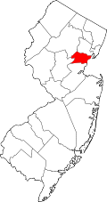
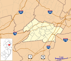
Connecticut Farms
Location in Union County
USA New Jersey relief location map.svg
Red pog.svg
Connecticut Farms
Location in New Jersey
Usa edcp relief location map.png
Red pog.svg
Connecticut Farms
Location in the United States
Coordinates: 40°41′34″N74°16′17″W / 40.69278°N 74.27139°W / 40.69278; -74.27139
CountryFlag of the United States.svg  United States
StateFlag of New Jersey.svg  New Jersey
County Union
Township Union
Area
[1]
  Total0.09 sq mi (0.24 km2)
  Land0.09 sq mi (0.24 km2)
  Water0.00 sq mi (0.00 km2)
Elevation
102 ft (31 m)
Population
 (2020) [2]
  Total545
  Density5,923.91/sq mi (2,297.40/km2)
Time zone UTC−05:00 (Eastern (EST))
  Summer (DST) UTC−04:00 (EDT)
ZIP Code
07083 (Union)
Area code 908
FIPS code 34-14815 [3]
GNIS feature ID2806063 [4]

Connecticut Farms is a neighborhood and census-designated place (CDP) [5] within Union Township, Union County, in the U.S. state of New Jersey.

Contents

The CDP is bordered by Elmwood Avenue and Stuyvesant Avenue to the north, by Rosemont Avenue, Bond Drive, and Burke Parkway to the east, by the Garden State Parkway to the south, by Chestnut Street to the southwest, and by Pennsylvania Avenue to the west. [6] Downtown Union borders the neighborhood to the north.

U.S. Route 22 passes through the southern part of the CDP, leading east 5 miles (8 km) to its terminus near Newark International Airport and southwest 20 miles (32 km) to Somerville.

Demographics

Historical population
CensusPop.Note
2020 545
U.S. Decennial Census [7]
2020 [2]

It was first listed as a census designated place in the 2020 census. [8]

2020 census

Connecticut Farms, New Jersey – Racial and ethnic composition
(NH = Non-Hispanic)
Note: the US Census treats Hispanic/Latino as an ethnic category. This table excludes Latinos from the racial categories and assigns them to a separate category. Hispanics/Latinos may be of any race.
Race / EthnicityPop 2020 [8] % 2020
White alone (NH)23543.12%
Black or African American alone (NH)8715.96%
Native American or Alaska Native alone (NH)10.18%
Asian alone (NH)519.36%
Pacific Islander alone (NH)00.00%
Other race alone (NH)91.65%
Mixed race or Multiracial (NH)203.67%
Hispanic or Latino (any race)14226.06%
Total545100.00%

Related Research Articles

<span class="mw-page-title-main">Colonia, New Jersey</span> Place in Middlesex County, New Jersey, United States

Colonia is an unincorporated community and census-designated place (CDP) located within Woodbridge Township, in Middlesex County, in the U.S. state of New Jersey. As of the 2010 United States Census, the CDP's population was 17,795.

<span class="mw-page-title-main">Middlebush, New Jersey</span> Populated place in Somerset County, New Jersey, US

Middlebush is an unincorporated community and census-designated place (CDP) located in Franklin Township, in Somerset County, in the U.S. state of New Jersey. As of the 2010 United States Census, the CDP's population was 2,326. It is perhaps most distinguished as being the host section for Franklin Township's municipal complex.

Auburn is an unincorporated community and census-designated place (CDP) in Salem County, in the U.S. state of New Jersey. It includes the Auburn section of Oldmans Township and extends southeast to include rural and semi-suburban land in Pilesgrove Township.

Queensland is a census-designated place south of Upper Marlboro in Prince George's County, Maryland, United States. The population of the CDP was 2,191 at the 2020 census. It was formerly known as Queenland until 2014 when its name was changed to Queensland and a small portion of its geography was transferred to Upper Marlboro.

<span class="mw-page-title-main">Barclay, New Jersey</span> Populated place in Camden County, New Jersey, US

Barclay Farm is an unincorporated community and census-designated place (CDP) located within Cherry Hill, in Camden County, in the U.S. state of New Jersey, that had been part of the Barclay-Kingston CDP until 2000, which was split to form the CDPs of Barclay and Kingston Estates as of the 2010 Census. Until the 2000 census, Barclay was included as part of the Barclay-Kingston CDP. As of the 2010 United States Census, the CDP's population was 4,428.

<span class="mw-page-title-main">Cologne, New Jersey</span> Populated place in Atlantic County, New Jersey, US

Cologne is an unincorporated community and census-designated place (CDP) located within Galloway Township, in Atlantic County, in the U.S. state of New Jersey. Cologne is located on U.S. Route 30, about 2.5 miles (4.0 km) southeast of Egg Harbor City. Cologne has a post office with ZIP Code 08213.

Absecon Highlands is an unincorporated community and census-designated place (CDP) in Atlantic County, in the U.S. state of New Jersey. It is in the eastern part of the county, in southern Galloway Township. It is bordered to the south by the city of Absecon and to the east by Reeds Bay, a tidal water body the connects to the Atlantic Ocean through Broad Creek and Absecon Inlet. The CDP includes the neighborhoods of Absecon Highlands, Seaview Estates, Seaview Park, Conovertown, and Holly Brook.

Arrowhead Lake is an unincorporated community and census-designated place (CDP) in Cumberland County, in the U.S. state of New Jersey. It is in the northwestern part of the county, in the northern part of Stow Creek Township. A small artificial lake is in the northwestern part of the CDP, with a residential neighborhood on its southern shore.

Carlls Corner is a census-designated place (CDP) located in Upper Deerfield Township in Cumberland County, in the U.S. state of New Jersey. It is bordered at its southwest corner by the city of Bridgeton, the county seat.

Centre Grove is a census-designated place (CDP) located in Cumberland County, in the U.S. state of New Jersey. It is in the center part of the county, on the east side of Lawrence Township. It is bordered to the east by the city of Millville. Bridgeton, the Cumberland county seat, is 9 miles (14 km) to the northwest.

Ampere North is an unincorporated community and census-designated place (CDP) in Bloomfield Township, Essex County, in the U.S. state of New Jersey. It is in the southern corner of the township, bordered to the north by the Watsessing CDP, to the northeast by Silver Lake, to the southwest by East Orange, and to the southeast by Newark. Ampere Parkway runs through the center of the CDP, from Bloomfield Avenue at the northeast border of the community, south into the Ampere neighborhood in East Orange.

Watsessing is a neighborhood and census-designated place (CDP) located in Bloomfield Township, Essex County, in the U.S. state of New Jersey. It is in the southwest corner of the township, bordered to the northwest by Glen Ridge, to the southwest by East Orange, to the southeast by the Ampere North part of Bloomfield, and to the northeast by the rest of Bloomfield. Watsessing Park is in the center of the community, in the valley of the Second River or Watsessing River, part of the Passaic River watershed.

Regency at Monroe is a gated community and census-designated place (CDP) located in Monroe Township, Middlesex County, in the U.S. state of New Jersey. It is in the eastern part of the township, bordered by Mounts Mills Road to the north, Spotswood-Englishtown Road to the east, and Buckelew Avenue to the southwest. It is 7 miles (11 km) northwest of Freehold, 15 miles (24 km) south-southeast of New Brunswick, and 22 miles (35 km) northeast of Trenton.

Renaissance at Monroe is a planned community and census-designated place (CDP) in Monroe Township, Middlesex County, in the U.S. state of New Jersey. It is in the southwest part of the township, bordered to the east by Monroe Manor and to the east by East Windsor Township in Mercer County. New Jersey Route 33 forms the northern edge of the community; it is 1.5 miles (2.4 km) west to Exit 8 on the New Jersey Turnpike and 11 miles (18 km) east to Freehold.

Bedminster is an unincorporated community and census-designated place (CDP) comprising the primary community in Bedminster Township, Somerset County, in the U.S. state of New Jersey. It was first listed as a CDP prior to the 2020 census.

Bridgewater Center is a census-designated place (CDP) located in the west-central part of Bridgewater Township, Somerset County, in the U.S. state of New Jersey. It was first listed as a CDP prior to the 2020 census with a population of 4,616.

Cranford is a census-designated place (CDP) comprising the downtown part of Cranford Township, Union County, in the U.S. state of New Jersey. It was first listed as a CDP prior to the 2020 census with a population of population was 2,032.

Union is a census-designated place (CDP) comprising the downtown area of Union Township, Union County, in the U.S. state of New Jersey. It was first listed as a CDP prior to the 2010 census. The area is also known as Union Center.

Springfield is a census-designated place (CDP) comprising the downtown area of Springfield Township, Union County, in the U.S. state of New Jersey. It was first listed as a CDP prior to the 2020 census.

South Union is an unincorporated community and census-designated place (CDP) in Oconee County, South Carolina, United States. It was first listed as a CDP prior to the 2020 census with a population of 341.

References

  1. "ArcGIS REST Services Directory". United States Census Bureau. Retrieved October 11, 2022.
  2. 1 2 Census Data Explorer: Connecticut Farms CDP, New Jersey, United States Census Bureau. Accessed June 15, 2023.
  3. Geographic Codes Lookup for New Jersey, Missouri Census Data Center. Accessed June 9, 2023.
  4. "Connecticut Farms Census Designated Place". Geographic Names Information System . United States Geological Survey, United States Department of the Interior.
  5. State of New Jersey Census Designated Places - BVP20 - Data as of January 1, 2020, United States Census Bureau. Accessed December 1, 2022.
  6. "Connecticut Farms CDP". TIGERweb. Geography Division, U.S. Census Bureau. Retrieved June 23, 2021.
  7. "Census of Population and Housing". Census.gov. Retrieved June 4, 2016.
  8. 1 2 "P2: Hispanic or Latino, and Not Hispanic or Latino by Race – 2020: DEC Redistricting Data (PL 94-171) - Connecticut Farms CDP, New Jersey". United States Census Bureau. Retrieved January 26, 2024.