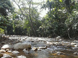
The Cordillera Oriental montane forests (NT0118) is an ecoregion in Venezuela and Colombia along the east slopes of the eastern cordillera of the Andes. The extensive region of submontane and montane forests includes distinctive flora and fauna in the north, center and southern sections. The ecoregion is home to numerous endemic species of fauna. Despite extensive changes due to logging, farming and ranching, large areas of the original habitat remain intact, and the ecoregion has rich biodiversity.
The Cordillera Oriental montane forests ecoregion extends along eastern slopes of the Cordillera Oriental of the Colombian Andes, mostly in Colombia but in the northwest of Venezuela to the west of Lake Maracaibo. It has an area of 6,785,768 hectares (16,768,000 acres).[1]
The Cordillera Oriental. The ecoregion covers the eastern slopes. In the north the Serranía del Perijá has a NNE–SSW axis. The isolated Sierra Nevada de Santa Marta is to the west. Further south the Cordillera Oriental has a NNW–SSE axis. South of that the axis is again NNE–SSW.
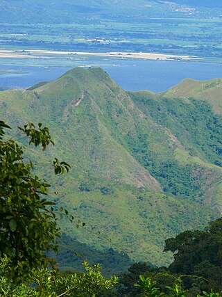
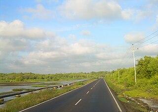
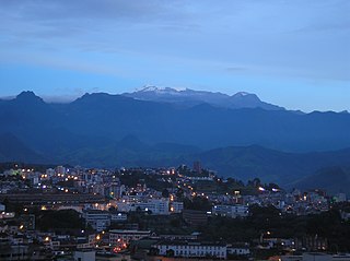
The ecoregion covers the mid-level and high-level northern Andes, including foothills.[1] There are three main sub-regions: the Serranía del Perijá in the north, somewhat isolated from the Cordillera Oriental and closer to the Sierra Nevada de Santa Marta, the northeastern slope of the Cordillera Oriental and the southeastern slope of the Cordillera Oriental. The southeastern slope extends southward from the west of the Tamá Massif past (and including) the Serranía de la Macarena. In the wider, northern section of this slope there are high, flat plains and páramos, and permanently snow covered peaks such as the 5,493 metres (18,022ft)Sierra Nevada del Cocuy. Further south it is narrower and lower, with peaks under 3,000 metres (9,800ft).[3]
Climate
Koppen climate in the Venezuelan section
The Köppen climate classification is "Cfb": warm temperate, fully humid, warm summer.[4] At a sample location at coordinates 5°45′N73°15′W / 5.75°N 73.25°W / 5.75; -73.25 mean monthly temperatures vary little throughout the year, ranging from 11.7°C (53.1°F) to 13°C (55°F). Yearly total rainfall is about 900 millimetres (35in). Monthly rainfall varies from 25.2 millimetres (0.99in) in January to 104.8 millimetres (4.13in) in April, drops to 55.2 millimetres (2.17in) in August and rises to 135.3 millimetres (5.33in) in October.[4]
The Serranía de Perijá in the north is in some ways more similar to the isolated Sierra Nevada de Santa Marta than to the eastern slope of the Cordillera Oriental. There are also significant differences in fauna of the northeastern and southeastern slopes, although flora are similar.[3]
Flora
Up to about 1,500 metres (4,900ft) the vegetation is dense premontane or montane moist forest. Higher up this gives way to temperate oak forests and then elfin forests, before yielding to ericaceous scrub and páramo at the highest levels.[1] There are pockets of premontane dry forest in areas with lower rainfall. Moist piedmont forest in the central part merges into the transition to the llanos grasslands. Moist piedmont forest in the southern part merges into the moist forest of the northwestern Amazon basin. The 1,800 metres (5,900ft) Serranía de la Macarena runs in a southeast direction from the southern part of the slope into lowland moist forest. It contains Andean, llanos and Amazonian species of flora.[3] Plants of families such as Arecaceae and Meliaceae are very similar in the northeastern and southeastern slopes. 63 species of palms have been identified, of which 5 are endemic.[3]
Of the Ithomiini and Heliconiinae butterfly subfamilies in the Serranía del Perijá, 80% are found in the Sierra Nevada but only 40% in the eastern cordillera slopes. 53 species of butterfly subfamily Satyrinae are found on the northeastern slope and 28 found in the southeastern slope. Only 9 are common to both slopes. 60 species and subspecies of the butterfly tribe Ithomiini are found on the northeastern slope and 78 found in the southeastern slope. Only 45 are common to both slopes.[3]
The World Wildlife Fund (WWF) gives the Cordillera Oriental montane forests ecoregion a status of "Vulnerable".[3] As of the mid-1980s remnants of the original vegetation covering 4,733 square kilometres (1,827sqmi) remained intact.[3] A 2006 book reported that of 68,736 square kilometres (26,539sqmi), 14,116 square kilometres (5,450sqmi) was protected, or 20.5%. 43% of the habitat has been transformed.[7] The WWF website in 2017 said 60% of the habitat in Colombia has been altered. The Venezuelan portion is thought to be more intact.[3]
The ecosystem has been fragmented by logging, farming and ranching, particularly in the lower areas. Hydroelectric projects and roads are also threats. Coal mining and oil extraction cause habitat destruction in Venezuela. Colonization in the foothills in the Amazon region and the Serranía de la Macarena is introducing subsistence agriculture and widespread grazing. Forest clearing to grow plants yielding illegal drugs, and destruction of these plants by burning and herbicides, are major causes of disruption to the habitat. Despite these threats, there are still high levels of biodiversity.[3]
The 3,000 square kilometres (1,200sqmi)Sierra de Perijá National Park in Venezuela has been proposed as a biosphere reserve. The 821 square kilometres (317sqmi)Catatumbo Barí National Natural Park in Colombia protects part of the ecoregion, and 1,746 square kilometres (674sqmi) lies within indigenous territories.[3]
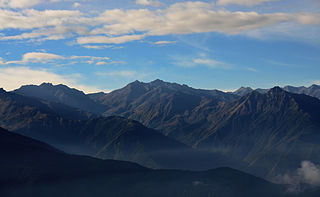
The Cordillera Oriental is the widest of the three branches of the Colombian Andes. The range extends from south to north dividing from the Colombian Massif in Huila Department to Norte de Santander Department where it splits into the Serranía del Perijá and the Cordillera de Mérida in Venezuelan Andes. The highest peak is Ritacuba Blanco at 5,410 m (17,750 ft) in the Sierra Nevada del Cocuy.
The Cordillera de la Costa montane forests is a montane ecoregion of the tropical and subtropical moist broadleaf forests biome, in the Venezuelan Coastal Range on the Caribbean Sea in northern Venezuela.
The Northern Andean páramo (NT1006) is an ecoregion containing páramo vegetation above the treeline in the Andes of Colombia and Ecuador. In the past, when the climate was cooler, the treeline and the páramo units were lower and the units were connected. During the present warmer Holocene epoch the páramos have migrated uphill, shrinking and becoming isolated. They contain many rare or endangered species, some of them restricted to a narrow area of one mountain or mountain range. The ecoregion is relatively well preserved, but faces threats from over-grazing and farming.
The Santa Marta páramo (NT1007) is an ecoregion containing páramo vegetation above the treeline in the Sierra Nevada de Santa Marta mountain range on the Caribbean coast of Colombia. The isolated position of the range has allowed unique species to evolve. Some are related to those found in Central America and the Caribbean coastal areas, and some to species from the Andes. The habitat is relatively stable, but has been drastically changed from the original by long-term human activity.
The Cordillera Central páramo (NT1004) is an ecoregion containing páramo vegetation above the treeline in the Andes mountain range of northern Peru and southern Ecuador. Due to its isolation there are high levels of endemism. Despite many human settlements and some destruction of habitat by agriculture and mining, the ecoregion is relatively intact.
The Venezuelan Andes montane forests (NT0175) is an ecoregion in the northern arm of the Andes in Venezuela. It contains montane and cloud forests, reaching up to the high-level Cordillera de Merida páramo high moor ecoregion. The forests are home to many endemic species of flora and fauna. Their lower levels are threatened by migrant farmers, who clear patches of forest to grow crops, then move on.
The Apure–Villavicencio dry forests (NT0201) is an ecoregion in Venezuela and Colombia to the east of the eastern cordillera of the Andes. The ecoregion covers the transition zone between montane forests in the Andes and the llanos, or lowland grasslands. It has been severely degraded by deforestation, farming and ranching. The remnants are poorly protected.
The Catatumbo moist forests (NT0108) is an ecoregion in Venezuela and Colombia to the west and east of Lake Maracaibo. It includes four regions of moist forest on slightly higher ground than the dry forest and mangroves that surround the lake. The forest has unique flora related to the flora of the Amazon basin. It is badly degraded due to farming, livestock grazing and oil exploration.
The Táchira Depression is a saddle of land connecting the Lake Maracaibo basin to the Orinoco basin in the state of Táchira, Venezuela. It forms a break in the eastern Andes, separating the Tamá Massif to the west from the Cordillera de Mérida to the east. The depression has been thought to present a barrier to the movement of species between the Colombian and Venezuelan Andes, but this effect may have been relatively low during the recent ice ages. The mountains of the region have potential for coffee farming and hydroelectric power generation, while the lower levels are suitable for farming.
The Maracaibo dry forests (NT0222) is an ecoregion in Venezuela around Lake Maracaibo. It contains the country's main oil fields. The habitat is criss-crossed by roads and is severely degraded by farming and livestock grazing.
The Napo moist forests (NT0142) is an ecoregion in the western Amazon rainforest of Colombia, Ecuador and Peru.
The Sinú Valley dry forests (NT0229) is an ecoregion in the north of Colombia.
The Chocó–Darién moist forests (NT0115) is a largely forested, tropical ecoregion of northwestern South America and southern Central America. The ecoregion extends from the eastern Panamanian province of Darién and the indigenous region of Guna Yala to almost the entirety of Colombia's Pacific coast, including the departments of Cauca, Chocó, Nariño and Valle del Cauca.
The Eastern Panamanian montane forests (NT0122) is an ecoregion in the east of Panama and the extreme northwest of Colombia. It contains diverse flora and fauna, with considerable endemism. The ecoregion is largely intact due to its inaccessibility, although the opening of an extension of the Pan-American Highway has introduced threats from human activity.
The Northwestern Andean montane forests (NT0145) is an ecoregion on the Andes mountains in the west of Colombia and Ecuador. Both flora and fauna are highly diverse due to effect of ice ages when the warmer climate zones were separated and the cooler ones combined, and interglacial periods when the reverse occurred. Because the environment is hospitable to humans, the habitat has been drastically modified by farming and grazing since the Pre-Columbian era.
The Magdalena Valley montane forests (NT0136) is an ecoregion in the Andes mountains of central Colombia.
The Cauca Valley montane forests (NT0109) is an ecoregion in western Colombia. It covers the sides of the Cauca Valley, which runs from south to north between the Central and Western Ranges (cordilleras) of the Colombian Andes. The ecoregion is home to very diverse fauna and flora, due in part to its varied elevations and climates, in part to its position near the isthmus of Panama, the route along which North American species invaded South America and then diversified as they moved to the upper parts of the Andes. Little of the original habitat remains at lower levels, but higher up there are sizeable blocks of forest, some of which are protected.
The Santa Marta montane forests (NT0159) is an ecoregion in the Sierra Nevada de Santa Marta, a massif on the Caribbean coast of northern Colombia. The ecoregion covers altitudes from near sea level up to around 3,300 metres (10,827 ft), where it gives way to Santa Marta páramo. The isolation of the massif and the range of elevations and climates has resulted in a wide variety of species including many endemics. The lower levels contained tropical rainforest, which has largely been cleared. Higher up, this gives way to cloud forest. Much of this has also been cleared for coffee plantations, pasture for sheep and cattle, and farming.
The Eastern Cordillera Real montane forests (NT0121) is an ecoregion in the eastern range of the Andes of southern Colombia, Ecuador and northern Peru. The ecoregion covers the eastern slopes of the Andes, and includes montane forest that rises from the Amazonian rain forest, with cloud forest and elfin forest at higher elevations. It is rich in species, including many endemics. It is threatened by logging and conversion for pasturage and subsistence agriculture.
This page is based on this Wikipedia article Text is available under the CC BY-SA 4.0 license; additional terms may apply. Images, videos and audio are available under their respective licenses.