Corte Madera Creek (San Mateo County, California)

Last updated
Corte Madera Creek
Corte De Madera Creek [1]
stream
Corte Madera Creek (San Francisquito Creek) in Jasper Ridge July 2011.jpg
Corte Madera Creek just below Searsville Dam July 22, 2011
Name origin: Spanish language
Country United States
State California
RegionSoutheastern San Mateo County
Tributaries
 - left Coal Creek,Gulch Creek,Rengstorff Gulch,Damiani Creek, Jones Gulch,Hamms Gulch, Alambique Creek, Dennis Martin Creek, Sausal Creek
 - rightWestridge Creek
City Portola Valley, California
Source
 - locationRussian Ridge Open Space Preserve.
 - elevation1,950 ft (594 m)
 - coordinates 37°19′26″N122°11′24″W / 37.32389°N 122.19000°W / 37.32389; -122.19000   [1]
Mouth Searsville Lake
 - location Portola Valley, California
 - elevation351 ft (107 m)
 - coordinates 37°24′03″N122°14′18″W / 37.40083°N 122.23833°W / 37.40083; -122.23833 Coordinates: 37°24′03″N122°14′18″W / 37.40083°N 122.23833°W / 37.40083; -122.23833   [1]
Relief map of California.png
Red pog.svg
Location of the mouth in California

Corte Madera Creek (Spanish for "a place where wood is cut") is a 7.3-mile-long (11.7 km) [2] creek that flows north-northwest to Searsville Dam and then joins with Bear Creek to form San Francisquito Creek in California.

Stream A body of surface water flowing down a channel

A stream is a body of water with surface water flowing within the bed and banks of a channel. The stream encompasses surface and groundwater fluxes that respond to geological, geomorphological, hydrological and biotic controls.

Searsville Dam

Searsville Dam is a masonry dam in San Mateo County, California that was completed in 1892, one year after the founding of Stanford University, and impounds Corte Madera Creek to form a reservoir known as Searsville Lake. Searsville Dam is located in the Jasper Ridge Biological Preserve and is owned and operated by Stanford University. Neighboring cities include Woodside and Portola Valley, California.

Bear Creek (San Francisquito Creek) stream originating north of the summit of Sierra Morena in the Santa Cruz Mountains

Bear Creek, or Bear Gulch Creek, is a 6.6-mile-long (10.6 km) southeastward-flowing stream originating north of the summit of Sierra Morena in the Santa Cruz Mountains, near the community of Kings Mountain in San Mateo County, California, United States. It flows through the town of Woodside. Bear Creek and Corte Madera Creek join to become San Francisquito Creek in the Jasper Ridge Biological Preserve at Stanford University.

Contents

Looking south across Searsville Reservoir from the dam on Corte Madera Creek Searsville Reservoir July 2011.jpg
Looking south across Searsville Reservoir from the dam on Corte Madera Creek
Shot looking southeast from Jasper Ridge's Sun Field Station up the Corte Madera Creek watershed with Russian Ridge on the right and Montebello Ridge on the left. Upper Watershed with Russian Ridge on Right and Montello Ridge on Left July 2011.jpg
Shot looking southeast from Jasper Ridge's Sun Field Station up the Corte Madera Creek watershed with Russian Ridge on the right and Montebello Ridge on the left.

History

Historically Corte de Madera Creek ran through the Rancho Cañada del Corte de Madera and Rancho Corte de Madera land grants (the latter surrounding the former). [3] [4]

Rancho Cañada del Corte de Madera

Rancho Cañada del Corte de Madera was a 3,566-acre (14.43 km2) Mexican land grant in present day Santa Clara County, California given in 1833 by Governor José Figueroa to José Domingo Peralta and Máximo Martínez. The name translates as "the valley where lumber is cut". The grant was located west of today's I-280, and south of San Francisquito Creek near Searsville Lake, and covered most of the Portola Valley.

Rancho Corte de Madera

Rancho Corte de Madera was a 13,316-acre (53.89 km2) Mexican land grant in present day Santa Clara County, California given in 1844 by Governor Manuel Micheltorena to Máximo Martínez. The name translates as "the place where lumber is cut". The roughly triangular shaped grant was west of today's I-280, and bounded on the north by Alambique Creek and San Francisquito Creek, on the south by Los Trancos Creek and Matadero Creek, and on the west by what is now Skyline Boulevard. The grant surrounded Rancho Cañada del Corte de Madera which extended along the Portola Valley. The land grant included parts of present day Woodside, Ladera and Stanford University.

Ecology

Corte Madera Creek was historically an anadromous steelhead (Oncorhynchus mykiss irideus) spawning stream; however, access to the creek has been blocked since 1890 by Searsville Dam. [5] Although steelhead can no longer run above Searsville Dam to spawn, stream resident coastal rainbow trout (O. m. irideus) populations live in upper Corte Madera Creek and its tributaries. [6] In a 1996 biotic assessment of upper Searsville Lake and the lower floodplain of Corte Madera Creek, Stanford biologists wrote that the native species likely included steelhead/coastal rainbow trout (Oncorhynchus mykiss irideus), sculpin, California roach (Hesperoleucas symmetricus), hitch (Lavinia exilcauda), speckled dace (Rhinichthys osculus), Sacramento sucker (Catostomus occidentalis), Pacific lamprey (Entosphenus tridentatus), and perhaps three-spined stickleback (Gasterosteus aculeatus), Sacramento pikeminnow (Ptychocheilus grandis), Sacramento blackfish (Orthodon microlepidontus), and coho salmon (Oncorhynchus kisutch). They noted that the only native species observed with any regularity in the study area are Sacramento sucker and rainbow trout, and attributed the now depauperate native fish fauna to dislocation of hydrologic connectivity due to the dam, transformation of the habitat above the dam from lotic to lentic, and the fact that Searsville Reservoir harbors many non-native species of centrarchid fishes (sunfish, black bass, and crappie) which prey on virtually all historically native fishes. They noted that federally threatened California red-legged frogs (Rana draytonii) occur in the lotic portions of Corte Madera Creek below the dam but not above, likely due to depredation by non-native fish and American bullfrogs (Lithobates catesbeiana). [7]

Cottidae family of fishes

The Cottidae are a family of fish in the superfamily Cottoidea, the sculpins. It is the largest sculpin family, with about 275 species in 70 genera. They are referred to simply as cottids to avoid confusion with sculpins of other families.

California roach species of cyprinid fish, native to western North America

The California roach is a cyprinid fish native to western North America and abundant in the intermittent streams throughout central California. Once considered the sole member of its genus, it has recently been split into a number of closely related species and subspecies.

<i>Lavinia exilicauda</i> species of fish

The hitch is a cyprinid fish endemic to central California, and was once very common. The name is derived from the Pomoan word for this species.

The extent by which Searsville Reservoir serves as a source for non-native species was illustrated when Stanford biologists studied the aquatic fauna found in the plunge pool below the Searsville dam spillway. The plunge pool was drained in 2013 to allow for a safety inspection of the base of the dam. Native species found when the plunge pool was pumped dry include two steelhead trout, 26 California roach and 22 Sacramento suckers. In contrast, more than 1,500 non-native fishes were encountered during the dewatering process, including over 500 sunfish including green sunfish ((Lepomis cyanellus), bluegill (Lepomis macrochirus) and likely redear sunfish (Lepomis microlophus), two bullhead catfish (Ameiurus species) and over 1,000 mosquitofish (Gambusia affinis). Other non-native in the plunge pool included 500 bullfrogs and 150 Louisiana red swamp crayfish. [8]

Green sunfish species of fish

The green sunfish is a species of freshwater fish in the sunfish family (Centrarchidae) of order Perciformes. A panfish popular with anglers, the green sunfish is also kept as an aquarium fish by hobbyists. They are usually caught by accident, while fishing for other game fish. Green sunfish can be caught with live bait such as nightcrawlers, waxworms, mealworms and, blood worms. Grocery store baits such as pieces of hot dog or corn kernels can even catch fish. Small lures have been known to occasionally catch green sunfish. They can be caught with fly fishing tackle.

Bluegill species of fish

The bluegill is a species of freshwater fish sometimes referred to as bream, brim, sunny, or copper nose. It is a member of the sunfish family Centrarchidae of the order Perciformes. It is native to North America and lives in streams, rivers, lakes, and ponds. It is commonly found east of the Rockies. It usually hides around, and inside, old tree stumps and other underwater structures. It can live in either deep or very shallow water, and will often move back and forth, depending on the time of day or season. Bluegills also like to find shelter among water plants and in the shade of trees along banks.

Redear sunfish species of fish

The redear sunfish is a freshwater fish in the Centrarchidae family and is native to the southeastern United States. Since it is a popular sport fish, it has been introduced to bodies of water all over North America. It is known for its diet of mollusks and snails.

In the spring of 1991, an adult steelhead (0.74m) was observed jumping at the base of Searsville Dam. In May 2002, the San Francisquito Watershed Council released a barrier survey including Corte Madera Creek. A private bridge apron adjacent to Willowbrook Drive and another downstream of the confluence with Damiani Creek were described as impassable barriers to upstream migrating steelhead. [6] In 2014 a systematic study of 1,400 plus dams in California identified Searsville Dam as a high-priority candidate to improve environmental flows for native fish conservation. [9]

Illegal fishing of rainbow trout (stream resident forms of O. m. irideus) has occurred in several places along Corte Madera Creek with significant damage to the surviving populations of native rainbows. In addition, there are also several private ponds stocked with warm water non-native species, such as Smallmouth Bass, Redear Sunfish and Bluegill that threaten the surviving native trout population fry and eggs. The most notable pond is on Iroquois Trail and empties into Corte Madera Creek through a single outlet which floods during El Niño, or a wet winter.

Watershed

Corte Madera Creek has its origin just northeast of Borel Hill in the Coal Creek Open Space Preserve (part of the Midpeninsula Regional Open Space District, and follows Alpine Road northwesterly along the San Andreas Fault to pick up Coal Creek, Rengstorff Gulch, Damiani Creek, Jones Gulch, Hamms Gulch - all draining the northeastern slope of the Santa Cruz Mountains. It levels out upon reaching Portola Valley and crosses under Portola Road at Brookside Drive. Before reaching Searsville Reservoir it arrives in a large laguna or freshwater marsh formed by the nexus of several creeks, including Westbridge Creek, Sausal Creek, Dennis Martin Creek, and Alambique Creek.

Midpeninsula Regional Open Space District

Formed in 1972 by voter initiative, the Midpeninsula Regional Open Space District (MROSD) is a non-enterprise special district in the San Francisco Bay Area. It has acquired and preserved a regional green belt of open space land and provides opportunities for ecologically-sensitive public enjoyment and education.

San Andreas Fault A continental transform fault through California between the Pacific Plate and the North American Plate

The San Andreas Fault is a continental transform fault that extends roughly 1,200 kilometers (750 mi) through California. It forms the tectonic boundary between the Pacific Plate and the North American Plate, and its motion is right-lateral strike-slip (horizontal). The fault divides into three segments, each with different characteristics and a different degree of earthquake risk. The slip rate along the fault ranges from 20 to 35 mm /yr.

Santa Cruz Mountains mountain range in California, United States

The Santa Cruz Mountains, part of the Pacific Coast Ranges, are a mountain range in central and northern California, United States. They form a ridge down the San Francisco Peninsula, south of San Francisco. They separate the Pacific Ocean from the San Francisco Bay and the Santa Clara Valley, and continue south to the Central Coast, bordering Monterey Bay and ending at the Salinas Valley. The range passes through the counties of San Mateo, Santa Clara, Santa Cruz, San Benito and Monterey, with the Pajaro River forming the southern boundary.

Just south of the intersection of Mountain Home Road and Portola Road, Alambique Creek enters a historic wetland pond (Lloyd's Pond) which is currently impounded by the road-fill of Portola Road and a culvert. From there Alambique Creek flows under Portola Road into the upper Searsville Reservoir at its confluence with Sausal Creek. Dennis Martin Creek flows into Sausal Creek just upstream of the reservoir area at the Family Farm Road bridge. From there Sausal Creek joins enters Searsville Reservoir. Corte Madera Creek enters Searsville Reservoir further to the east. Old maps suggest that Dennis Martin Creek and Alambique Creek were historically tributary to Sausal Creek. [10] This unique confluence of streams and natural wetlands was submerged and buried with sediment due to the construction of Searsville Dam and the siltation of the reservoir.

Below Searsville Dam Corte Madera Creek joins with Bear Creek to form San Francisquito Creek.

See also

Related Research Articles

Rainbow trout species of trout

The rainbow trout is a trout and species of salmonid native to cold-water tributaries of the Pacific Ocean in Asia and North America. The steelhead is an anadromous (sea-run) form of the coastal rainbow trout(O. m. irideus) or Columbia River redband trout (O. m. gairdneri) that usually returns to fresh water to spawn after living two to three years in the ocean. Freshwater forms that have been introduced into the Great Lakes and migrate into tributaries to spawn are also called steelhead.

Arroyo Hondo (Santa Clara County, California) river in the United States of America

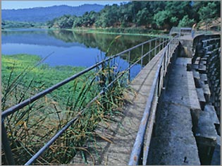
Arroyo Hondo is a northwestward-flowing 13.0-mile-long (20.9 km) river in Santa Clara County, California, United States, that lies east of Milpitas. The area is privately owned by the San Francisco Water Department and is closed to public access because of its usage as drinking water. Bounded to the east by Oak Ridge and to the west by Poverty Ridge, Arroyo Hondo empties into the Calaveras Reservoir where it joins Calaveras Creek. It is formed by the confluence of Smith Creek and Isabel Creek which drain the west and east slopes of Mount Hamilton, respectively.

Stevens Creek (California) river in the United States of America

Stevens Creek is a creek in Santa Clara County, California. The creek originates in the Santa Cruz Mountains on the western flank of Black Mountain in the Monte Bello Open Space Preserve near the terminus of Page Mill Road at Skyline Boulevard. It flows southeasterly through the Stevens Creek County Park before turning northeast into Stevens Creek Reservoir. It then continues north for 12.5 miles through Cupertino, Los Altos, Sunnyvale and Mountain View before emptying into the San Francisco Bay at the Whisman Slough, near Google's main campus.

Alameda Creek river in the United States of America

Alameda Creek is a large perennial stream in the San Francisco Bay Area. The creek runs for 45 miles (72 km) from a lake northeast of Packard Ridge to the eastern shore of San Francisco Bay by way of Niles Canyon and a flood control channel.

San Francisquito Creek river in the United States of America

San Francisquito Creek is a creek that flows into southwest San Francisco Bay in California, United States. Historically it was called the Arroyo de San Francisco by Juan Bautista de Anza in 1776. San Francisquito Creek courses through the towns of Portola Valley and Woodside, as well as the cities of Menlo Park, Palo Alto, and East Palo Alto. The creek and its Los Trancos Creek tributary define the boundary between San Mateo and Santa Clara counties.

San Leandro Creek river in the United States of America

San Leandro Creek is a 21.7-mile-long (34.9 km) year-round natural stream in the Berkeley Hills, in Alameda County and Contra Costa County of the East Bay in northern California.

Smith Creek (Santa Clara County, California)

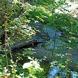
Smith Creek is a 14-mile-long (23 km) perennial stream which flows along the western flank of Mount Hamilton in Santa Clara County. The creek begins near Bollinger Ridge, about 7.7 km SxSW of Mount Hamilton.

Wildcat Creek (California) river in the United States of America

Wildcat Creek is a 13.4-mile-long (21.6 km) creek which flows through Wildcat Canyon situated between the Berkeley Hills and the San Pablo Ridge, emptying into San Pablo Bay in Contra Costa County, northern California.

Marsh Creek (California) river in the United States of America

Marsh Creek is a stream in east Contra Costa County, California in Northern California which rises on the eastern side of Mount Diablo and flows 30 miles (48 km) to the Sacramento–San Joaquin River Delta at Oakley, California, near Big Break Regional Shoreline. The creek flows through Marsh Creek State Park (California), where water is impounded to form Marsh Creek Reservoir, then through the city of Brentwood, California.

Los Trancos Creek river in the United States of America

Los Trancos Creek is a creek that flows northerly from Monte Bello Ridge on the northeast slope of the Santa Cruz Mountains to its confluence with San Francisquito Creek at Stanford University in California, United States. The creek forms the boundary between northwestern Santa Clara County and southeastern San Mateo County.

San Anselmo Creek river in the United States of America

San Anselmo Creek is an eastward-flowing stream that begins on the eastern flank of Pine Mountain in the Marin Hills of Marin County, California. At its confluence with Ross Creek, it becomes Corte Madera Creek.

Cascade Creek is a stream that flows south then southeast from its source on White Hill to its confluence with San Anselmo Creek just west of Fairfax in Marin County, California.

San Tomas Aquino Creek river in the United States of America

San Tomas Aquinas Creek, known locally as San Tomas Aquino Creek, is a 16.5-mile-long (26.6 km) stream that heads on El Sereno mountain in El Sereno Open Space Preserve in Saratoga, California in Santa Clara County, California, United States. It flows north through the cities of Saratoga, Monte Sereno, Los Gatos, Campbell, Santa Clara and San Jose before its confluence with the Guadalupe Slough in south San Francisco Bay.

Martin Creek, known locally as Dennis Martin Creek, is a 1.4-mile-long (2.3 km) north by northeastward-flowing stream originating just east of Skyline Boulevard in the Santa Cruz Mountains, near the community of Skylonda in San Mateo County, California. It flows through the town of Woodside before joining Sausal Creek on Stanford University lands just across the border from Woodside. Sausal Creek enters Searsville Reservoir, which flows to San Francisco Bay via San Francisquito Creek.

Alambique Creek river in the United States of America

Alambique Creek, or Arroyo Alembique, is a 2.7-mile-long (4.3 km) stream located in San Mateo County, California in the United States. It is part of the San Francisquito Creek watershed.

Sausal Creek is a 2.5-mile-long (4.0 km) northwesterly-flowing stream originating in Portola Valley along the northeastern edge of the Windy Hill Open Space Preserve in the eastern foothills of the Santa Cruz Mountains, in San Mateo County, California, United States. It joins a nexus of creeks becoming Corte Madera Creek in a natural marsh above Searsville Reservoir on Stanford University lands. Below Searsville Reservoir, Corte Madera Creek joins with Bear Creek to form San Francisquito Creek and flows to San Francisco Bay.

Isabel Creek river in the United States of America

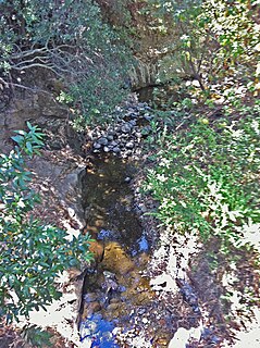
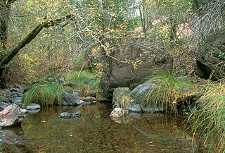
Isabel Creek is a 18-mile-long (29 km) perennial stream which flows northwestly along the eastern then northern flank of Mount Hamilton in Santa Clara County. It joins Smith Creek to form Arroyo Hondo north of Mt. Hamilton and is part of the southernmost Alameda Creek watershed.

References

  1. 1 2 3 U.S. Geological Survey Geographic Names Information System: Corte Madera Creek
  2. U.S. Geological Survey. National Hydrography Dataset high-resolution flowline data. The National Map Archived 2012-04-05 at WebCite , accessed March 15, 2011
  3. Erwin G. Gudde, William Bright (2004). California Place Names: The Origin and Etymology of Current Geographical Names. University of California Press. p. 92. ISBN   978-0-520-24217-3 . Retrieved 2010-09-20.
  4. Durham, David L. (1998). Durham's Place Names of California's San Francisco Bay Area: Includes Marin, San Francisco, San Mateo, Contra Costa, Alameda, Solano & Santa Clara counties. Word Dancer Press, Sanger, California. p. 44. ISBN   1-884995-14-4 . Retrieved 2010-08-30.
  5. Skinner, John E. (1962). The Freshwater Fish and Fisheries of the San Francisco Bay Area. California Department of Fish and Game, Water Projects Branch Report no. 1. Sacramento, California: California Department of Fish and Game. Archived from the original on 2011-07-26. Retrieved 2010-09-20.
  6. 1 2 Leidy, R.A.; G.S. Becker; B.N. Harvey (2005). "Historical distribution and current status of steelhead/rainbow trout (Oncorhynchus mykiss) in streams of the San Francisco Estuary, California" (PDF). Center for Ecosystem Management and Restoration, Oakland, CA. pp. 145–146. Retrieved 2009-12-28.
  7. Craig Fee, Alan Launer, Steve Rottenborn (1996-10-21). Biotic assessment of upper Searsville Lake and the lower floodplain of Corte Madera Creek (PDF) (Report). Stanford University. pp. 17–18. Retrieved 2014-01-04.
  8. Alan Launer, Christina Feng, Annette Potvin (2013-11-15). Report on the fish relocations associated with the Searsville Dam plunge pool dewatering (PDF) (Report). Stanford University. Archived from the original (PDF) on 2015-01-05. Retrieved 2015-01-05.
  9. T. E. Grantham, J. H. Viers, PB Moyle (2014). "Systematic Screening of Dams for Environmental Flow Assessment and Implementation". BioScience. 64: 1006–1018. doi:10.1093/biosci/biu159 . Retrieved 2014-10-27.
  10. Janet M. Sowers (2005). "San Francisquito Watershed and Alluvial Fan, in Creek & Watershed Map of Palo Alto & Vicinity". Oakland Museum of California. Retrieved 2012-02-11.