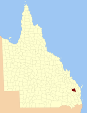
Howard is a rural town and locality in the Fraser Coast Region, Queensland, Australia. In the 2016 census, Howard had a population of 1,359 people. It is located 284 kilometres (176 mi) north of Brisbane and 37 kilometres (23 mi) west of Hervey Bay.

Torquay is a coastal suburb in Hervey Bay in the Fraser Coast Region, Queensland, Australia. In the 2016 census, Torquay had a population of 6,316 people.

Wicklow County is a county in Queensland, Australia, located in the Wide Bay–Burnett region. On 7 March 1901, the Governor issued a proclamation legally dividing Queensland into counties under the Land Act 1897. Its schedule described Wicklow thus:
Bounded on the east by the county of Yarrol; on the south by the county of Newcastle; on the west by the eastern watershed of the Dawson River; and on the north by the south boundaries of Knockbreak Lease, Calrossie Resumption, Culcragie Lease, part of Culcragie Resumption, and by the north boundary of Eidsvold Resumption.

The County of March is a county in Queensland, Australia. The county consists of the Noosa area, plus the eastern parts of the Gympie and Fraser Coast regions.
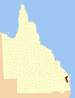
The County of Lennox is a county in Queensland, Australia. Like all counties in Queensland, it is a non-functional administrative unit, that is used mainly for the purpose of registering land titles.
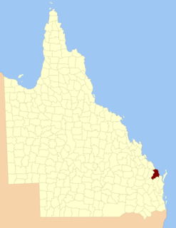
The county of Cook is a cadastral division of Queensland, centred on the city of Bundaberg, and its name honours Captain James Cook. It was officially named and bounded by the Governor in Council on 7 March 1901 under the Land Act 1897.

The County of Fraser is one of 322 counties of Queensland, Australia, in the Wide Bay–Burnett region, which consists Fraser Island and some satellite islands off its southwestern coast. It was established on 7 March 1901 under the Land Act 1897, and borders County of March, which lies mainly on the Queensland mainland, but also includes Big Woody Island and other islands in the northern Great Sandy Strait.

The County of Fitzroy is a county in Queensland, Australia. Like all counties in Queensland, it is a non-functional administrative unit, that is used mainly for the purpose of registering land titles.

Wide Bay–Burnett is a region of the Australian state of Queensland, located between 170–400 km (110–250 mi) north of the state capital, Brisbane. The area's population growth has exceeded the state average over the past 20 years, and it is forecast to grow to more than 430,000 by 2031. It is the subject of the Draft Wide Bay–Burnett Regional Plan, which aims to facilitate this growth while protecting over 90% of the region from urban development.

The County of Bowen is a county in Queensland, Australia, located in the Wide Bay–Burnett region to the west of Bundaberg. It was named in honour of Sir George Ferguson Bowen, the first Governor of Queensland. On 7 March 1901, the Governor issued a proclamation legally dividing Queensland into counties under the Land Act 1897. Its schedule described Bowen thus:
Bounded on the east by the county of Cook; on the south by the county of Mackenzie; on the west by [...] the parishes of Mundowran, Boomerang, Binjour, Jonday, Yenda, Wolca, Wombah, Kolonga and Toweran; and on the north by the northern boundaries of the parishes of Toweran, Kolonga and Manduran.
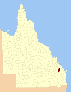
The County of Yarrol is a county in Queensland, Australia, located in the Wide Bay–Burnett region to the west of Bundaberg. On 7 March 1901, the Governor issued a proclamation legally dividing Queensland into counties under the Land Act 1897. Its schedule described Yarrol thus:
Bounded on the east by the county of Bowen; on the south and west by the Burnett River upwards to the western watershed of Three Moon Creek, by that watershed northerly to the southern watershed of Glassford Creek; and on the north by the southern boundary of the parish of Bompa.
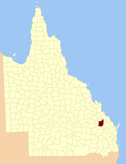
The County of Rawbelle is a county in Queensland, Australia, located in the Wide Bay–Burnett region. On 7 March 1901, the Governor issued a proclamation legally dividing Queensland into counties under the Land Act 1897. Its schedule described Rawbelle thus:
Bounded on the south by the county of Wicklow; on the west by the eastern watershed of the Dawson River; on the north by the northern watersheds of Rawbelle River and Three Moon Creek; and on the east by the county of Yarrol.

The County of Newcastle is a county in the Wide Bay–Burnett region of Queensland, Australia. On 7 March 1901, the Governor issued a proclamation legally dividing Queensland into counties under the Land Act 1897. Its schedule described Newcastle thus:
Bounded on the east by the counties of Mackenzie and Boondooma; on the south by the Main Dividing Range; on the west by the eastern watershed of the Dawson River; on the north by the northern boundaries of the leased parts of Auburn and Hawkwood Runs and the Auburn River from the confluence of Narayen Creek downwards to its junction with the Burnett River.

The County of Boondooma is a county in the Wide Bay–Burnett region of Queensland, Australia. It was named and bounded by the Governor in Council on 7 March 1901 under the Land Act 1897.

The Boyne River is a river located in the Wide Bay–Burnett region of Queensland, Australia.

The Burrum River is a river located in the Wide Bay-Burnett region of Queensland, Australia.

Mungungo is a rural town and locality in the North Burnett Region, Queensland, Australia. In the 2016 census, Mungungo had a population of 77 people.

Island Plantation is a rural locality in the Fraser Coast Region, Queensland, Australia. In the 2016 census, Island Plantation had a population of 146 people.

Doongul is a rural locality in the Fraser Coast Region, Queensland, Australia. In the 2016 census, Doongul had a population of 29 people.
