
The Hunter River is a major river in New South Wales, Australia. The Hunter River rises in the Liverpool Range and flows generally south and then east, reaching the Tasman Sea at Newcastle, the second largest city in New South Wales and a major harbour port. Its lower reaches form an open and trained mature wave dominated barrier estuary.

The Hawkesbury River, or Hawkesbury-Nepean River a river located northwest of Sydney, New South Wales, Australia. The Hawkesbury River and its associated main tributary, the Nepean River, almost encircle the metropolitan region of Sydney. Between Wisemans Ferry and the Pacific Ocean marks the boundary of Greater Metropolitan Sydney in the south and the Central Coast region to the north.

Brooklyn is a suburb and the northern most town on the Pacific Highway in Sydney, New South Wales, Australia. Brooklyn is located on the northern outskirts of Sydney and is located in the local government area of the Hornsby Shire with a population of 737 as of the 2021 census. Brooklyn is surrounded by the Muogamarra Nature Reserve and occupies a strip of waterfront along the southern bank of the Hawkesbury River.

Long Island is an elongated island of 73 hectares in the Hawkesbury River, about 50 kilometres (31 mi) north of the Sydney central business district,New South Wales, Australia. It is joined to the mainland at its south eastern edge by the railway causeway across Sandbrook Inlet. At the other end of this causeway is the Sydney suburb of Brooklyn in Hornsby Shire, to which Long Island belongs.

Brandy Hill is a suburb of the Port Stephens local government area in the Hunter Region of New South Wales, Australia. It was originally farmland but was subdivided in the 1980s and now supports a population of almost 700 people living on large, primarily residential, blocks. It overlooks working farmland and offers superb views of the greater Morpeth area, with visibility extending to Maitland.
Cooks Hill is an inner city suburb of Newcastle, New South Wales, Australia. It is typified by its tree lined streets, rows of Victorian terrace housing, turn of the century timber cottages and corner pubs.

Dangar Island is a forested island, 30.8 hectares in area, in the Hawkesbury River, on the northern outskirts of Sydney, New South Wales, Australia. Dangar Island is a suburb of Hornsby Shire and as at the 2021 census had a population of 313, which swells dramatically during holiday seasons. The island is serviced regularly by Brooklyn Ferry Service and departs from Brooklyn and takes about fifteen minutes. The Brooklyn ferry is itself adjacent to Hawkesbury River railway station. The ferry service is in operation 7 days a week.

Dangarsleigh is a rural locality and minor trigonometrical station about 11 km south east of Armidale, New South Wales. The locality is at an altitude of about 1,020 metres on the Northern Tablelands in the New England region of New South Wales, Australia. The name Dangarsleigh commemorates the surveyor and pastoralist Henry Dangar’s name. It is within the Armidale Regional Council local government area and Sandon County.

Stratford is a rural locality in the Mid-Coast Council local government area in the Hunter Region of New South Wales, Australia. The largest population centre in the area is the town of Stratford, which is approximately 14 kilometres (9 mi) south of Gloucester and 109 km (68 mi) north of Newcastle. Stratford, which is next to the Avon River, is on Bucketts Way, 66 km (41 mi) from the Pacific Highway, the nearest major highway.
John Howe (1774–1852) was a free settler and explorer of Australia in the early period of British colonisation. He became a successful building contractor, and also served as a chief constable and coroner. It is believed that he was born at Redbourn, Hertfordshire, England, the son of John How and his spouse Mary Roberts.

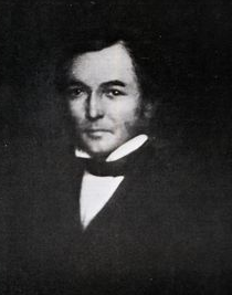
Henry Dangar (1796–1861) was a surveyor and explorer of Australia in the early period of British colonisation. Despite an upheld challenge to some of his early land claims, he received huge land grants.

The Halls Heeler is the presumed ancestor of two present-day dog breeds, the Australian cattle dog and the Australian stumpy tail cattle dog.

Joseph Fleming was an Australian born pastoralist and politician who was a Member of the Queensland Legislative Assembly. He was an important pioneering figure in the British pastoral colonisation of the Gwydir River, Balonne River and Warrego River regions.
Donald McIntyre, sometimes referred to as Donald MacIntyre, was a Scottish-Australian colonial politician, who was a member of the New South Wales Legislative Council from 1848 to 1851.
Neotsfield is a heritage-listed homestead at Neotsfield Lane, Whittingham, Singleton Council, New South Wales, Australia. It was designed by Henry Dangar and built from 1827 to 1888, with William Dangar supervising much of the initial construction. What remains of the original property include a two storied brick homestead and associated western wing, the original carriage house and stables building, a meat store, and the remains of a greenhouse. The property includes a ballroom, servants' quarters, gentlemen's parlour, breakfast room and guest reception room, and sits on a 9.71 hectares block fronting onto the Hunter River. The gates and gate house/lodge survive but are no longer part of the Neotsfield property. The eastern wing has been demolished, and the front balcony and verandah roofs are missing. The main building has "lost its face" and its original proportions. It was added to the New South Wales State Heritage Register on 2 April 1999.
Benjamin Singleton (1788–1853) was a free settler, miller, and explorer of Australia in the early period of British colonisation. He was born in England on 7 August 1788 and arrived in the Colony of New South Wales on 14 February 1792 in the Pitt, a convict ship. His father, William, had been sentenced to transportation for seven years, and had brought his wife and two sons with him. An older son, James, arrived as a free settler in 1808.
John Henry Fleming was an Australian-born squatter and stockman, who is best known as being the ringleader of the 1838 Myall Creek massacre which resulted in the murder of at least twenty-eight unarmed members of the Wirraayaraay people, Indigenous Australians who spoke a Gamilaraay language.
Keera is a locality on the upper Gwydir River in Murchison County in the New England region of New South Wales, Australia. The nearest town is Bingara which is approximately 20km to the north-west.
Peter MacIntyre, sometimes referred to as Peter McIntyre, was a Scottish born colonist of New South Wales. He is credited as being one of the main pioneers of British colonisation in the Upper Hunter and New England regions.
Thomas Simpson Hall was an Anglo-Australian pastoralist who was at the forefront of British colonial expansion into what is now northern New South Wales and southern Queensland. He established large pastoral leases in these areas on Aboriginal lands and was subsequently involved in considerable frontier conflict with these original occupants. Hall was a pioneer of the British settlements of Dartbrook, Manilla, Bingara, Moree and Surat. He also became a leading breeder of Shorthorn cattle in Australia and developed a type of working dog called the Halls Heeler, from which the Australian cattle dog is descended.
