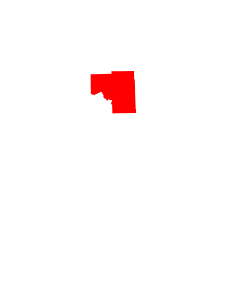
Deer Lake, Minnesota | |
---|---|
Coordinates: 47°20′06″N93°40′18″W / 47.33500°N 93.67167°W | |
Country | United States |
State | Minnesota |
County | Itasca |
Area | |
• Total | 216.0 sq mi (559 km2) |
• Land | 182.7 sq mi (473 km2) |
• Water | 33.3 sq mi (86 km2) |
Population (2010) | |
• Total | 3,495 |
• Density | 16/sq mi (6.2/km2) |
Time zone | UTC–6 (CST) |
• Summer (DST) | UTC–5 (CDT) |
ZIP Code | 55721, 55744, 56636 |
Area code | 218 |
Deer Lake is an unorganized territory in Itasca County, Minnesota, United States. The population was 3,495 at the 2010 census. [1]
According to the United States Census Bureau, the unorganized territory has a total area of 216.0 square miles (559.4 km2), of which 182.7 square miles (473.2 km2) is land and 33.3 square miles (86.2 km2), or 15.41%, is water. U.S. Highway 2, and State Highways 6 (MN 6) and 38 (MN 38) are in the surrounding area.
The unincorporated community of Suomi is located within Deer Lake Unorganized Territory.
Deer Lake also refers to a lake in the area. Nearby towns include Deer River, Cohasset, and Grand Rapids.
At the 2000 census there were 3,286 people, 1,304 households, and 993 families living in the unorganized territory. The population density was 18.0 inhabitants per square mile (6.9/km2). There were 2,154 housing units at an average density of 11.8 per square mile (4.6/km2). The racial makeup of the unorganized territory was 98.05% White, 0.91% Native American, 0.27% Asian, 0.03% Pacific Islander, 0.12% from other races, and 0.61% from two or more races. Hispanic or Latino of any race were 0.49%. [2]
Of the 1,304 households 28.9% had children under the age of 18 living with them, 69.2% were married couples living together, 3.6% had a female householder with no husband present, and 23.8% were non-families. 20.3% of households were one person and 7.7% were one person aged 65 or older. The average household size was 2.51 and the average family size was 2.87.
The age distribution was 23.3% under the age of 18, 6.9% from 18 to 24, 23.9% from 25 to 44, 32.1% from 45 to 64, and 13.8% 65 or older. The median age was 43 years. For every 100 females, there were 105.8 males. For every 100 females age 18 and over, there were 108.1 males.
The median household income was $47,115 and the median family income was $53,520. Males had a median income of $38,393 versus $26,298 for females. The per capita income for the unorganized territory was $19,556. About 4.3% of families and 8.5% of the population were below the poverty line, including 9.1% of those under age 18 and 16.1% of those age 65 or over.
Liberty Township was a township in Itasca County, Minnesota, United States. The population was 62 at the 2010 census. In November 2014, the residents of Liberty Township voted to dissolve their township status. In October 2015, the process was finalized and what was once Liberty Township is now an unorganized territory of Itasca County.
Angora Township is a township in Saint Louis County, Minnesota, United States. The population was 249 at the 2010 census. Angora Township was named after Angora, in Turkey.
Cedar Valley Township is a township in Saint Louis County, Minnesota, United States. Cedar Valley Township was named for the white cedar in the valley of the Floodwood River. The population was 195 at the 2010 census.
Fayal Township is an urban township in Saint Louis County, Minnesota, United States. The population was 1,809 at the 2010 census.
French Township is a township in Saint Louis County, Minnesota, United States. The population was 567 at the 2010 census.
Morse Township is a township in Saint Louis County, Minnesota, United States. The population was 1,213 at the 2010 census.
Pike Township is a township in Saint Louis County, Minnesota, United States. The population was 417 at the 2010 census.
White Township is an urban township in Saint Louis County, Minnesota, United States. The population was 3,229 at the 2010 census.
Square Lake is an unorganized territory in Aroostook County, Maine, United States. The population was 706 at the 2020 census.
South Clearwater is an unorganized territory in Clearwater County, Minnesota, United States. The population was 8 at the 2020 census, down from 10 in 2010.
Bowstring Lake is an unorganized territory in Itasca County, Minnesota, United States. The population was 1,166 at the 2010 census.
Little Sand Lake is an unorganized territory in Itasca County, Minnesota, United States. As of the 2010 census, its population was 349.
Northeast Itasca is an unorganized territory in Itasca County, Minnesota, United States. The population was 1,179 at the 2010 census.
Heikkala Lake is an unorganized territory in Saint Louis County, Minnesota, United States. The population was 322 at the 2000 census.
Jeanette Lake is an unorganized territory in Saint Louis County, Minnesota, United States. The population was 249 at the 2000 census.
Kabetogama Township is a township in Saint Louis County, Minnesota, United States. The population was 135 at the 2010 census. A portion of the township is located within the Kabetogama State Forest.
Mud Hen Lake is an unorganized territory in Saint Louis County, Minnesota, United States. The population was 320 at the 2000 census.
Whiteface Reservoir is an unorganized territory in Saint Louis County, Minnesota, United States. The population was 292 at the 2000 census.
Nett Lake is an unorganized territory in Saint Louis County, Minnesota, United States. The population was 272 at the 2000 census.
Effie is an unorganized territory in Itasca County, Minnesota, United States. The population was 203 at the 2010 census.