Deerfield | |
|---|---|
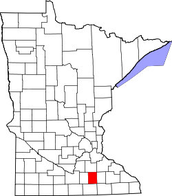
 Deerfield Location of the community of Deerfield within Deerfield Township, Steele County  Deerfield Deerfield (the United States) | |
| Coordinates: 44°10′03″N93°21′35″W / 44.16750°N 93.35972°W | |
| Country | United States |
| State | Minnesota |
| County | Steele |
| Township | Deerfield Township |
| Elevation | 1,175 ft (358 m) |
| Time zone | UTC-6 (Central (CST)) |
| • Summer (DST) | UTC-5 (CDT) |
| ZIP code | 55049, 55060, and 56093 |
| Area code | 507 |
| GNIS feature ID | 654669 [1] |
Deerfield is an unincorporated community in Deerfield Township, Steele County, Minnesota, United States, near Medford and Owatonna. The community is located along NW 66th Street near NW 73rd Avenue. Mackenzies Creek and Mud Creek both flow nearby.