Hope | |
|---|---|
 Grain elevator in Hope | |
 Hope Location of the community of Hope within Somerset Township, Steele County  Hope Hope (the United States) | |
| Coordinates: 43°57′43″N93°16′34″W / 43.96194°N 93.27611°W | |
| Country | United States |
| State | Minnesota |
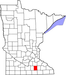
| County | Steele |
| Township | Somerset Township |
| Elevation | 1,201 ft (366 m) |
| Time zone | UTC-6 (Central (CST)) |
| • Summer (DST) | UTC-5 (CDT) |
| ZIP code | 56046 |
| Area code | 507 |
| GNIS feature ID | 645169 [1] |
Hope is an unincorporated community in Somerset Township, Steele County, Minnesota, United States. Hope has a post office with ZIP code 56046.